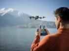
Today in a post on the Facebook Inspire 1 & 2 owners group this image surfaced. Apparently, it shows a new drone, called the DJI Phantom 4 RTK from Chinese drone manufacturer, DJI. RTK stands for Real-Time Kinematic and is a very precise and accurate satellite navigation device, which offers its value in highly accurate mapping situations. Normal drones offer precision measurements with up to 5-meter (16.4 feet) accuracy. With RTK the measurements are accurate up to 5 cm (2 inches).
About the Phantom 4 RTK
So far very little information is known of the DJI Phantom 4 RTK. We have reached out to DJI for comment but have not yet heard back. We will update this post when we have more information on this new drone. *** See here for update ***
On Facebook, the following information was provided. Keep in mind that as of yet we do not know if this is 100% accurate.
“D-RTK is a high precision navigation and positioning system specially designed for DJI A3 series flight controllers. Using dynamic differential technology, it provides ultra-accurate, centimeter-level 3D positioning. This enhanced accuracy over typical barometer, compass and GPS systems makes D-RTK essential for commercial, industrial and scientific applications where accuracy is imperative.”
Real-Time Kinematic
From Wikipedia, we learn that RTK stands for Real-Time Kinematic satellite navigation and that:
Real Time Kinematic (RTK) satellite navigation is a technique used to enhance the precision of position data derived from satellite-based positioning systems (global navigation satellite systems, GNSS) such as GPS, GLONASS, Galileo, and BeiDou. It uses measurements of the phase of the signal’s carrier wave, rather than the information content of the signal, and relies on a single reference station or interpolated virtual station to provide real-time corrections, providing up to centimeter-level accuracy. With reference to GPS in particular, the system is commonly referred to as Carrier-Phase Enhancement or CPGPS.[1] It has applications in land survey, hydrographic survey, and in consumer unmanned aerial vehicle navigation.
Other RTK solutions
If you currently need RTK precision for your mapping requirements, companies like SkyCatch and AirGon can help. Since the commercial application of drones is a fast growing business it makes sense that DJI would come out with their own RTK solution and it seems that is what they have done.
No news yet on pricing or availability but we will keep you informed as soon as we know more.


Above: Difference between regular measurements and RTK measurements for mapping services.
FTC: We use income earning auto affiliate links. More.


Comments