Ian, which made landfall along the southwestern coast of Florida as a powerful Category 4 hurricane Wednesday, has left catastrophic damage in its wake. As rescue crews and disaster relief groups jump-start recovery in the region, drones have emerged as a critical force multiplier for damage assessment and search and rescue efforts.
Utility asset inspection and damage assessment
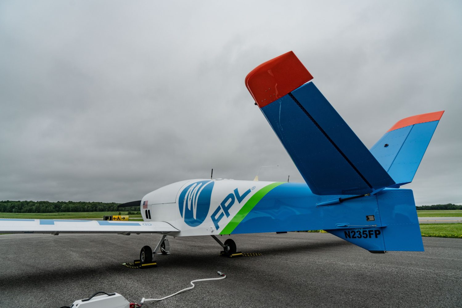
Florida Power & Light Company (FPL), an electric utility that serves more than 12 million people in Florida, is using its new FPLAir One drone to assess the damage on the West Coast. Since this fixed-wing drone can fly in heavy winds, it can gather real-time information about the damage caused by Hurricane Ian. This is enabling FPL to get the right crews and the right equipment to the right place, speeding up the restoration efforts considerably.
Telecom company AT&T has dispatched drone operators to areas that are too risky to be accessed by its ground team. The pilots are flying their aircraft from a safe distance and providing wireless and wireline damage assessments to restoration workers.
Verizon‘s drone teams have also mobilized from the safe zones where they were pre-staged before the storm to inspect cell tower damage. During previous disasters, operators have been able to determine the state of a flooded cell site’s equipment using drone footage. If the aerial video shows a site can be refueled safely, a boat crew can get to the generator and make the site operational in a matter of hours instead of days.
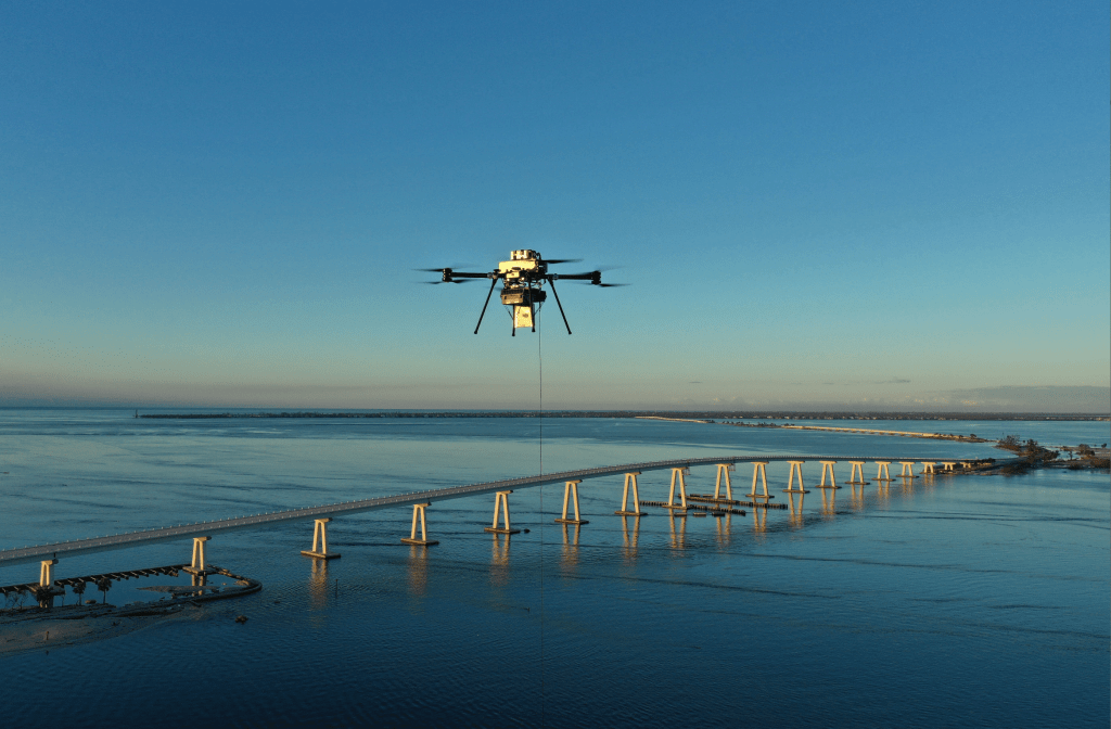
A Verizon drone flies to provide cover over Sanibel Island on October 1 at dawn
Search and rescue missions
In the meantime, the members of the Florida State University Center for Disaster Risk Policy (CDRP) drone team are supporting the state’s urban search and rescue efforts. In the wake of a hurricane, drones can provide accurate, near-real-time data in lieu of maps that are typically weeks and months old. That information can help prioritize the allocation of resources, saving valuable time — and lives.
Support from drone community
The drone industry has also stepped forward to help communities respond faster to the damage inflicted by the storm.
Drone maker Skydio has established a 24/7 hotline to resolve any aircraft flight, feature, or accessory issues that it public safety or industrial users may encounter. This team would also initiate an overnight advanced replacement of any damaged drone free of charge. Moreover, the company is offering its full suite of drone data processing products free of charge to operators impacted by Hurricane Ian for the duration of the local emergency response.
Then there is drone software company DroneDeploy, whose platform converts aerial data into 3D maps and models for emergency response teams. DroneDeploy is offering qualified organizations free short-term access to its enterprise cloud-processing platform, as well as priority support from the company’s crisis response and technical support teams.
How can drone pilots help?
The role drones are playing in Hurricane Ian response and recovery is vital, but it’s important to remember that only pre-authorized pilots are allowed to fly during such times because many emergency response flight operations take place at low altitudes.
As such, the FAA often implements Temporary Flight Restrictions (TFRs) around areas affected by a hurricane to protect ongoing aerial emergency response efforts. And even if a TFR is not in place, NOTAMs may be issued providing pilots with guidance about hazardous conditions that can affect the flight.
You can instead get in touch with organizations such as DroneBase and see if they need any support for clients who are looking to get the condition of their property and infrastructure assessed post-storm.
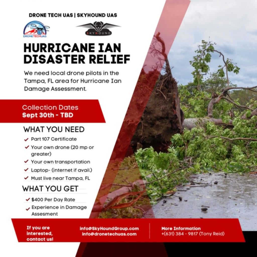
You can also reach out to Skyhound UAS and Drone Tech UAS who are looking for Part 107-certified pilots specifically in the Tampa area for Hurricane Ian damage assessment:
Read: Hurricane Fiona drone video: What a Category 4 storm looks like from the inside
FTC: We use income earning auto affiliate links. More.


Comments