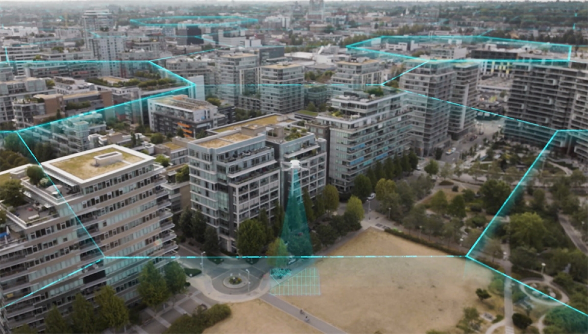
Canadian drone startup Spexi Geospatial has secured $5.5 million in seed funding to fuel the world’s first standardized “fly-to-earn” drone imagery platform powered by blockchain technology.
The Spexigon drone platform is a new offering by the Vancouver-based company whose core purpose is to produce accurate and shareable aerial data quickly. In addition to basic photos and videos, Spexi offers its users a host of drone data products, including:
- 360-degree panoramas with hot spots for points of interests
- Orbits that circle around the property to see the building from all angles
- High-resolution image galleries with annotations for easy collaboration
- Up-to-date Google Map tiles showing the property with the ability to measure slopes and volumes, and annotate features
- 3D models and point clouds showing proportionality of the building and structural features
At the heart of the company’s operations are its iOS and Android apps compatible with the latest DJI drones. These apps offer pilots autonomous flight planning tools and cloud-based footage processing and sharing features for their missions.
The new Spexigon fly-to-earn drone platform, meanwhile, taps into the power of crowdsourcing. It allows people who own consumer drones to earn $SPEXI tokens and dollars while building a high-resolution base layer of the earth.
Read: New drone racing game will let fans earn cryptocurrency, NFTs
Spexi fly-to-earn drone platform explained
According to the company, each mission a pilot flies will help to create an ultra-high resolution base layer image of the earth. This base layer will enable governments and organizations to make better decisions about real-world assets such as buildings, utilities, infrastructure, risk, and natural resources, without requiring their own people on the ground.
Essentially, organizations that require high-resolution drone data will no longer need to own their own drones or hire their own pilots. Instead, they’ll use the Spexi web and mobile app to search for and purchase imagery.
Meanwhile, the drone pilots who collect data for Spexigon will be rewarded in crypto tokens, and in some cases, dollars (depending on the mission). There will be some initial online training involved, but largely the Spexi app will control each pilot’s drone automatically while they supervise the flight. There will naturally be an option for the pilot to take back manual control at any time if the need arises.
Basically, the app will show the pilots a map of the earth overlaid with hexagonal zones called “Spexigons”. Spexigons that are open and ready to fly will be easily visible, so pilots can choose an area close to them and begin collecting imagery.
Spexi expects this platform to launch fully in Spring of 2023.
Read: This free app tracks nearby drone flights using Remote ID data
FTC: We use income earning auto affiliate links. More.


Comments