Drone fleet management platform AirData says it is encouraging law enforcement transparency by making more public-facing features available to community-oriented police departments across the US. The company’s Public Portal program boosts public trust by improving accountability in drone use.
AirData is a leading drone fleet management and live-streaming platform that serves over 300,000 users with 38 million flights uploaded to date, processing an average of 25,000 flights a day. With detailed data tracking being a key feature of AirData, the Public Portal tool comes as a proactive solution for public safety organizations.
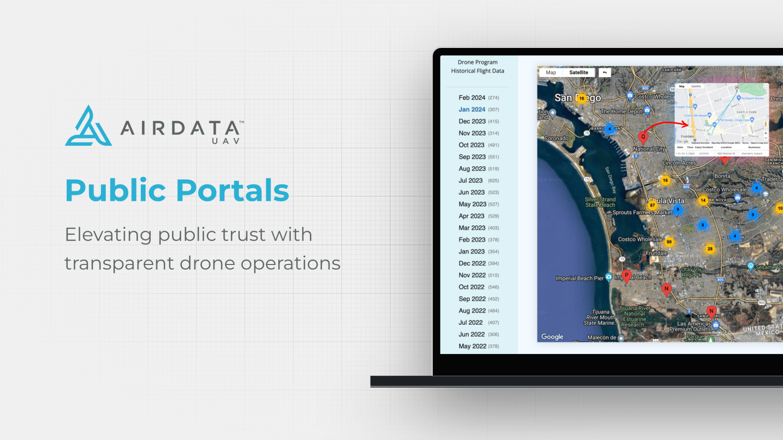
At its core, the program allows law enforcement agencies to publicly share flight information through custom-configured websites. As such, people can look up missions by location or time period. That said, the data shared is tailored to the needs of each police department and can be automatically filtered to protect confidentiality.
Also read: Dronetag releases new Remote ID module weighing just 5 grams
AirData explains that it has built on the expertise of police agencies that have a successful Drone as First Responder (DFR) program. AirData users include Chula Vista PD, Sacramento PD, and Las Vegas Metro PD. Privacy, officer safety, and operational security are serious concerns for these agencies. As such, AirData has built a powerful set of backend features that allow officers to adjust parameters as appropriate for their operations.
One important feature is the option to delay flight sharing by a customized time. Pilots on sensitive missions, for instance, can keep their flights confidential by quickly completing a post-flight checklist from the AirData UAV mobile app.
Detective Steven Oscar, program coordinator and chief drone pilot at Las Vegas Metro PD, says that implementing AirData’s Public Portal has revolutionized the way the department shares its drone operations with the community.
“It’s transparent, user-friendly, and bridges the gap between technology and public trust. With real-time data sharing, we’re not just flying drones; we’re fostering an environment of openness and accountability. AirData has enabled us to elevate our program’s transparency to new heights, ensuring our community is always in the loop and fully aware of the benefits our drone initiatives bring,” says Oscar.
Read more: Police drones to monitor spring break crowds at Miami Beach
FTC: We use income earning auto affiliate links. More.


Comments