For decades, weather forecasters have had a blind spot. It sits in the lower atmosphere — roughly from 50 feet to about 20,000 feet above the ground — where many of the most disruptive weather events actually begin. That’s where fog forms, storms organize, smoke spreads, and low-level winds turn dangerous. And until now, it’s been one of the thinnest areas in the US weather observing system.
That’s starting to change, thanks to drones.
Weather intelligence company Meteomatics is joining forces with the National Oceanic and Atmospheric Administration (NOAA) to make operational weather drone data available to the National Weather Service for the first time.
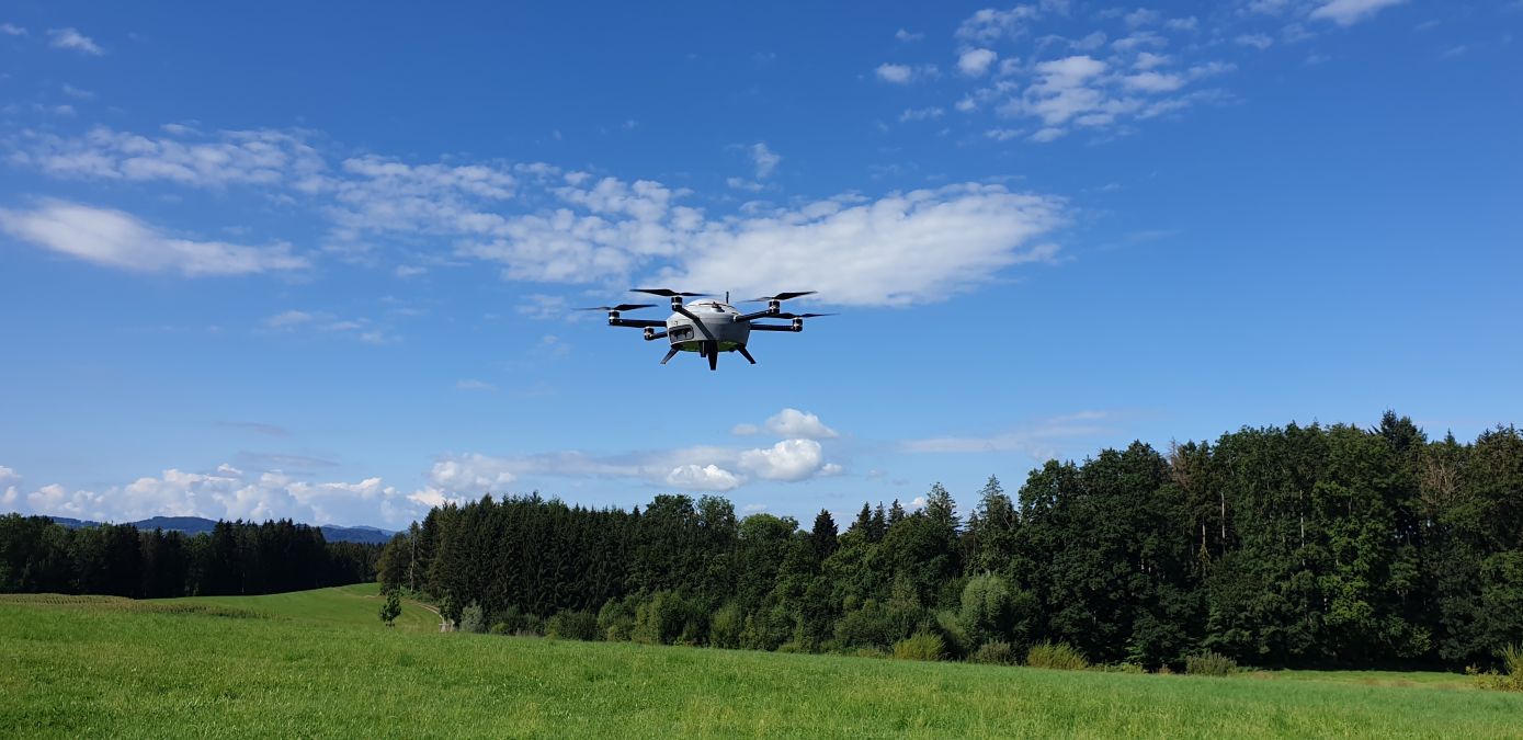
Through the program, Meteomatics’ autonomous Meteodrones will collect detailed atmospheric data and feed it into daily forecasting operations. The work runs through the National Mesonet Program, with KBR serving as the prime contractor and Synoptic Data integrating the drone observations into NOAA systems.
Meteodrones fly vertical profiles through the lower atmosphere, measuring temperature, humidity, and wind — conditions that play an outsized role in high-impact weather. These frequent, high-resolution measurements help forecasters better pinpoint when thunderstorms may develop, how long fog may persist, whether a winter storm delivers rain, snow, or ice, and how smoke and poor air quality spread.
New: Mini 4K or Flip? These DJI drone discounts make the choice tough
The move builds on earlier NOAA efforts to evaluate weather drones in real-world conditions. In June 2024, the National Weather Service launched drone-based atmospheric research at the GrandSKY Flight Operations Center in North Dakota, where drones collected data up to nearly 17,000 feet under a multi-year research agreement. That work focused on determining whether drone observations could meaningfully improve forecast accuracy.
This latest announcement marks a clear next step — shifting drone data from controlled research trials into operational use, where it directly supports day-to-day forecasting and warning decisions.
As part of an initial pilot under the National Mesonet Program, Meteomatics is running routine drone flights from a remotely operated Meteobase in Oklahoma through April 2026. These Meteobases allow pilots to manage multiple drone sites from a centralized operations center, improving efficiency and scalability.
Better data at these critical altitudes leads to more confident forecasts and more timely warnings, particularly for aviation, highways, utilities, agriculture, and emergency management. The National Mesonet Program already aggregates data from more than 35,000 observing platforms across all 50 states, and drone-based observations help fill one of the system’s most persistent blind spots.
“Public-private partnerships like the National Mesonet Program are essential to expanding national weather observing capabilities,” says Meteomatics CEO Martin Fengler, noting that Meteodrones are designed specifically to capture data that traditional systems often miss.
Synoptic Data President and CEO Ashish Raval says the goal is to ensure NOAA and the National Weather Service receive high-quality, low-latency data that can be used immediately. KBR’s National Mesonet Program manager Ellen Cousins calls the integration of drone data a major step toward strengthening vertical profiling across the US weather observing system.
For forecasters, and the millions of Americans who rely on their warnings, that added clarity could prove critical as weather events grow more frequent and severe.
More: Walmart’s drone delivery service is about to hit your neighborhood
FTC: We use income earning auto affiliate links. More.


Comments