
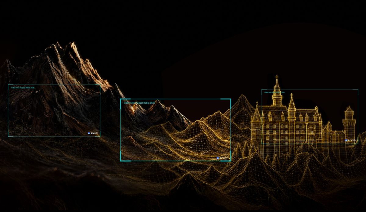
What if a drone flight could do more than capture pretty aerial footage? DJI is asking drone operators around the world to put their aircraft to work documenting places that may not always look the same in the future. The company has launched its World Heritage 3D Conservation Initiative, a global competition that challenges drone operators to create 3D reconstructions of natural and cultural heritage sites and turn those models into flythrough videos.
The initiative runs through October 10, 2026, with winners to be recognized in November. DJI is offering camera prizes, along with the chance for selected projects to receive global exposure through its channels.
The idea is fairly straightforward: Pick a heritage site, capture it from the air, build a 3D model and use DJI Reality to transform that model into a video people can explore virtually. And the sites don’t have to be famous tourist attractions.
From glaciers to old buildings
DJI has divided the competition into two categories: Natural Heritage and Cultural Heritage.
Natural Heritage entries can focus on mountains, lakes, forests, and other landscapes with ecological, geological, or scenic value. That could mean a well-known national park, but it could just as easily be a significant landscape closer to home.
Cultural Heritage covers a similarly broad range. Participants can document monuments, archaeological sites and historic architecture, along with old villages, industrial sites, urban landmarks and structures featuring historical or artistic significance.
The common thread is creating a digital record of something worth preserving. That matters because physical heritage sites face plenty of threats, from erosion and storms to changing landscapes and ordinary deterioration. A detailed 3D reconstruction can’t replace the real thing, but it can provide a digital snapshot that can be revisited, studied and shared.
DJI has already demonstrated how that kind of aerial mapping can be used beyond simply making impressive visuals.
At Mount Qomolangma’s Khumbu Icefall, for example, a DJI Matrice 4E has been used to survey the constantly shifting glacier. DJI Terra processes the aerial data into detailed 3D models that can help Icefall Doctors plan routes and allow researchers to monitor changes in the glacier.
In Guatemala’s El Mirador Basin, DJI says a Matrice 400 equipped with a Zenmuse L3 LiDAR sensor has been used to capture point-cloud data through rainforest vegetation, helping generate digital elevation models of Maya archaeological sites hidden beneath the canopy.
The new competition takes that kind of work and adds a storytelling component.
Your 3D model becomes the video
The workflow starts with mission planning. Operators plan their flight around the terrain or structure they’re documenting before collecting aerial imagery with a compatible DJI drone.
The captured data can then be processed into a 3D reconstruction using DJI Terra. Depending on the project, that reconstruction can take the form of a mesh model, 3D Gaussian Splatting (3DGS) model or point cloud.
From there, DJI Reality takes over. The software can turn those 3D datasets into flythrough videos, allowing viewers to virtually move through the reconstructed site. DJI encourages participants to go beyond simply exporting a digital tour, suggesting they add real-world footage, behind-the-scenes survey footage, before-and-after comparisons and music.
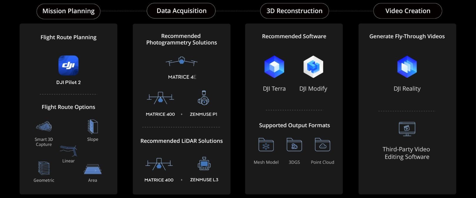
The required submission is an MP4 generated using DJI Reality and based on a 3D model of the heritage site. DJI recommends 4K at 60 frames per second, with videos running between 30 seconds and five minutes.
There’s also a catch for anyone thinking about using generative AI to make their entry look more impressive: DJI says fabricated or artificially altered 3D models or video content will result in disqualification.
There are prizes, too
Four winners will receive an Osmo Pocket 4 Standard Combo for Excellence in Natural Heritage, while another four will receive the same prize for Excellence in Cultural Heritage.
There’s also a People’s Choice Award with four winners, each receiving an Osmo 360 Standard Combo.
The timeline is slightly unusual because the People’s Choice announcement comes before the final showcase. DJI lists October 10 as the submission deadline, October 15 for the People’s Choice announcement, and November 3 for its Excellence Showcase. To enter, participants need to post their flythrough videos on eligible social platforms, including Instagram, Facebook, LinkedIn, YouTube, or X, while using #DJIMapYourHeritage and #DJIEnterprise and tagging DJI Enterprise.
There are some important conditions. Operators are responsible for following drone laws at their chosen location and ensuring their work doesn’t violate third-party rights. Participants also grant DJI worldwide, perpetual, and royalty-free rights to display, distribute, and use submitted work.
DJI Reality itself is free to download, so operators don’t need a separate software license to turn an existing reconstruction into a competition entry.
For drone pilots who already do mapping, surveying or photogrammetry, the initiative offers a reason to point those skills toward something a little different. Instead of creating another 3D model that lives on a hard drive, the goal is to turn that data into a visual record of a place that future viewers may appreciate — whether it’s a famous landmark or a piece of heritage hiding in plain sight.
More: FCC clears nationwide test of cellular networks for drones


FTC: We use income earning auto affiliate links. More.




Comments