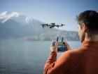
Five days ago, we first reported on the newly announced DJI Phantom 4 RTK (Real-Time Kinematic). This new DJI model with very precise and accurate mapping technology, showed up during an official event of the Chinese drone manufacturer where two other new drones for the agricultural market were introduced. Details of the Phantom 4 RTK where very limited initially. We had reached out to DJI to find out more but at the time they could only confirm that this was indeed a new DJI drone model. We do not have any information yet on price and availability.
Since then new photos and more information about the Phantom 4 RTK have emerged.
What we know about the Phantom 4 RTK
Initially, we had found this on Facebook:
“D-RTK is a high precision navigation and positioning system specially designed for DJI A3 series flight controllers. Using dynamic differential technology, it provides ultra-accurate, centimeter-level 3D positioning. This enhanced accuracy over typical barometer, compass and GPS systems makes D-RTK essential for commercial, industrial and scientific applications where accuracy is imperative.”
Then we received the confirmation from DJI:
“DJI unveiled the Phantom 4 RTK (Real-Time Kinematic) at an event in China, though it is still a prototype and we do not yet have a timetable for when it will be available for purchase. It uses the Phantom 4 Pro 20-megapixel camera and is augmented by a high-precision GNSS (satellite positioning) module to provide much more accurate RTK-level data. This is designed for surveying and mapping applications that need centimeter-level accuracy in flight as well as post-processing. As this product comes closer to market, expect us to have more to say about its capabilities and availability.”
And also found the following text, photos and video clip with the help of @d0tslash
The PC GS Pro works with the Phantom 4 RTK, with a precision-targeted RTK, 1-inch 20-megapixel CMOS and OcuSync 2.0 HD digital image transmission technology, can easily complete the homework. In addition, you can still use Phantom 4 Pro and Phantom 4 Advanced for jobs.
PC GS Pro can use the DJI UAV for automatic image acquisition of farmland, farmland 2D images can be synthesized in real-time. It only takes 25 minutes to complete the image collection, processing and job planning of 550mu plots, which is far more efficient than traditional manual planning. Users can also choose to import images after the way to build a map to obtain more accurate images.


Phantom can make maps… pic.twitter.com/koCxzo1S4M
— KF (@d0tslash) December 20, 2017
We will keep you posted about DJI’s new Phantom 4 RTK as new information becomes available.
FTC: We use income earning auto affiliate links. More.


Comments