Enforcing local drone rules can be extremely challenging for communities. Too often the rules are simply not presented to drone pilots broadly enough. And many a time, their compliance becomes dependent on posted signs that can be easily missed. It’s a problem that 6,600 US state parks desperately want to solve. Aloft Technologies says its new geospatial data platform, Aloft Geo Portal, can help.
Launched today, Aloft Geo Portal is a free tool to publish airspace and ground-rule advisories to the Aloft data network, including B4UFLY. It aims to close the gap between FAA airspace rules and local ground rules for drone operations nationwide.
Related: Reckless drone use leaves 1,500 elegant tern eggs abandoned
“As it exists today, there’s a major information awareness gap in the industry and for drone pilots everywhere that makes compliance elusive,” Aloft CEO and Founder Jon Hegranes points out. “We’re connecting the dots between drone operators, local governments, and comprehensive rules of operations to the largest and most active drone flight data network.”
The company, which powers more than 70% of all LAANC authorizations in the US, says its Geo Portal will put the control of advisories in the hands of verified users and enable them to reach the widest possible audience of drone pilots through Aloft. The plan is to expand the program globally once it is seen as a success in the US.
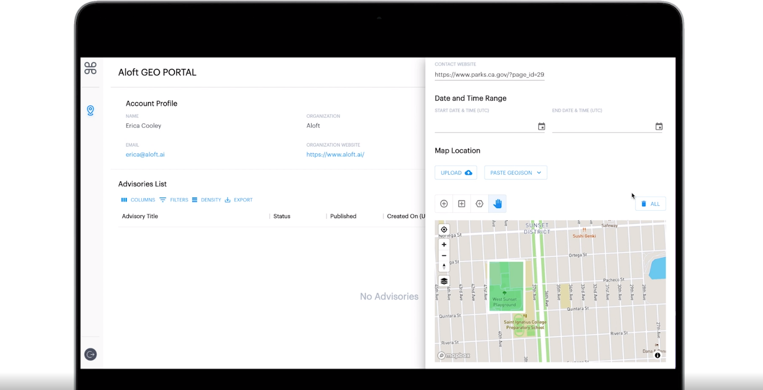
How to use Aloft Geo Portal
To create an account and start publishing advisories, users will need to submit a verifiable email from the organization they work for as well as detailed information on the parameters and basis for the advisory. Here’s a short video that shows how the portal works:
Hegranes sums up:
The remotely-piloted nature of drones is precisely what makes them so revolutionary, so transformative, and so safe. But it also causes havoc when it comes to compliance. Not only does one need to comply with federal airspace regulations, but you also need to adhere to the rules on the ground that apply to your feet and thumbs. We’re going to solve this for the benefit of all of our users, partners, and the future of the industry. If you think this is an issue with small drones and recreational pilots, just wait for drone delivery and air taxis.
Read more: DJI M300 RTK drone, Zenmuse L1 firmware update slashes mapping mission time by 40%
FTC: We use income earning auto affiliate links. More.


Comments