Update, January 27, 2023: American Water has clarified that advanced drone flights are being made possible courtesy of its partnership with the New Jersey Innovation Institute (NJII), an New Jersey Institute of Technology (NJIT) corporation which holds an FAA Part 91 Certificate of Authorization.
The earlier report from American Water follows…
American Water says it has earned a new waiver from the Federal Aviation Administration (FAA) that would allow the utility to fly its drones both beyond visual line of sight (BVLOS) and up to an altitude of 1,500 feet above ground level.
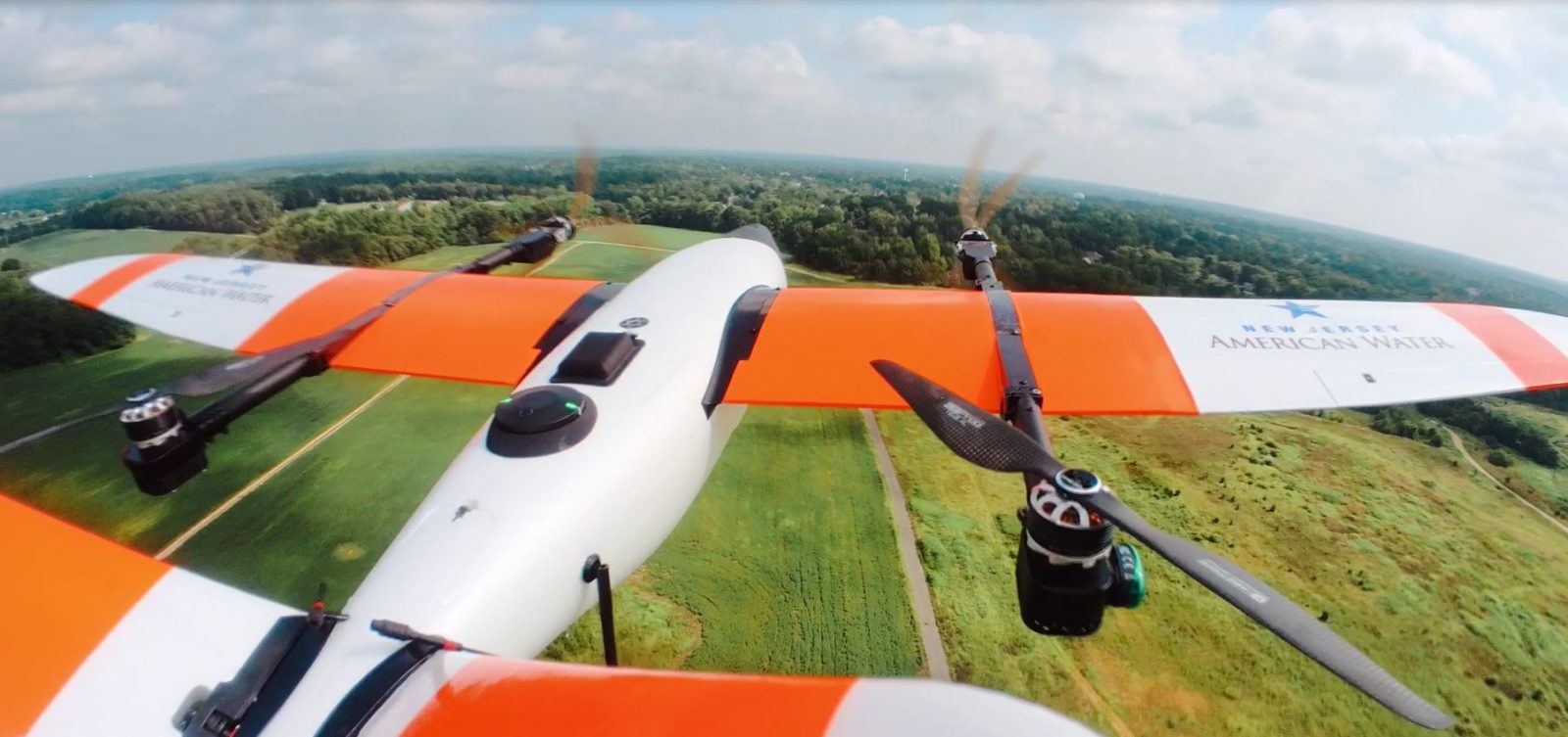
American Water uses its drone program to capture hundreds of thousands of images and aerial maps of critical assets annually. Aerial imagery helps the water and wastewater utility company to monitor its systems and improve the reliability of its services.
Last year, American Water secured a BVLOS waiver to safely inspect the facilities that become inaccessible for extended periods of time during flooding events. Now, the new authorization certificate provides the company with opportunities for enhanced environmental monitoring.
As Christopher Kahn, director of UAS at American Water, explains:
American Water is proud to earn this authorization from the FAA, which will allow us to fly three miles from a UAS pilot at an altitude of 1,500 feet to capture wide area mapping at high resolutions. This significant milestone will enhance the monitoring of source water and potential environmental threats to the water supply.
American Water uses Censys Technologies Sentaero BVLOS V2 aircraft for long-range mapping and inspection missions. The drone’s high-resolution cameras help to inspect facilities from miles away while staying in the air for over an hour. Trevor Perrott, CEO and co-founder of Censys Technologies, adds:
American Water earning this FAA approval is important for the integration of drones in the national airspace because it is an example of enterprise operation standardization across multiple applications. Through American Water’s leadership, our country is another step closer to making safe BVLOS drone missions commonplace. The exciting part is the story doesn’t end here.
American Water is also working closely with several government agencies and partner organizations to enable BVLOS drone missions during temporary flight restrictions, which are commonly in place after natural disasters. In New Jersey, for instance, the company has been collaborating with national, regional, and local emergency management agencies to demonstrate how drones can be used to support natural disaster recovery efforts and improve coordination between first responders.
Read: DroneDeploy autonomous flight app adds support for DJI Mavic 3E
FTC: We use income earning auto affiliate links. More.


Comments