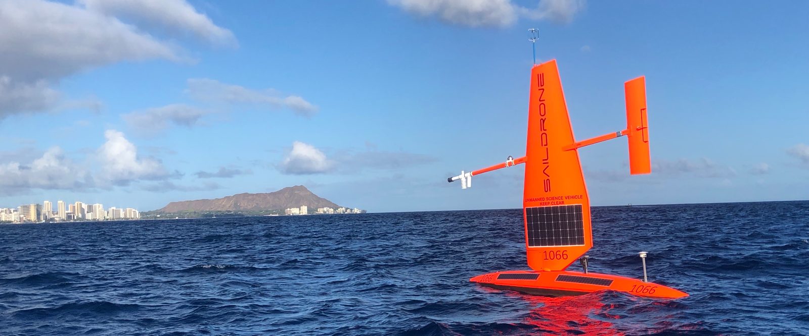
Three semi-autonomous uncrewed marine drones have set sail from Honolulu for a six-month mission collecting data off the coasts of Hawaii’s larger islands to measure the acidic effects of climate change on nearshore oceanic environments.
The three surface Explorer UAVs produced by Saildrone have begun their half-year scientific journey, during which they will gather marine data up to five kilometers off the coasts of Maui, Oahu, Kauai, and Hawaii Island. In particular, the study of pH and carbon dioxide measurements taken from the craft will permit researchers to better understand how much nearshore waters are accumulating fossil fuel emissions.
Read: Drone flown robotic arm revolutionizes Kauai’s rare flora preservation
Deployment of the new maritime UAVs will mark a significant improvement in capabilities over earlier generations of marine drones and crewed boats off Hawaii. The updated craft will permit 24/7 operation, and real-time transmission of data back to labs for continual analysis.
That, project leaders say, will not only provide about 1,000 times more ocean chemistry measurements in coastal waters than was previously possible, but it will in particular reveal just how much the pH of coastal waters has been altered by the creation of carbonic acid when carbon dioxide mixes with water.
“Many people maybe are not familiar that the oceans are absorbing between 25 and 30 percent of all the CO2 that we release into the atmosphere,” said Christopher Sabine, an oceanography professor at the University of Hawaii-Mānoa, which along with the National Oceanic and Atmospheric Administration’s Pacific Marine Environmental Lab is one of the main partners in the project.
“We’re seeing pH levels that are lower than the oceans have seen for perhaps as long as 20 million years,” Sabine continued “And so, many of these organisms that live in the ocean evolved during a time of very stable pH… so we’re changing the fundamental chemistry of the oceans by changing the pH.”
While two of the 23-foot marine drones zigzag their way between Hawaii’s coasts and the five-kilometer limit mark, a third will sail a straight and continuous route around each of the main islands. Measurements collected will establish pH maps and alert researchers to hot spots of ocean acidification.
The three University of Hawaii marine drones are equipped with advanced safety protocols that enable their unprecedented, data-enriching, round-the-clock operation.
Those include automated dynamic positioning and piloting based on real-time measurements of GPS location, winds, and currents. An automatic identification system, meanwhile, will detect and avoid other vessels, while highly visible lights and markings keep the vehicles safe even when close to shore.
Read: Drones lead Hawaii’s coconut rhinoceros beetle battle
One of the main questions researchers will be studying is how organisms that create calcium carbonate, like corals, oysters, and crabs, are adversely affected by acidified water in producing their shells and skeletons.
“That’s the primary effect that we’re focusing on — in this case, for the Hawaiian Islands — is the impact that ocean acidification will have on our coral reefs,” Sabine said. “Because, of course, the coral reefs are critical for tourism, for protecting our coastlines from storms, for cultural practices, and subsistence fishing.”
FTC: We use income earning auto affiliate links. More.


Comments