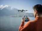
Having an eye in the sky is essential for Wilderness International, a nonprofit that has saved more than 4.5 million square meters of valuable and endangered rainforest to date. Here’s how drones are enabling the organization to follow a transparency-centric approach to conservation…
Wilderness International was founded in Germany, Canada, and Peru in 2008 with a mission to protect the planet’s fragile natural treasures and at-risk ecosystems. The organization works by legally securing the purchase of ecologically valuable and acutely threatened wilderness areas around the world, so it can protect them in perpetuity.
More specifically, every 1€ in donation helps to safeguard a square meter of forest. Donors receive a personalized certificate with an aerial photograph and geocoordinates of the area. Not only does this allow donors to see exactly which piece of forest Wilderness International is protecting with their donation, but it also makes the rainforest tangible for those who don’t have the opportunity to visit it.
Also read: 191-pound drone gets nationwide exemption from FAA to fly BVLOS
Though Wilderness International has been using drones since 2014, this year, the organization has entered into an official partnership with DJI to create key documentation. The world’s largest consumer drone maker has provided Wilderness International with aircraft of various sizes and capabilities, including the new Mavic 3 Enterprise, Mavic 3 Multispectral, and Mini 3 Pro.
The compact and discreet Mini 3 Pro is being used in Peru to uncover illegal activities that threaten the ecosystem. According to Wilderness International forest guardian Santiago Durand, detecting illegal logging in a systematic manner is almost impossible without the help of aerial tools such as drones.
“Previously, you would have to hire a helicopter to do this work, but that is not only prohibitively expensive but it can also be heard from miles away. So, the loggers can disappear out of sight before pictures are taken. Drones are cheaper, can be deployed spontaneously, and are much more unobtrusive,” Durand points out.
Another key use of drones is rapid assessments. As Tom Andersch, cofounder of Wilderness International, explains, “We have a fast-growing base of supporters. This means we need to assess and protect more and more pieces of land faster, all of which need to be surveyed. With Mavic 3 Enterprise, we managed to inspect 140 [hectares] in only 50 minutes, and I was thrilled that the drone performed the flight autonomously. It’s going to make our job a lot easier in the future.”
Also read: Drone pilot gets $1,900 fine for ‘complete disregard’ for the rules
Mavic 3 Multispectral, meanwhile, is helping the nonprofit conduct more scientific research on biodiversity and connections to climate change as well as other conservation-related topics.
The high-tech sensors on this drone can see the spectral signature of a tree that cannot be detected by the human eye as it lies outside the visible light spectrum. Wilderness International is feeding the drone data into AI-based software to identify tree species and select the most biodiverse forest areas for conservation.
Read more: Walmart expanding drone delivery service with Alphabet’s Wing
FTC: We use income earning auto affiliate links. More.


Comments