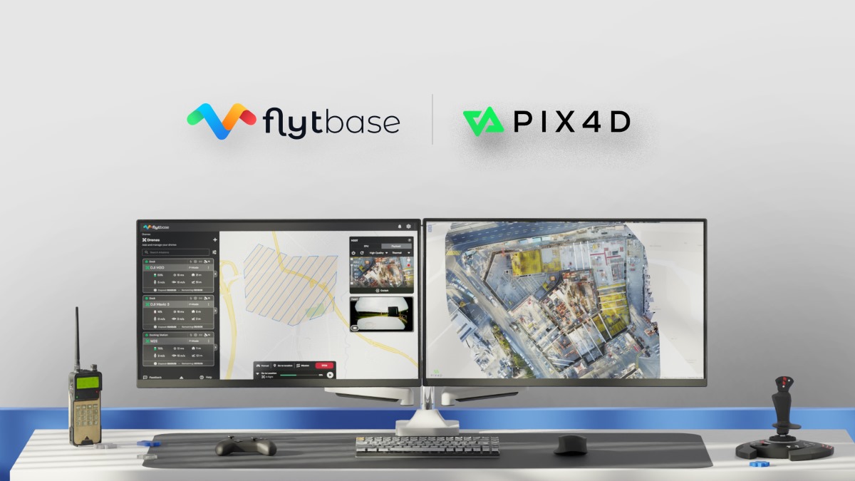
Drone autonomy software specialist FlytBase has announced a strategic partnership with photogrammetry company Pix4D. The collaboration will enable FlytBase users in construction monitoring, mapping, and surveying industries to seamlessly upload drone data directly to PIX4Dcloud, streamlining project management and reducing manual tasks.
As automated drone-docked operations become more prevalent, the demand for efficient data collection is also growing. Operators are now conducting numerous daily missions, even scheduling them in advance from remote command centers. The current process of planning, executing, and managing drone operations, however, involves multiple platforms, creating inefficiencies and increasing the potential for errors.
This is where FlytBase’s Pix4D Flink offering comes in. Users can sync their drone data directly from FlytBase to PIX4Dcloud, a top online platform specializing in terrestrial and drone mapping, progress tracking, and site documentation.
PIX4Dcloud processes high-resolution images using advanced photogrammetry algorithms, converting them into precise, georeferenced orthomosaics, 3D meshes, point clouds, and elevation models.
Complying with ISO 27001, SOC 2 Type II, and GDPR standards, FlytBase provides the latest automation functionalities required for docked drone operations, combined with flight safety and fleet management capabilities. It enables users to execute consistent drone data collection operations while seamlessly integrating with beyond visual line-of-sight (BVLOS) hardware and software solutions, such as parachutes, detect-and-avoid systems, uncrewed traffic management, and weather monitoring systems for safe operations.
“The integration of FlytBase and Pix4D addresses long-standing operational challenges in the drone industry by consolidating mission planning, data collection, processing, and analysis into a cohesive, end-to-end solution,” says Nitin Gupta, CEO and founder of FlytBase.
Jeff Muller, director of platform at Pix4D, adds, “Efficient drone monitoring of enterprise assets and construction projects has never been easier, thanks to the one-click integration of Pix4D’s photogrammetry technology and FlytBase’s drone autonomy platform. This seamless workflow will automatically deliver the data you need to make the right decisions to deliver the best outcomes.”
You can join FlytBase and Pix4D for their webinar “Automating 3D Data Acquisition & Processing in Construction with Drone Docks” on August 14 at 10 a.m. CT.
Read more: NYC allows drone flights over people with FAA’s latest waiver
FTC: We use income earning auto affiliate links. More.


Comments