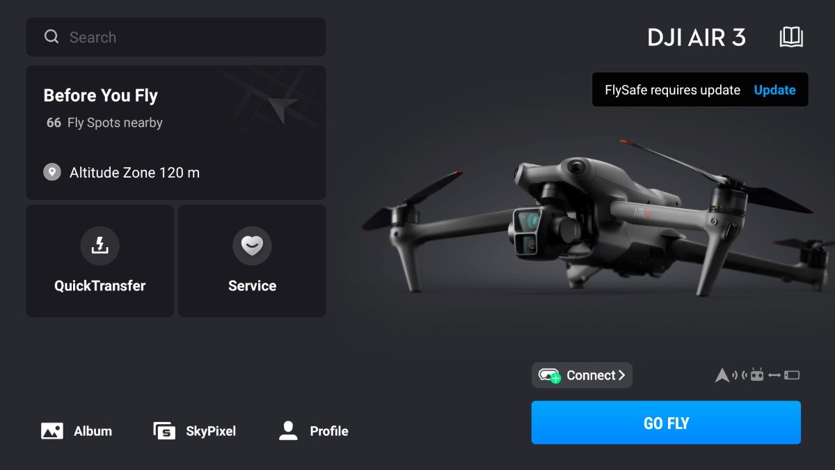
In a pivotal shift for drone operations, DJI, the world’s largest civilian drone manufacturer, has scrapped its proprietary geofencing system in favor of official Federal Aviation Administration (FAA) data across the United States. The update, effective January 13, 2025, changes the way drone operators navigate controlled airspace — placing full responsibility for flight safety and potential violations squarely on their shoulders.
Under the new system, areas previously designated by DJI as Restricted Zones, often termed No-Fly Zones, are now categorized as Enhanced Warning Zones. This adjustment means operators will no longer face automatic flight restrictions but will receive alerts when entering sensitive areas such as airports and government facilities. The shift effectively puts critical decision-making in the hands of drone pilots, who must now self-regulate their compliance with FAA rules.
DJI emphasizes that users must stay connected to the internet and update their flight apps regularly to maintain current airspace data. However, unlike the previous system that enforced automatic limitations, pilots are solely responsible for ensuring lawful and safe drone operations.
New: Insta360 Flow Pro 2 vs. Flow Pro vs. Flow: Smartphone gimbals compared
From guardian to guide: DJI’s departure from hard geofencing
DJI initially introduced its Geospatial Environment Online (GEO) system in 2013 to safeguard against accidental flights in restricted zones during a time when drone regulations were still evolving. With the new update, the company has aligned its safety system more closely with FAA data but has relinquished much of its gatekeeping role.
This move mirrors similar changes in Europe, where DJI integrated national aviation authority data last year in response to evolving drone regulations.
The update arrives amid heightened scrutiny of drone operations following recent airspace safety incidents. A recent notable case in Los Angeles involved a DJI Mini drone collision with a “Super Scooper” firefighting aircraft combating a wildfire, causing significant damage and raising alarms about the risks of unauthorized drone flights during emergency operations.
The FAA continues to investigate, reinforcing the legal consequences for drone pilots who endanger lives by ignoring flight restrictions. Violations can lead to hefty fines or imprisonment, particularly when they interfere with emergency responders.
Update: No, DJI’s drone geofencing update isn’t retaliation for proposed US ban
DJI’s overhaul represents a significant wake-up call for drone operators, urging them to take full ownership of their flight decisions. The FAA has made clear that ignorance of no-fly zones will not be tolerated, emphasizing that pilots are expected to remain vigilant and compliant at all times.
To support operators in this responsibility, DJI recommends users regularly:
- Update flight applications: Ensure the latest geofencing data is downloaded.
- Secure necessary authorizations: Obtain proper FAA permissions when operating near controlled airspace.
- Consult official FAA resources: Stay informed on the latest regulations and restrictions.
The replacement of DJI’s proprietary system with FAA data marks a new era for drone operations in the US — one where the onus of responsibility for compliance and safety now rests heavily on the shoulders of drone pilots.
At the same time, it’s worth pointing out that since introducing the GEO system in 2013, DJI has pioneered several safety features to promote responsible drone usage, including Remote Identification technology to assist authorities in identifying and monitoring airborne drones, autonomous Return-to-Home technology and Vision Assist to ensure drones return safely if they lose connection or have critically low batteries, as well as increased use of obstacle and aircraft detection sensors that enhance situational awareness to prevent collisions.
More: Cinematic FPV at your fingertips: DJI launches O4 Air Unit
FTC: We use income earning auto affiliate links. More.


Comments