When labor is tight and timing matters, technology is stepping in to pick up the slack. That’s the reality many US farmers are facing right now, and it’s exactly where the newly available XAG P150 Max agricultural drone is positioning itself as a practical solution.
With spray windows getting shorter and skilled labor harder to find, the P150 Max is built around one simple idea: help farmers finish critical fieldwork faster, with fewer people, and without cutting corners. Instead of focusing on a single task, the drone is designed as a multi-role workhorse that can spray, spread, map fields, and even support on-farm logistics — often on the same day.
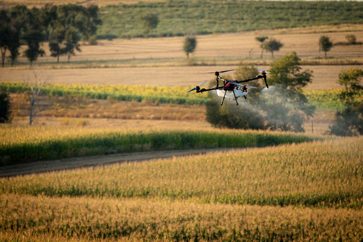
At the heart of the P150 Max is speed and scale. The drone can carry payloads up to 176 pounds and fly at speeds approaching 45 mph, reducing the number of stops needed for refills. Under normal conditions, it can spray roughly 50 to 60 acres per hour, with peak output climbing as high as 70 to 80 acres per hour. That puts it among the most productive agricultural drones currently available, especially when time-sensitive applications are on the line.
New: Drone threat or laser test? Texas airport reopens after chaos
One standout feature is its swarm control capability. A single operator can manage two drones at once, effectively doubling output without doubling labor. For farms stretched thin during peak season, that kind of flexibility can make the difference between finishing on time, or not.
The P150 Max also leans heavily on real-world reliability. It’s part of XAG’s P Series platform, which has accumulated more than 9.3 million flight hours globally since 2022. Field testing across places like New Zealand, Australia, South Africa, and parts of Europe has shaped a system designed for uneven terrain, irregular field boundaries, and complex obstacles — conditions that mirror much of rural America.
On the application side, the drone adapts to different crops and use cases. Its liquid spraying system carries just over 21 gallons and supports adjustable droplet sizes, making it suitable for everything from row crops to denser canopies. An optional upgrade boosts flow rates for orchard and specialty crop work. For spreading tasks like fertilizer, cover crops, or biologicals, the drone’s vertical broadcast system pushes material evenly while reducing wind drift — an ongoing challenge with traditional methods.
Navigation and safety are handled by a high-precision control system that uses RTK positioning for centimeter-level accuracy. Onboard radar and imaging help the drone recognize obstacles like power lines and center pivots, while built-in field mapping tools can survey large areas and automatically generate optimized flight routes. Missions can be planned from a smartphone or dedicated controller, even in areas with limited connectivity.
To keep operations moving, the P150 Max uses fast-charging batteries that can be turned around in minutes, minimizing downtime during long days in the field.
Now FCC-approved and available through authorized US dealers, the XAG P150 Max arrives as a globally tested platform tailored for American agriculture. With local training, service, and parts support in place, it’s aimed squarely at farms looking to do more with less, without sacrificing precision or reliability.
More: Valqari locks major patent for fully autonomous drone delivery
FTC: We use income earning auto affiliate links. More.


Comments