As Europe prepares for its largest-ever coordinated wildfire response, drones are becoming indispensable tools for spotting fires, tracking their spread, and keeping emergency crews informed. The problem? Once those drones leave cellular coverage, getting live video back to responders typically means carrying heavy satellite terminals. That’s exactly the challenge OQ Technology says it has solved with a new satellite demonstration.
The company has successfully completed what it calls Europe’s first drone video transmission over a Low Earth Orbit (LEO) satellite network using standardized 3GPP Non-Terrestrial Network (NTN) technology operating on Mobile Satellite Service (MSS) S-band spectrum.
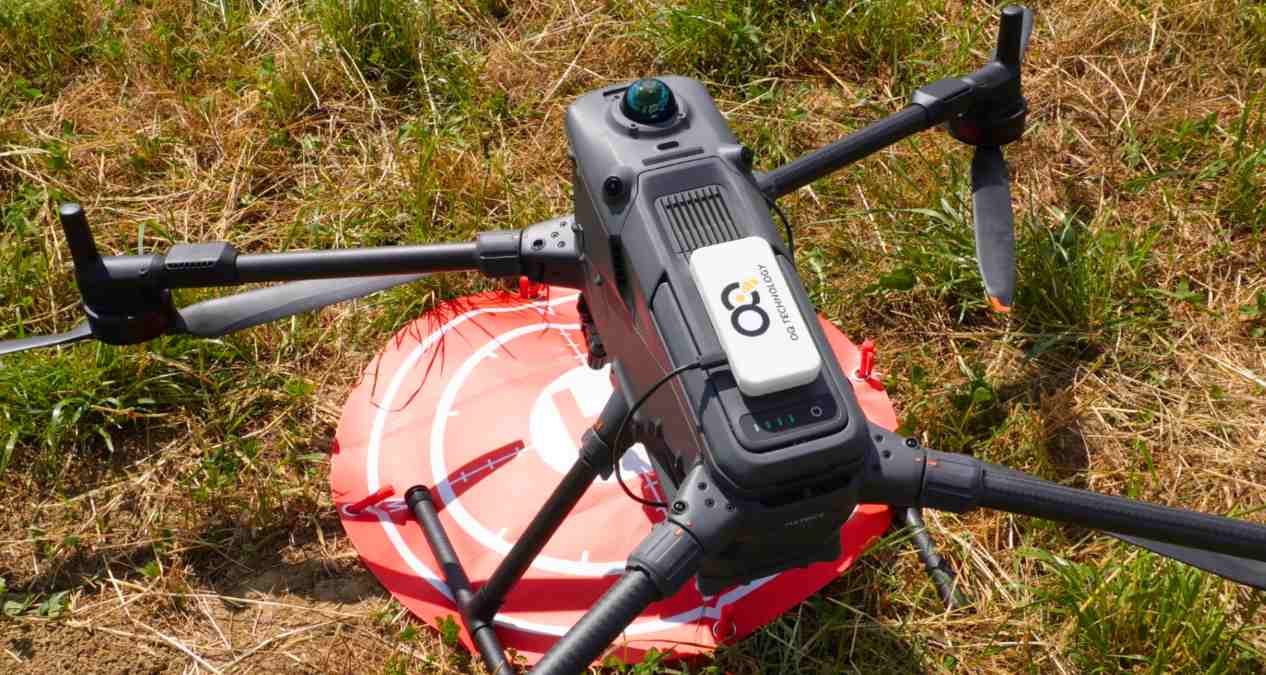
The demonstration, which you can watch on YouTube below, involved a compact drone transmitting video through OQ Technology’s European LEO satellite constellation before the footage was delivered through a secure cloud infrastructure located in Europe.
What’s particularly interesting isn’t just that the drone sent video via satellite. It’s how it accomplished the task.
Instead of relying on the bulky VSAT or broadband satellite terminals commonly used for beyond-line-of-sight communications, the drone carried a compact 3GPP NTN IoT modem integrated directly into the aircraft. The video was processed and compressed onboard using edge computing before being transmitted over a narrowband satellite connection, dramatically reducing the size, weight, power requirements, and overall cost of the system.
That’s an important distinction because every extra ounce matters on a drone. Smaller communication hardware means longer flight times, simpler integration, and potentially lower costs for commercial operators.
New: DJI expands Pocket 4P rollout to three more countries
According to founder and CEO Omar Qaise, the demonstration also shows how standardized 3GPP NTN technology is maturing into a practical communications platform rather than remaining an experimental concept.
The company says the same standards-based satellite network is designed to support not only drones but also IoT devices and even smartphones from manufacturers such as Apple, Google, and Samsung, creating a unified communications ecosystem that extends beyond traditional terrestrial networks.
To showcase the technology’s real-world potential, OQ demonstrated three drone applications during the test: infrastructure inspection, traffic monitoring, and autonomous navigation toward a designated destination. These are exactly the kinds of missions that can become difficult when aircraft move beyond reliable cellular coverage.
The company believes the technology could eventually support disaster response after floods or wildfires, search-and-rescue operations, critical infrastructure inspections, maritime monitoring, border surveillance, environmental monitoring, and other missions where maintaining situational awareness is critical.
For Europe, the milestone also aligns with broader efforts to strengthen sovereign communications infrastructure through initiatives such as IRIS, which aims to expand secure satellite connectivity across the continent.
While the demonstration doesn’t suddenly replace existing satellite communication systems, it does suggest a future where lightweight drones can transmit useful video data over satellite links without carrying the heavy equipment that has traditionally made those missions impractical. If that vision becomes commercially scalable, operators could gain another option for flying and staying connected in places where cellular coverage simply doesn’t exist.
More: Zipline adds Wonder to its growing drone delivery network
FTC: We use income earning auto affiliate links. More.


Comments