
Drone operations beyond a pilot’s visual line of sight are becoming more common across industries, but safely sharing airspace with crewed aircraft remains one of the biggest challenges. A new partnership between uAvionix and Airwise Solutions aims to tackle that problem by giving drone operators a much clearer picture of what’s happening in the skies in real time.
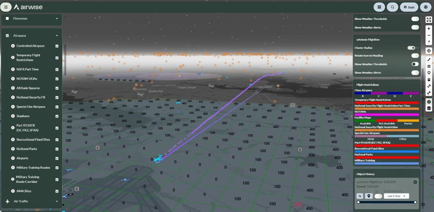
The two companies announced they have integrated uAvionix’s FlightLine surveillance service into Airwise Solutions’ enterprise drone platform and Nexus common operating picture. The collaboration is being rolled out through Skyway Range, a 1,200-square-mile Beyond Visual Line of Sight (BVLOS) flight test range based in Tulsa, Oklahoma.
The goal is straightforward: make advanced drone operations safer and easier to scale by combining reliable aircraft surveillance data with enterprise-grade uncrewed traffic management (UTM) software.
At the heart of the partnership is FlightLine, uAvionix’s nationwide surveillance service powered by its FlightStation network. The system collects Automatic Dependent Surveillance-Broadcast (ADS-B) data across both 978 MHz UAT and 1090 MHz Extended Squitter frequencies, allowing operators to detect cooperative aircraft flying at very low altitudes.
Instead of requiring organizations to install and maintain their own ground sensors, FlightLine delivers this surveillance data directly into the Airwise platform through a secure API. That means drone operators can access trusted airspace traffic information without investing in additional infrastructure or juggling multiple software systems.
The companies say the integration provides several benefits for organizations conducting complex drone missions. Operators receive continuous visibility into cooperative aircraft sharing the same airspace, helping improve situational awareness during flights. Low-latency traffic updates can also support faster decision-making and help prevent potential conflicts between crewed aircraft and drones.
Beyond flight awareness, the platform also offers real-time monitoring of FlightStation sensor health and data quality, giving operators confidence that the information they’re using is reliable. Because the system is already integrated, organizations can deploy UTM capabilities more quickly, whether they’re managing a handful of drone flights or a nationwide fleet.
Thomas Jimenez, vice president of Uncrewed Systems at uAvionix, says dependable surveillance data is essential as autonomous aviation continues to grow. “Reliable surveillance data is the cornerstone of scalable autonomous aviation,” Jimenez explains. “By integrating FlightLine directly into the Airwise platform and Nexus COP, we are eliminating the burden of local sensor deployment while providing operators with trusted, FAA-grade airspace traffic data right out of the box.”
Airwise Solutions believes the industry is moving beyond standalone drone software toward integrated operational platforms. “As drone operations continue to grow in complexity, operators need more than individual software tools; they need trusted data delivered within a unified operational environment,” John Powers, chief revenue officer at Airwise Solutions, stresses.
He adds that combining uAvionix’s surveillance capabilities with Airwise’s drone operations software and UTM tools gives organizations the confidence needed to safely expand advanced drone operations.
The partnership also strengthens Skyway Range, one of the country’s largest BVLOS testing environments. The range supports industry, government and academic organizations developing next-generation autonomous aviation technologies in both rural and urban settings.
The integrated capability is available immediately for Skyway Range participants as well as enterprise customers using the Airwise platform and Nexus common operating picture. As regulators and industry continue pushing toward routine BVLOS drone operations, partnerships like this are designed to provide the real-time airspace intelligence needed to safely support increasingly complex commercial drone missions.
More: Why America’s nuclear bases suddenly need DJI drones


FTC: We use income earning auto affiliate links. More.




Comments