
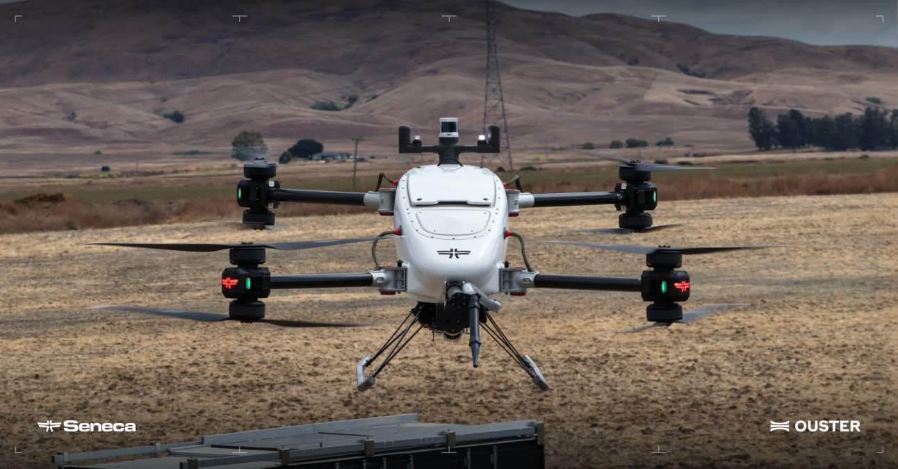
Wildfires are one of the hardest environments for autonomous drones to navigate. Smoke can obscure cameras, terrain can change quickly, and a drone carrying a heavy load has little room for error. That is why Ouster and Seneca are teaming up to give autonomous wildfire-response drones a better view of the world around them.
The companies announced a partnership to integrate Ouster’s Rev8 OS1 Max digital LiDAR into Seneca’s autonomous drone platform. The goal is straightforward: improve how the aircraft perceive, navigate, and avoid obstacles while operating in the unpredictable conditions surrounding wildfires.
LiDAR works differently from a conventional camera. Instead of relying on visible imagery, it sends out laser pulses and uses the returning signals to build a detailed 3D picture of the surrounding environment. That can give an autonomous aircraft another way to understand what’s around it when visibility becomes difficult.
For Seneca, that capability matters across several types of missions. The company’s drones are designed to carry heavy cargo to the fire line, follow terrain for mapping and vegetation management, and inspect structures and utility infrastructure. With Ouster’s LiDAR integrated into the perception system, Seneca says its aircraft can build a more precise 3D representation of their surroundings while performing those tasks.
The Rev8 OS1 Max is particularly suited to high-speed autonomous flight because of its range and resolution. The sensor uses 256 channels and can deliver up to 4K horizontal resolution, giving the aircraft more information about what’s ahead as it moves through an environment.
That’s important when an autonomous drone is moving quickly. More detection range can mean more time for the aircraft to identify an obstacle and adjust its flight path.
Seneca previously relied on infrared sensors and cameras for tasks such as collision avoidance, mapping, and object detection. The addition of LiDAR gives the company another layer of environmental perception that isn’t as dependent on visible-light conditions.
Durability is another consideration. Wildfire-response aircraft may encounter everything from extreme heat and smoke to dust, cold temperatures, and rough operating conditions.
Seneca says the Rev8 OS1 Max is rated IP68 and IP69K and qualified to operate across temperatures from -40°C to 85°C. The company also highlighted the sensor’s shock tolerance as a factor in its selection.
For Seneca CEO Stuart Landesberg, that ruggedness could be just as important as lidar performance when the aircraft are being deployed around active fires and other demanding environments.
The partnership also fits Seneca’s focus on American-built autonomous aircraft. Ouster says its digital LiDAR platform is compliant with NDAA Section 164 and Buy America Build America (BABA) requirements, supporting Seneca’s approach to designing and assembling its systems in the US.
The bigger picture is the growing role of autonomous aircraft in emergency response. As drones take on more demanding jobs around wildfires, simply being able to fly isn’t enough. They also need to understand their surroundings well enough to operate safely with limited human intervention.
For Seneca, adding LiDAR is another step toward that goal, and potentially toward drones that can spend more time doing useful work where conditions are too dangerous or difficult for conventional aircraft and ground crews.
More: US military taps Echodyne radars for a $250 million counter-drone deal


FTC: We use income earning auto affiliate links. More.


Comments