
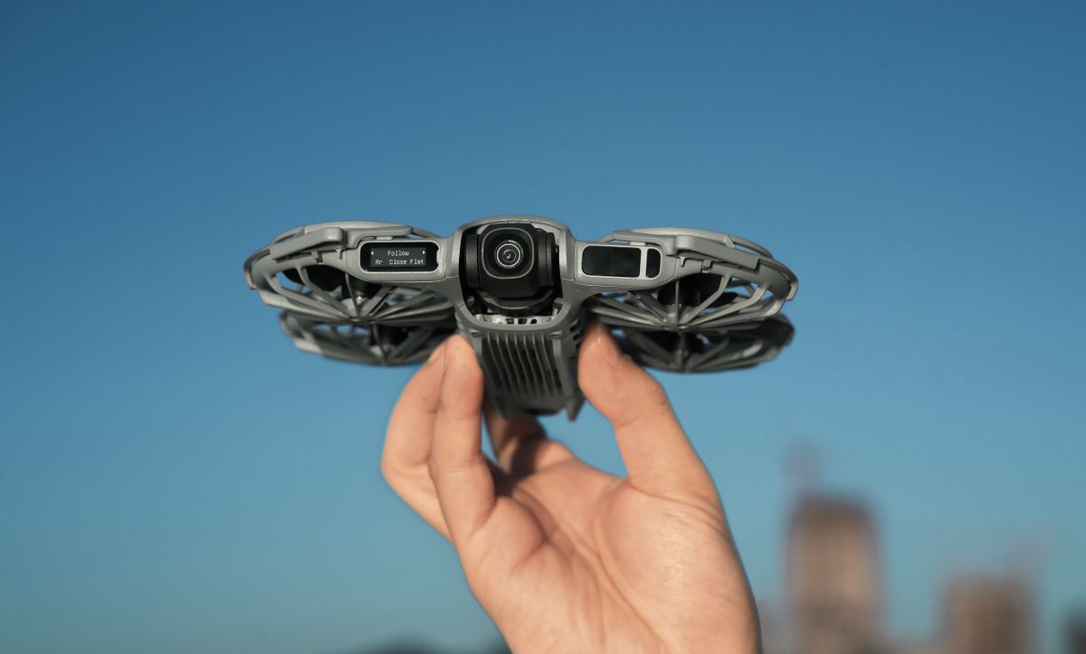
For most drone pilots, LiDAR isn’t something they actively think about. If you’ve flown a newer DJI drone after sunset and watched it safely weave around obstacles on its way home, the technology has probably already done its job without you noticing. Now, however, that tiny sensor is finding itself in the middle of a much bigger conversation.
The Federal Communications Commission (FCC) has proposed treating certain foreign-made drones equipped with advanced technologies like LiDAR as “military-grade” systems under new rules aimed at Chinese drone manufacturers. The proposal has sparked concern because several of DJI’s newest consumer drones, including the Air 3S, Mavic 4 Pro, Mini 5 Pro, and Neo 2, feature forward-facing LiDAR primarily for one reason: keeping recreational pilots from crashing.
That raises an obvious question.
If LiDAR is suddenly attracting regulatory scrutiny, why has DJI been putting it into nearly every premium consumer drone it launches?
The answer has much more to do with flight safety than military capability.
It’s like giving a drone its own flashlight
Most consumer drones rely heavily on cameras to avoid obstacles. That works well during the day, when there’s plenty of light for the cameras to recognize trees, buildings, and other hazards. But once the sun goes down, those vision sensors become far less reliable.
LiDAR solves that problem differently. Instead of waiting for reflected light like a camera, LiDAR actively emits laser pulses and measures how long they take to bounce back. That allows the drone to build an accurate picture of what’s in front of it, even when the environment is too dark for traditional cameras to see clearly.
Think of it as giving the drone its own invisible flashlight that works regardless of ambient lighting. That’s why DJI has increasingly positioned LiDAR as a nighttime safety upgrade rather than a photography feature.
The real benefit appears when Return-to-Home kicks in
One of the biggest advantages of DJI’s forward-facing LiDAR isn’t while you’re actively flying. It’s when you’re not.
If the drone loses signal or you tap Return-to-Home (RTH), newer DJI aircraft can continue scanning the path ahead using LiDAR. When an obstacle is detected, the aircraft can automatically climb roughly 10 meters to fly over it before continuing toward its home point.
If the obstacle is taller than the drone can safely clear, it simply stops and hovers, waiting for the pilot to take over.
That additional layer of protection becomes especially valuable during twilight or nighttime flights, when branches, trees, and buildings are much harder for cameras alone to distinguish.
New: GoPro MAX2 camera, now 40% off, unlocks pro video tools in free update
Cameras and LiDAR work together
One misconception is that DJI has replaced its vision system with LiDAR. It hasn’t.
During daytime flights, drones like the Air 3S primarily depend on their camera-based vision sensors for obstacle avoidance. The onboard flight computer automatically decides when LiDAR should assist, blending information from both systems to improve reliability.
At night, however, the balance shifts. If the cameras struggle because of poor lighting, the forward-facing LiDAR continues operating, allowing the aircraft to recognize objects ahead even when vision sensing becomes less effective.
DJI says the sensor provides a 60-degree horizontal and 60-degree vertical field of view, with an effective nighttime detection range of 0.5 to 25 meters on objects with sufficient reflectivity. The smaller Neo 2 has a shorter detection range of 0.3 to 8 meters, reflecting its compact size and intended beginner audience.
LiDAR isn’t magic
Despite its capabilities, LiDAR has limitations, and DJI is upfront about them. The system generally cannot reliably detect:
- Thin wires
- Glass
- Snow-covered landscapes
Flying speed also matters. Even if LiDAR detects an obstacle, approaching it too quickly may leave insufficient time for the aircraft to react. That’s one reason DJI recommends slower speeds in poor lighting conditions.
The company also notes that regular nighttime objects larger than about 2.5 centimeters with adequate reflectivity are generally detectable, although actual performance depends on the environment.
Why Sport mode turns LiDAR off
Pilots may be surprised to learn that LiDAR isn’t always active. Switch into Sport mode, and DJI automatically disables forward-facing LiDAR along with obstacle avoidance. That’s intentional.
Sport mode prioritizes maximum speed and responsiveness, leaving full responsibility with the pilot.
In Normal and Cine modes, however, users can choose whether obstacle avoidance, and therefore LiDAR, remains active through the Safety menu. If obstacle avoidance is switched off, both the vision system and LiDAR are disabled.
A tiny sensor with clever engineering
If you’ve looked closely at the Mavic 4 Pro, you may have noticed something unusual. Instead of placing the LiDAR sensor directly on the nose, DJI mounted it on the right front arm.
That wasn’t an aesthetic choice. The drone’s large camera gimbal already occupies much of the front of the aircraft. By relocating LiDAR to the arm, DJI gives the sensor an unobstructed field of view without compromising measurement accuracy or obstacle detection.
Meanwhile, the Mini 5 Pro adopts an entirely different solution. Its LiDAR uses a split-structure design, allowing engineers to increase the camera gimbal’s tilt range while still fitting advanced obstacle sensing into an ultralight aircraft.
Both drones rely on solid-state LiDAR, a newer, more compact technology that avoids the bulky spinning components once associated with early automotive laser scanners.
Fun details most owners never notice
LiDAR actually uses non-visible light, so pilots won’t see a laser beam while flying.
However, some smartphone cameras can detect a faint flashing purplish-red glow coming from the sensor during operation. DJI notes that certain devices, including some iPhones and iPads, may not capture this effect at all.
The sensor also remains inactive while the drone is sitting on the ground, activating only once the aircraft is flying. Even if communication between the aircraft and remote controller is lost, LiDAR continues functioning, allowing obstacle avoidance to remain available during automated flight.
Why this matters now
For years, LiDAR was mostly associated with self-driving cars, industrial surveying, and high-end mapping equipment. Today, it’s quietly becoming one of the biggest safety upgrades in consumer drones. That’s what makes the FCC’s proposal so noteworthy.
The same laser sensor regulators increasingly view through a national security lens is also helping everyday pilots avoid nighttime crashes, complete safer Return-to-Home flights, and navigate environments where cameras alone can struggle.
Whether the FCC’s proposal ultimately changes the availability of future DJI models in the United States remains to be seen. But one thing is already clear: LiDAR is no longer reserved for specialized industrial aircraft. It’s rapidly becoming a standard feature on mainstream camera drones, and for many pilots, it’s one of the most useful pieces of technology they never realized was working in the background.
More: The DJI trick every social media creator should know


FTC: We use income earning auto affiliate links. More.





Comments