
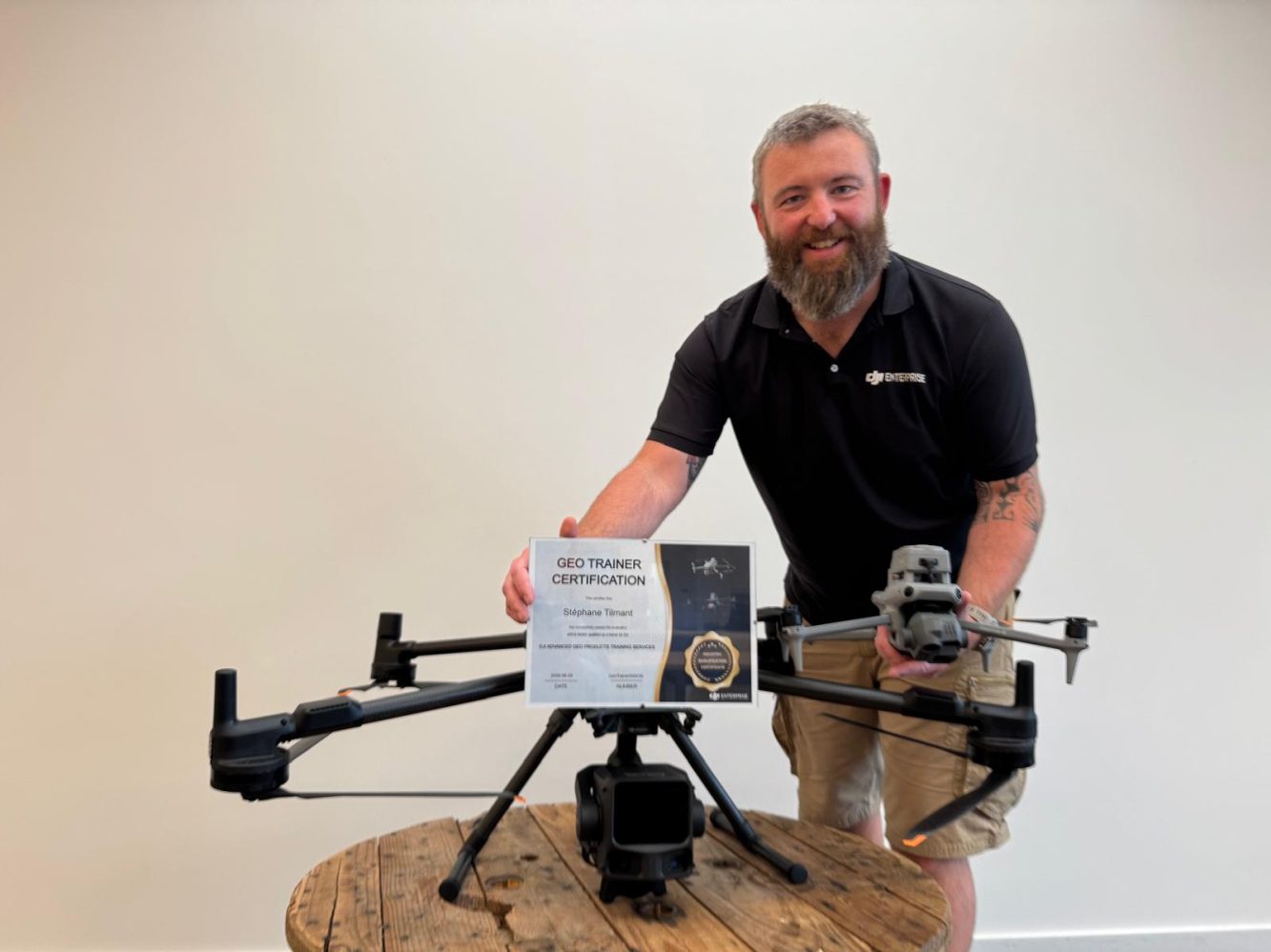
Flying a mapping drone is relatively easy. Getting consistently accurate, usable survey data out of it is a different story. That gap is what DJI is trying to address with its new Advanced GEO Products Training Services programme, which has now reached Europe’s Benelux region.
Drone Parts Center in Nivelles, Belgium, has become the first DJI-certified training dealer in the Benelux, which is the name for the economic/political cooperation area made up of Belgium, the Netherlands, and Luxembourg. Its operations manager, Stéphane Tilmant, completed DJI’s GEO Trainer Certification in August 2026, allowing the company to offer official training for DJI’s Matrice 4E mapping drone and Zenmuse L3 LiDAR sensor.
The programme was launched by DJI Enterprise in Europe in 2026 and is designed to standardize how professionals learn to use the company’s mapping hardware. Rather than relying primarily on online tutorials, trial and error, or informal instruction, operators can now follow a manufacturer-approved curriculum delivered by dealers that have gone through DJI’s own qualification process.
And there’s quite a bit more to professional mapping than simply getting a drone into the air.
Mission planning, data capture, RTK or PPK workflows, processing, quality control, and producing usable deliverables all play a role in whether a survey actually meets professional requirements.
DJI’s Matrice 4E course focuses on advanced photogrammetry workflows, including Smart 3D Capture, corridor, area and oblique missions, close-range flights and D-RTK 3 base station deployment. Trainees also learn how to process data in DJI Terra, edit models using DJI Modify, and carry out GIS analysis.
The Matrice 4E can cover up to 2 square kilometers per flight, making the training relevant to applications ranging from topographic surveys and construction monitoring to stockpile calculations, roof and facade surveys and accident scene reconstruction.
The Zenmuse L3 course takes a different approach, focusing on LiDAR-based mapping. The sensor can fire up to two million laser pulses per second and offers vertical accuracy of around 3 centimeters at 120 meters, according to DJI.
The course covers LiDAR fundamentals, acquisition planning, complex missions, RTK and PPK workflows, point cloud classification, editing and reconstruction. Those skills can be particularly useful for mapping forests, embankments, quarries, power lines and railways, where vegetation can make traditional photogrammetry more difficult.
The training itself starts with online self-study through DJI’s training portal. The material is currently available in English, with a French version expected in January 2027.
That is followed by one or two days of hands-on training in Nivelles or at the customer’s site. Sessions can be conducted in French or English and are organized privately for individual organizations.
Trainees also complete practical and theoretical assessments before receiving an official DJI certificate. Their access to updated course material remains valid for five years.
Importantly, participants don’t need a surveying background, and the course isn’t a substitute for a remote pilot license. They also don’t have to purchase the equipment first, meaning organizations can use the training to evaluate whether DJI’s mapping solutions fit their actual workflows.
“We sell increasingly capable drones, and we see too many customers using only part of them because nobody taught them the method,” says Didier Van Nes, founder of Drone Parts Center. “With this certification we can finally hand over the manufacturer’s know-how, not just the hardware.”
For DJI, the bigger goal appears to be making sure increasingly sophisticated mapping systems are used to their full potential. For Benelux professionals considering drones for surveying, construction, infrastructure, or other geospatial work, that could make the difference between simply owning capable hardware and actually getting professional results from it.
More: 11,000 drones just turned the Texas sky into a spectacle


FTC: We use income earning auto affiliate links. More.



Comments