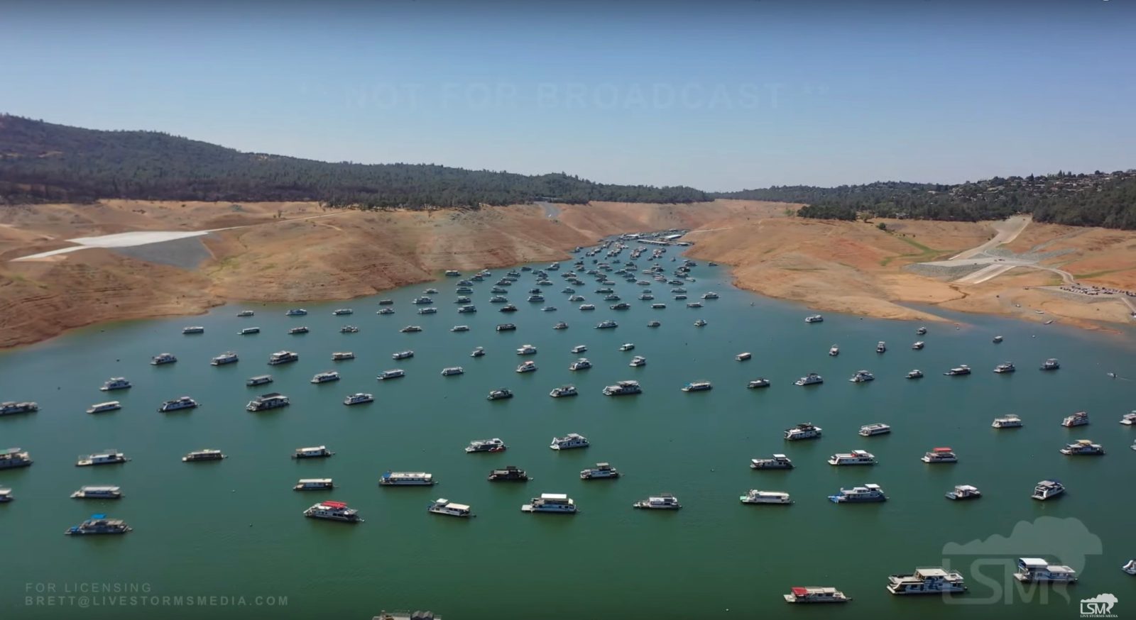
Frequent mention of even critical problems can cause them to blur into abstract notions in the human mind – a mental phenomenon often cured by perspective-restoring visual aids. That’s exactly what one drone pilot offered this week with his video laying bare just how grave California’s drought is.
Drone pilot’s arresting video of emptying reservoir amid California’s drought
The drone video was shot by Brandon Clement of Live Storms Media over sections of a reservoir severely emptied by California’s drought. Lake Oroville, the second-largest water reserve in the state, was filmed at an historic low level this week, with vast expanses of its shores and bottom usually hidden beneath the surface now exposed. Its volume has dropped so much that further evaporation is expected to halt operation of the reservoir’s hydroelectric power plant soon.
Revealed in Clement’s footage are steep slopes of Lake Oroville’s shores, marked by tiers and varying colors indicating higher water levels; the bare, sandy bottom of the reservoir already looking like an arid moonscape; and groups of boats anchored tightly together in the only areas of the lake still deep enough to accommodate them.
Those drone video visuals provide arresting immediacy to the less concrete statistical realities behind the emptying of the lake amid California’s drought.
On August 3 the lake’s surface – when full measuring in at 900 feet above sea level – was recorded at 643.5 feet. The previous record low mark was 645.11 feet during the 1977 drought, which represented around 25% of the area’s capacity. Officials warn that once the surface dips below the 140 foot mark, the lake’s Edward Hyatt hydroelectric power plant will cease functioning due to lack of water – another historical first. (The turbines have been temporarily shut down before, but for other reasons.)
State water officials have begun drawing off other reservoirs to supply Southern California clients, but the diminishing volume of Lake Oroville isn’t only a serious problem to humans. Several rivers rely on flows from the Oroville dam. The reduced source of those means river levels are low, and water temperatures in them rising in ways that may prove harmful to fish.
Those, perhaps, will be the subjects of Clement’s next drone video making California’s drought tangible to all viewers again.
FTC: We use income earning auto affiliate links. More.


Comments