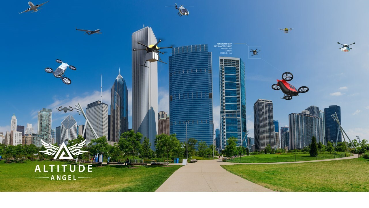
A UK consortium has revealed its blueprint to build the world’s largest and longest “drone superhighway,” connecting towns and cities across the nation. The 165-mile (265 km) Project Skyway is being hailed as “the most ambitious transport project proposed for the UK since the advent of the railway network in the 18th century.”
Led by Unified Traffic Management (UTM) software provider Altitude Angel, the consortium says it would initially connect the Midlands with the Southeast to cover cities such as Reading, Oxford, Milton Keynes, Cambridge, Coventry, and Rugby. In the second phase of the project, the superhighway could be extended to Southampton on the south coast and Ipswich on the east coast.
Also read: 14 amazing drone photos from DJI SkyPixel contest winners
The idea is to enable businesses in these regions to develop and grow through the commercialization of new drone-based products, processes, and services. However, a decision on whether the project would receive the green light is not expected for a few weeks at least.
But that’s not stopping Richard Parker, CEO and founder at Altitude Angel, from calling the proposed drone superhighway a harbinger of the second transport revolution in Britain. Here’s Parker:
Drones have the potential to transport goods in a way our ancestors could never have imagined but would have surely understood. Britain can lead the world in these innovative and life-saving technologies, we have the skills and ambition to open our skies to safe and secure drone and air-taxi flights.
With the government’s support, using this technology as its foundation, we can create networks spanning the length and breadth of Britain, a super-highway-network-in-the-sky, providing a critical digital infrastructure that will, in turn, enable the world’s first truly national drone economy.
Parker also points out that existing drone corridors or research facilities restrict access to operators by imposing punitive financial barriers to fly. Meanwhile, the drone superhighway planned in the UK would support fully automated drone flights beyond visual line of sight (BVLOS) from any drone company that completes a series of basic technical integrations, without requiring a specialist hardware onboard the drone.
Parker’s company is counting on the success of this highly ambitious project. Because once the UK drone superhighway is established, Altitude Angel would be able to market its detect and avoid technology to any organization, airport, or city in the UK or beyond, which wants to operate a similar corridor.
Read more: Canadian Draganfly drones to deliver medical supplies in war-torn Ukraine
FTC: We use income earning auto affiliate links. More.


Comments