Automated drone inspection software company Drone Harmony has announced a major app update. The company has combined all versions of its app into one streamlined platform, enabling both enterprise and professional users to access the features most relevant to their projects easily.
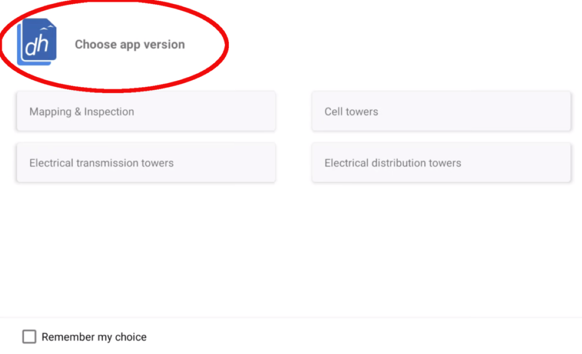
When you open the updated Drone Harmony app, you will now have the option to select the specific version you wish to use. The consolidation includes:
- Power Scanner Distribution and Power Scanner Transmission: Access both versions of Power Scanner seamlessly within the app.
- Tower Scanner: Tower Scanner functionality is now integrated into the unified platform, simplifying workflows for cell tower inspection tasks.
- General Mapping and Terrain app: The mapping and terrain capabilities are now part of the consolidated app, enhancing efficiency in mapping and inspection tasks.
Your access to features, meanwhile, will depend on your subscription plan. So, for instance, users with enterprise-level subscriptions will have access to all features within the app, but professional users will see only Mapping and Terrain functions. For ease of use, you can choose a default version of the app based on your preferences or the tasks you perform most frequently.
In addition, Drone Harmony’s app update packs in significant enhancements, including:
- Towers have the color defined on the web – now supports different colors.
- Electric towers: Ability to add notes to electric tower assets which was already supported on the web.
- Integration of Sony a7r IV camera.
- The loading site now has a landscape orientation.
- Super-Res Shooting option added on DJI M300 – H20 combination.
- New camera control icon for switching modes between normal image taking – Super Resolution – Video.
- Changed home point visualization in 3D view.
- On RC → It is not possible to open “Last drone position” in Google Maps, so we will copy the coordinates only.
- Latest PhaseOne firmware support.
- Waypoint mission info on selection in map view.
- Added + – buttons on gimbal controls for pitch and yaw.
- Zooming in improvements on large sites.
- Panorama is also supported through the camera trigger button similar to Hi-Res Grid.
- Super Resolution is to be called a Hi-Res Grid shot.
Finally, several bug have also been fixed with the latest app update. This list includes:
- An issue with RTH on missions requiring multiple uploads.
- Improved auto resume on large missions.
- Edit buttons were sometimes unresponsive but it is fixed now.
- Map view -> fixed drone follow/tracking logic.
Read more: DJI Mic 2 can now connect to Sony cameras
FTC: We use income earning auto affiliate links. More.


Comments