Swiss drone maker Wingtra has launched WingtraGROUND, a new ground control kit designed to take the guesswork out of collecting accurate drone data.
Surveyors rely on drones to map construction sites, track land changes, and gather crucial geographic data. But even with the best drone, ensuring precision has always required a complicated ground setup — one that involves multiple devices, manual data transfers, and a lot of patience. WingtraGROUND simplifies this entire process, making professional-grade surveys faster, more reliable, and accessible to beginners.
Drone surveying without the headaches
High-accuracy drone surveys need ground truth data — a reference point that corrects any positioning errors in aerial images. Traditionally, setting up these ground control points (GCPs) has been a slow, complex, and error-prone task.
“Drone data holds the power to boost safety and productivity across a range of vital industries,” says André Becker, senior product manager at Wingtra. “Yet when you need high accuracy, you need ground truth to prove it. The current error-prone ground control setup — which requires a lot of expertise to get right — has been a big blocker to unlocking the potential of drone data use. So we’re happy to bring you WingtraGROUND, offering a unified workflow for even beginner-level surveyors to get high-accuracy drone maps.”
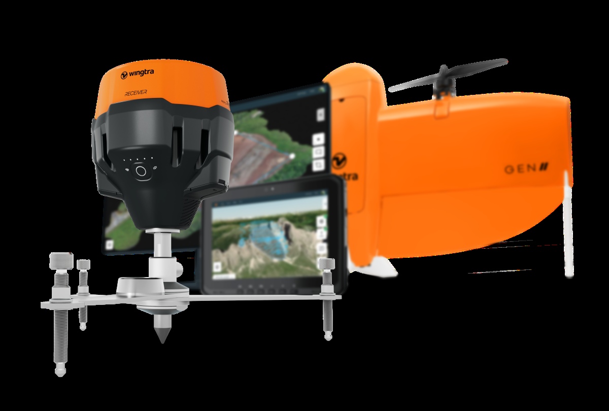
How WingtraGROUND works
WingtraGROUND is a portable, all-in-one survey kit featuring GNSS receivers powered by Emlid technology. These receivers act as a base station and rover, ensuring precise location data that integrates directly with Wingtra’s ecosystem.
Unlike traditional setups that require multiple tools from different manufacturers, WingtraGROUND provides step-by-step guidance to walk users through the setup. It also automatically syncs and processes data, reducing the risk of errors and eliminating the need for tedious manual work.
For surveyors like Jake Hinton, a partner at Flyover Services, this has been a game-changer.
“Capturing approximately seven sites daily, my biggest challenges were connecting multiple devices and manually downloading and organizing files,” Hinton says. “WingtraGROUND has been a game-changer by automatically syncing data, saving me significant time, and eliminating numerous manual steps.”
WingtraGROUND speeds up the ground control process while improving accuracy. Some of its standout features include:
- 4x faster setup: Reduces field setup time with automatic connections and step-by-step guidance.
- Seamless integration: Works effortlessly with Wingtra drones and software for an end-to-end workflow.
- Automatic data syncing: Eliminates the need for manual file transfers and reduces human error.
- Greater accessibility: Allows non-surveyors to collect reliable data without needing advanced expertise.
By streamlining ground control setup and eliminating technical roadblocks, WingtraGROUND can help more industries adopt drone technology with confidence. Whether monitoring construction progress, mapping forests, or inspecting infrastructure, surveyors can now collect accurate, high-quality data with minimal effort.
More: DJI just made the Osmo Action 5 Pro even more tempting
FTC: We use income earning auto affiliate links. More.


Comments