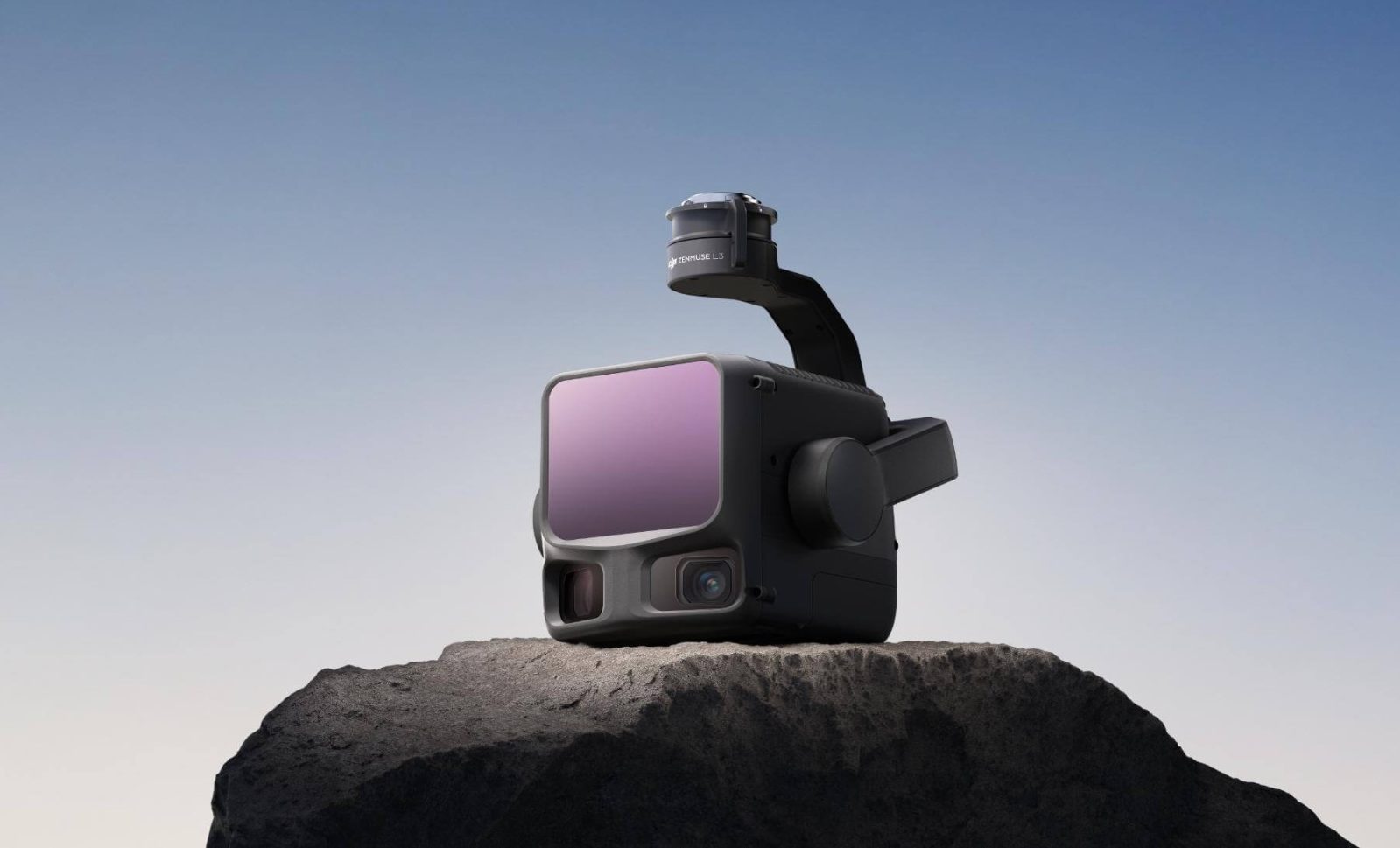
DJI just dropped a serious upgrade for mapping professionals, and it’s not a drone this time. Meet the Zenmuse L3, DJI’s first long-range, high-accuracy aerial LiDAR system that’s designed to take geospatial mapping and surveying to a whole new level.
Think of it as the ultimate precision tool for drone pilots who need detailed, reliable data from the air — whether they’re mapping power lines, analyzing forests, or planning city infrastructure. The L3 combines a next-generation 1535 nm LiDAR with dual 100-megapixel cameras, delivering both long-range detection and crisp RGB imagery in a single, unified system.
Pushing geospatial boundaries with DJI Zenmuse L3 LiDAR
If DJI’s previous Zenmuse L2 set the bar high, the L3 just vaulted over it. The new sensor can detect objects up to 950 meters away, even those with as little as 10% reflectivity — that’s like spotting a dull gray target from almost a kilometer out.
The 1535 nm wavelength LiDAR is self-developed by DJI and delivers a repeatability of 5 mm at 150 meters — an impressive feat that speaks to the system’s precision. In plain English: when you map the same object twice, your readings line up almost perfectly.
Even better, the L3 supports microsecond-level time synchronization, ensuring each data point — from LiDAR pulse to image capture — lines up precisely for highly accurate mapping models. DJI claims it can easily handle professional survey scales like 1:500 and 1:1000, offering vertical accuracy as tight as 3 cm at 120 m altitude.
That’s the kind of performance that used to require much heavier, costlier setups.
New: DJI Osmo Mobile 8 goes global, leaves US creators waiting
100 MP cameras, more laser power
If you’ve ever struggled with narrow camera angles during mapping, DJI just fixed that too. The Zenmuse L3 packs dual 100MP RGB mapping cameras, each with a large 4/3 CMOS sensor and a mechanical shutter. Together, they provide a massive 107° horizontal field of view — meaning each shot covers more area, faster.
Even when flying at 300 meters, you still get a ground sample distance (GSD) of just 3 cm, giving you incredibly detailed imagery. And because the cameras work in sync with the LiDAR, users can generate multiple mapping outputs — from digital orthophoto maps (DOMs) to digital elevation models (DEMs) — from a single flight.
DJI clearly wants to simplify life for aerial surveyors: fewer flights, less data merging, more time saved.
And here’s where things get even more interesting. The L3 can fire off 2 million laser pulses per second, with support for up to 16 returns. That means it doesn’t just scan what’s visible on the surface; it penetrates vegetation and other obstacles to capture the terrain beneath.
Its new Star-Shaped scanning mode helps balance coverage and accuracy, capturing denser and more complete point clouds. This is especially useful for forestry, archaeology, and urban terrain mapping where obstacles are everywhere.
The laser beam’s divergence is also impressively tight: just 0.25 mrad. Compared to its predecessor, the Zenmuse L2, the L3’s beam spot is about five times smaller, making it capable of detecting even tiny features like thin power lines or small branches with greater precision.
100 km² of coverage per day
More: Insta360 launches new 8K X4 Air camera as sales skyrocket 90%
Mounted on DJI’s Matrice 400 drone, the Zenmuse L3 becomes an efficiency powerhouse. At a flight altitude of around 300 meters, it can cover up to 10 km² per flight, and up to 100 km² in a single day.
Even more impressive? The system captures both LiDAR and RGB data simultaneously, so you don’t need to make separate flights for visual and depth mapping. And despite offering that wide coverage, the L3 maintains high accuracy even with a 20% side overlap, further speeding up survey projects.
If you’re a surveyor or engineer, that kind of output is pure gold, especially when deadlines are tight or when covering massive areas like power corridors, highways, or open forests.
If you’re familiar with DJI Enterprise solutions, you likely know the company has been steadily building an ecosystem that makes aerial mapping smoother from start to finish. And the L3 fits right into that vision.
It’s fully compatible with DJI’s D-RTK 3 Multifunctional Station for centimeter-level positioning, and integrates seamlessly with DJI Pilot 2, DJI Terra, DJI Modify, and DJI FlightHub 2 software. Together, these tools let users plan missions, collect data, process point clouds, and generate final deliverables, all within DJI’s ecosystem.
In short: no need to juggle third-party software or manually sync data. DJI’s aiming for a plug-and-play professional workflow where the drone, sensor, and software all speak the same language.
With Zenmuse L3, DJI is doubling down on enterprise-grade aerial intelligence. With its long-range capabilities, pinpoint accuracy, and seamless integration, the L3 could easily find its way into topographic surveys, emergency response, historical site preservation, energy infrastructure inspections, and even forest management. For geospatial pros looking to elevate their aerial data game, this might just be the sensor to watch.
New: Italian watchdog accuses DJI of drone price-fixing, restricting imports
FTC: We use income earning auto affiliate links. More.


Comments