A US drone company is running 34 autonomous drone docks across 965 square miles in China, and multiple government agencies are using them at the same time.
That’s the reality unfolding just outside Shanghai, where A2Z Drone Delivery, a Torrance, California–based drone developer, has completed the second phase of construction on one of the world’s largest shared autonomous drone dock networks. What began as a focused experiment in waterway monitoring has now grown into a region-wide aerial infrastructure supporting public safety, transportation inspections, search and rescue, and even last-mile food delivery — all from the same network of elevated drone docks.
Why this project exists in China, not the US
Like many commercial drone developers, A2Z is testing large-scale autonomous operations outside the United States, where regulatory constraints still make it difficult to operate persistent, beyond visual line of sight (BVLOS) drone networks at scale. China offers an environment where real-world autonomy can be deployed, stressed, and refined across daily missions rather than limited trials.
That regulatory flexibility has allowed A2Z engineers to operate what they call a “shared aerial utility” — a growing grid of AirDocks and Longtail drones serving multiple customers simultaneously across a 965-square-mile region.
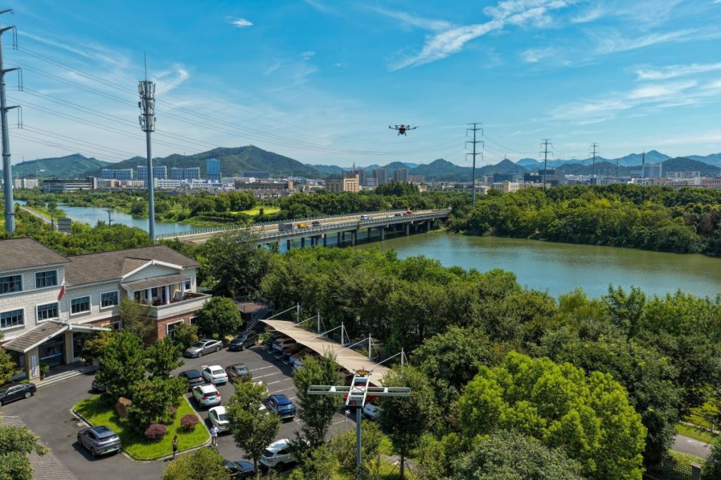
The project launched in late 2024 in Anji County, when the local Bureau of Water Resources installed eight elevated AirDocks along roughly 23 miles of urban waterways. A small fleet of Longtail Patrol drones began flying fully autonomous missions, inspecting rivers, reservoirs, and tributaries on a routine schedule.
Before drones, those inspections were slow and manpower-heavy. Crews relied on vehicles and foot patrols, often taking several days to complete what the drones now handle in about 90 minutes. Hard-to-reach sections of the water system — previously inspected infrequently or not at all — became part of every routine flight.
The early results were compelling enough that the dock network didn’t stay limited to water management for long.
New: This high-capacity farm drone is now available in the US
A shared drone network, not a single-purpose system
Local first responders began using the same AirDocks to monitor traffic congestion and support rapid response to vehicle accidents. When government agencies weren’t flying, the infrastructure didn’t sit idle. Instead, local restaurants and cafés were allowed to tap into the network using a separate fleet of Longtail Cargo drones to deliver food to hotels and eco-resorts throughout the region.
The idea was simple but powerful: one set of drone docks, many different missions.
Demand quickly outpaced the original plan. The initial eight docks expanded to 15 test locations, and after a year of real-world operations, county leaders approved a major second phase.
That expansion added 19 more AirDocks, bringing the total to 34 permanently installed docking stations and extending aerial coverage across nearly 1,000 square miles. With the additional scale came new use cases.
The county highway department now uses Longtail drones to inspect roadways from above, spotting cracks, surface wear, or debris without sending crews into live traffic. Emergency services leverage infrared-equipped aircraft for repeatable search-and-rescue missions, particularly useful at night or in rugged terrain.
Each AirDock can automatically recharge up to four Longtail drones at once, allowing aircraft to move between docks, perch to top off batteries, or operate continuous “endless range” missions without human intervention.
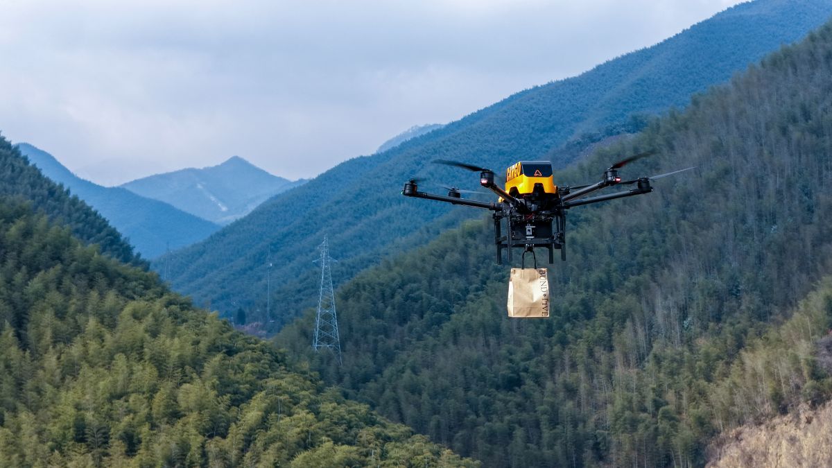
The food delivery side of the network has also scaled rapidly. Hotel guests place orders through a Yelp-like app, while restaurant staff bring prepared meals to the nearest AirDock. When the drone lands, it lowers an integrated winch, allowing staff to attach the order without needing a trained drone operator.
At the destination, which is often miles away, the drone safely lowers the package from altitude, keeping spinning propellers far from people and property. The elevated design of the AirDock system plays a key role here, enabling safe loading, unloading, and charging even in dense or wooded environments.
AI-powered drone inspections, fewer wasted hours
As the network expanded, A2Z engineers worked with local departments to upgrade onboard cameras and data workflows. The drones now combine high-resolution and infrared imagery with AI-powered analysis to detect roadway defects, algae blooms, or signs of water pollution.
Potential problem areas are automatically compared against historical data, flagged, and logged with precise coordinates. Inspectors receive targeted alerts, rather than spending hours reviewing footage or rechecking unchanged areas. The result is less time spent searching and more time fixing actual issues.
Despite the network’s size, it doesn’t require a large control staff. Through A2Z’s Mission Dispatch interface, a single operator can monitor fleets of patrol and cargo drones as they move between docks and execute their assigned missions.
With four government departments now sharing the same infrastructure, the cost of hardware and deployment is spread across multiple budgets, making the entire system far more financially viable than siloed drone programs.
Anji County’s AirDock network offers a glimpse of what municipal drone operations can look like when autonomy, infrastructure sharing, and real-world scale come together. Instead of pilot programs or one-off deployments, the county has built an always-on aerial layer that serves public agencies and private businesses alike.
For US cities watching from afar, the message is hard to miss: the technology to run city-scale autonomous drone networks already exists. The question isn’t whether it works; it’s where regulations will allow it next.
More: How to shoot epic ski footage with DJI Osmo 360 camera
FTC: We use income earning auto affiliate links. More.


Comments