

As drones become faster, smarter, and more difficult to track, counter-drone technology has to keep pace. That’s the thinking behind DroneShield’s latest quarterly software release, which the Australian company says delivers significant improvements in radio-frequency (RF) detection, tracking speed, and overall operational performance across its counter-drone platform.
Announced this week, the Q3 2026 software update is available to eligible customers through the DroneShield Access Portal and continues the company’s strategy of rolling out quarterly software enhancements rather than relying solely on new hardware.
One of the biggest upgrades is a 58% improvement in track update speed, allowing operators to follow rapidly maneuvering drones with greater accuracy. DroneShield also says it has enhanced RF detection and geolocation capabilities, enabling its systems to identify drone signals more reliably and pinpoint their source more precisely in challenging environments where interference or crowded airspace can complicate detection.
DroneShield also shared several additional performance gains across its RF-based counter-drone systems. For the DroneSentry-X Mk2, the company says the software delivers 15% better directional accuracy for more precise localization of RF emitters, alongside a 3% improvement in tracking accuracy. Meanwhile, the RfPatrol Mk2 Wideband handheld detector sees 9% faster track updates, 5% better tracking accuracy, and a 3% increase in detection range.
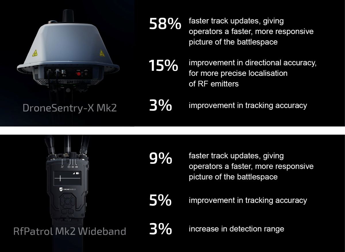
While some of those percentage gains may appear modest, even small improvements can help operators detect, locate, and track fast-moving drones more reliably in real-world operations.
More: Some DJI users face September support cutoff for older hardware
DroneShield has also improved geolocation accuracy, helping operators pinpoint the location of drone threats more precisely. That can be especially valuable for military units, critical infrastructure operators, airports, and public safety agencies that need to react quickly to unauthorized drone activity.
Another notable addition is support for air-gapped deployments, allowing software updates and mapping data to be installed on systems that operate without an internet connection. This capability is particularly important for defense customers and other high-security users who intentionally isolate networks from external access. The release also adds support for Cloud Optimized GeoTIFF (COG) maps, improving how mapping data is handled in disconnected environments.
According to DroneShield, the release reflects the changing nature of drone threats. Commercial drones are becoming faster and more autonomous, while military-grade systems continue to evolve with increasingly sophisticated navigation and communications. That means counter-drone platforms must process sensor data more quickly and present operators with actionable information in less time.
Rather than introducing new hardware every time threats evolve, DroneShield has focused on continuously enhancing the software that powers its existing systems. The company says this approach allows deployed customers to receive measurable capability improvements without replacing equipment, extending the value of existing installations.
The latest release builds on a series of quarterly software updates that have emphasized faster decision-making, improved sensor performance, and greater automation.
More: How automated DJI drones are changing public safety in Celaya


FTC: We use income earning auto affiliate links. More.




Comments