
If you’ve ever wondered whether drones can do more than capture stunning mountain footage, DJI’s latest Mount Everest case study offers a pretty compelling answer.
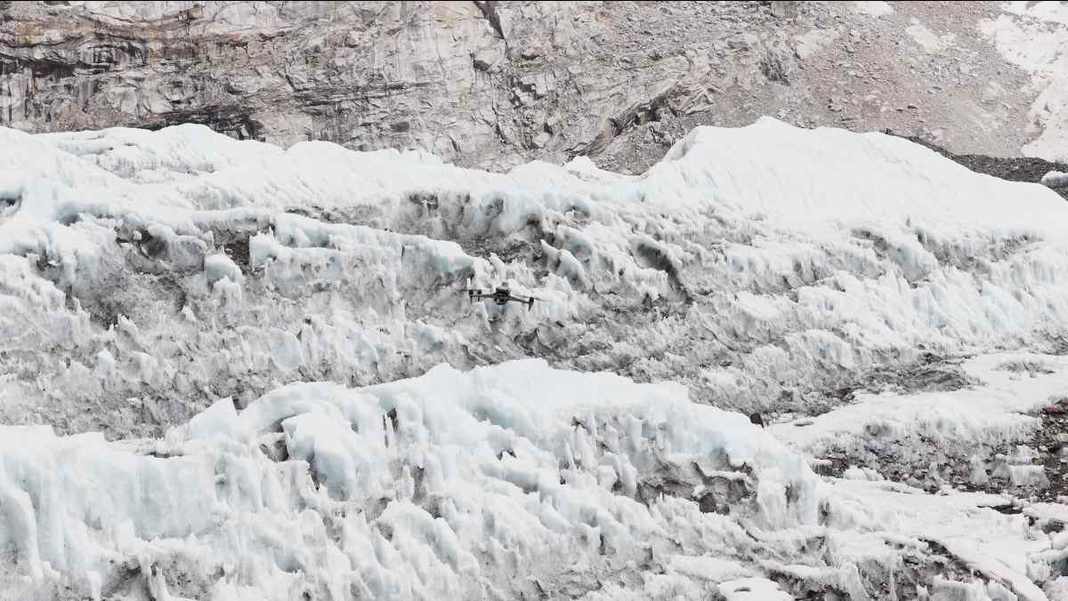
The company has released new footage showing how Nepal-based Airlift Technology used the DJI Matrice 4E and DJI Terra to map the notorious Khumbu Icefall during the 2026 Everest climbing season. The project wasn’t just about creating beautiful aerial imagery. It gave the Sherpas responsible for opening Everest’s climbing route a detailed 3D map of one of the world’s most dangerous landscapes, before anyone had to step onto the ice.
For anyone attempting to summit Mount Everest from the Nepal side, the Khumbu Icefall is unavoidable. Stretching between Everest Base Camp at about 17,600 feet (5,364 meters) and Camp 1 at roughly 21,300 feet (6,500 meters), the constantly shifting glacier is filled with deep crevasses, unstable towers of ice known as seracs, and massive blocks that can collapse without warning.
Every climbing season, specially trained Sherpas known as “Icefall Doctors” cross this dangerous terrain on foot to install ladders and ropes that thousands of climbers will later rely on. Traditionally, that process has involved days — or even weeks — of navigating unstable ice while searching for the safest route. This year, drones changed that workflow.
Flying pre-programmed missions at elevations above 19,600 feet (6,000 meters) and in temperatures below -4°F (-20°C), the Matrice 4E surveyed more than three square kilometers of the Khumbu Icefall in just three and a half hours. Thanks to its five-directional imaging system, the enterprise drone captured high-resolution imagery of the glacier’s steep and complex terrain without requiring anyone to enter the hazard zone.
More: This DJI Mini 5 Pro drone deal saves up to $110 today
The collected images were then processed in DJI Terra to generate highly detailed 3D models with centimeter-level accuracy. DJI says the software uses next-generation reconstruction technology, including 3D Gaussian Splatting, to create an accurate digital representation of the icefall.
Rather than producing a one-time map, the team repeatedly surveyed the glacier throughout the climbing season. Comparing models from different days allowed Icefall Doctors to see exactly where crevasses had widened, where unstable ice had shifted, and which sections remained stable enough for ladders and fixed ropes.
According to Raj Bikram Maharjan, CEO of Airlift Technology, the approach allowed teams to identify hazards and plan safe routes without first climbing through the icefall themselves. He also noted that, to the company’s knowledge, this marks Nepal’s first deployment of this kind and could be among the first large-scale operational uses of drone mapping for high-altitude expedition route planning.
The technology proved especially valuable during the 2026 climbing season when a rare, large-scale serac field formed overnight, blocking every route through the Khumbu Icefall and leaving hundreds of climbers stranded at Base Camp. Using the updated drone surveys and 3D models, Icefall Doctors were able to quickly assess the changing terrain, rebuild the route, and resume climbing operations much faster than traditional surveying methods would have allowed.
Beyond improving safety for mountaineers, the repeated mapping missions could also benefit scientists studying glacier movement. By creating accurate digital records of the Khumbu Icefall over time, researchers can better monitor how one of the world’s most famous glaciers is changing as warming temperatures continue to reshape high-altitude environments.
DJI’s new video offers a fascinating behind-the-scenes look at how enterprise drones are moving far beyond photography, and helping make one of the world’s most dangerous adventures a little safer. Take a look:
More: DJI’s first eVTOL drone debuts where few aircraft can fly


FTC: We use income earning auto affiliate links. More.





Comments