
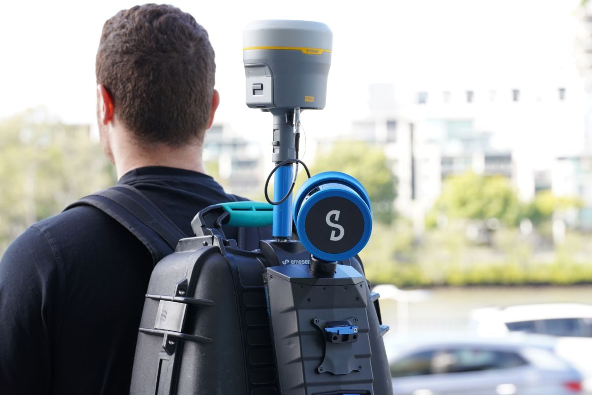
If you’ve ever dealt with a massive point cloud file and wondered where it fits into the rest of your project, Emesent and Trimble are trying to make that process a little less painful. Emesent announced at Intergeo 2026 in Munich that its mobile SLAM scanners can now feed data directly into Trimble Connect and Trimble Business Center, creating a more streamlined path from field scanning to finished survey and construction deliverables.
The integration covers Emesent’s GX1 and Hovermap STX scanners. Both use Emesent’s SLAM (Simultaneous Localization and Mapping) technology to capture 3D LiDAR data, including in places where GPS can be unreliable or unavailable.
That can be particularly useful for drone operators and survey teams working around infrastructure, inside buildings, underground or across other difficult environments.
The GX1 is aimed primarily at ground-based surveying and combines SLAM with an integrated RTK/PPK receiver. Emesent says it can deliver 5–10mm global accuracy using SLAM and 15mm accuracy with RTK/PPK. It can also be mounted on a backpack, survey pole, or vehicle.
The Hovermap STX, meanwhile, is built with more flexible deployments in mind. It can be used with drones, vehicles, robots, or as a handheld/backpack system, making it particularly interesting for hard-to-reach or hazardous sites. The scanner can capture up to 1.92 million LiDAR points per second in multi-return mode and has a range of up to 300 meters.
Here’s where the new Trimble connection comes in.
After a scan, data is processed through Emesent’s Aura Cloud platform, which generates dense, georeferenced point clouds. Those datasets can then flow into Trimble Connect and onward into Trimble Business Center without the traditional export-and-convert shuffle.
From there, the data can be used in broader Trimble workflows, including BIM work in Tekla Structures and 3D modeling with SketchUp.
In practical terms, the goal is pretty simple: capture the site, process the data, and get it into the software teams already use to build models, create as-builts, and manage projects.
“This integration brings the power of our proven SLAM-based scanning technology into Trimble’s industry-leading geospatial data management and collaboration software,” Emesent director of product Ryan Palfrey said.
For US surveyors, engineers, construction teams and drone operators, the bigger takeaway may be less about another scanning platform and more about interoperability. If the point cloud can move from a challenging site into an established project workflow without several extra steps, that could make mobile LiDAR considerably easier to put to work.
Emesent is demonstrating the integration, GX1 and Hovermap at Intergeo 2026 in Munich through September 17.
More: Drone Assistant wants to make international drone rules less painful


FTC: We use income earning auto affiliate links. More.


Comments