There’s a reason scientists are increasingly turning to drones to understand climate change, and a new mission in Greenland shows exactly why.
In July 2025, a team of explorers and researchers set out across Greenland’s icy coastline aboard Perseverance, the world’s largest oceanographic research sailboat. Their goal: capture the most detailed view yet of how Arctic glaciers are evolving — and breaking apart — in real time.
Leading the expedition was legendary explorer Jean-Louis Étienne, alongside a team blending satellite expertise with cutting-edge drone technology. At the heart of the mission was the DJI Mavic 3 Enterprise, a compact yet powerful drone capable of capturing ultra-detailed aerial imagery for 3D modeling.
And the results? A level of detail that satellites simply can’t match.
Why drones matter more than ever
For years, satellites have revolutionized how scientists study Earth’s ice. They offer a big-picture view of glacier movement and ice loss. But there’s a catch… they can’t zoom in enough to explain how things are happening. That’s where drones step in.
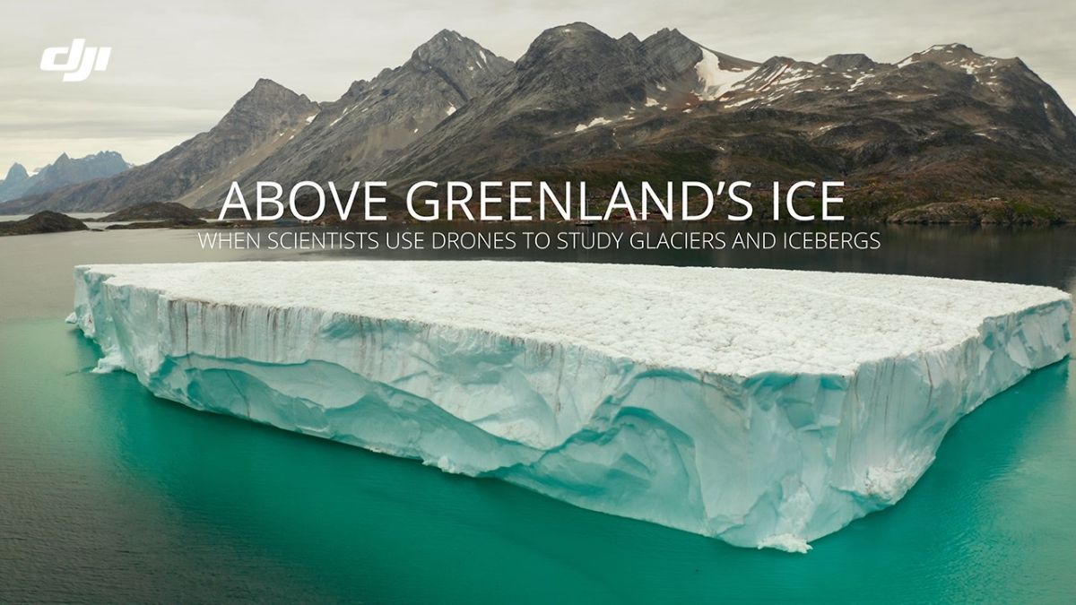
By flying close to glaciers like Eqip Sermia and Sermeq Kujalleq — one of the fastest-moving glaciers on the planet — the DJI drone captured thousands of high-resolution images. These were stitched together into precise 3D models, revealing cracks, crevasses, and structural weaknesses in the ice.
And those details are critical. Scientists say these fracture patterns often determine when — and how — massive chunks of ice break off into the ocean, a process known as iceberg calving. It’s one of the biggest unknowns in predicting future sea-level rise.
New: 2026 might be the most affordable year to buy a DJI drone
A closer look at glacier collapse
The expedition’s data is now being analyzed in collaboration with the University of Aberdeen, where glaciologists are studying how glaciers melt, fracture, and interact with ocean waters.
One key breakthrough: 3D models of icebergs in the water.
These models help researchers measure not just how fast ice melts, but how quickly it disintegrates. That meltwater doesn’t just disappear — it changes ocean circulation and even impacts marine ecosystems.
In simple terms, what happens to a single iceberg can ripple across entire ocean systems.
What makes this mission especially significant isn’t just the data; it’s how it was collected. Just a decade ago, this kind of research would have required massive funding, specialized aircraft, and large teams. Today, a compact drone and a skilled operator can deliver similar, and sometimes better, results.
That’s a big deal for climate science. It means more researchers, in more places, can gather high-quality data faster and at lower cost. And in a region like Greenland, where change is happening rapidly, speed matters.
The bigger picture
Greenland is warming faster than most parts of the planet. Its glaciers are melting, shifting, and breaking apart in ways scientists are still trying to fully understand. By combining satellite imagery with drone-based 3D modeling, researchers are finally getting both the big picture and the fine details — a powerful combination for predicting what comes next.
But to really grasp what’s happening, you need to see it. The expedition’s footage brings these frozen landscapes to life, showing towering ice walls, deep crevasses, and massive chunks of ice collapsing into the sea — all captured from a drone’s-eye view.
If you want to understand how fast our planet is changing, and why it matters, this is one video worth watching:
More: DJI’s latest deals make shaky phone footage a thing of the past
FTC: We use income earning auto affiliate links. More.


Comments