Drone mapping software keeps getting better at building 3D models. But for many users, the hardest part comes afterward: figuring out what they’re looking at. That’s the problem SkyeBrowse is targeting with a major platform update that improves model quality, boosts AI-generated floor plans, and makes its Image Walkthroughs feature available to all users at no additional cost.
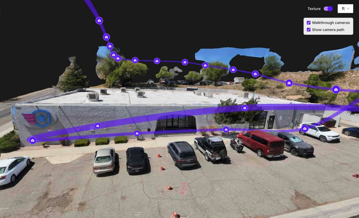
The company’s new Image Walkthroughs feature allows users to click directly on image locations within a model and instantly see exactly what the camera captured from that position. The feature effectively turns a complex 3D reconstruction into something that feels more like walking through a building.
That matters because many of SkyeBrowse’s customers aren’t mapping specialists. Public safety agencies, investigators, construction managers, inspectors, attorneys, and command staff often need quick answers rather than advanced modeling tools. The company says the feature is particularly useful for accident reconstruction, crime scene documentation, inspections, construction projects, and pre-incident planning.
The release also includes significant upgrades behind the scenes. According to SkyeBrowse, its multi-video workflow now delivers three times better matching accuracy when combining multiple video sources into a single model. The company has also improved texture quality and image matching throughout its processing engine.
Another notable enhancement involves AI Floor Plans. Internal testing showed the automatically generated floor plans are now twice as accurate as before, with tighter alignment between the floor plan and underlying 3D reconstruction. The tool remains available to users at no additional cost and can reportedly create an aligned floor plan from an interior model in roughly 20 seconds.
The update continues SkyeBrowse’s broader push as one of the fastest-growing 3D modeling platforms in the drone mapping space, to make reality capture accessible to users without photogrammetry expertise. Earlier this year, the company introduced AI-powered quality control and processing improvements aimed at reducing manual work for investigators and public safety teams.
Taken together, the announcement reveals where drone mapping software may be headed next. The race is no longer just about building better 3D models. It’s about making those models easier for everyone else to use.
More: Why Motorola is spending $1.5 billion on drone defense
FTC: We use income earning auto affiliate links. More.


Comments