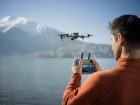
DJI’s Matrice 300 RTK (M300) drone is a workhorse. It’s intended for the not-so-average job site that requires greater flight time, more payloads, and enhanced protection against collisions. And now, new software support is enabling this drone to survey complex terrain, like highways, bridges, and mines, with exceptional reliability in almost any kind of weather.
Propeller Aero, a drone data visualization and analytics platform, has announced that the DJI M300 drone is now compatible with its site surveying and 3D mapping software that is uniquely designed for the construction and earthworks industries.
DJI M300 RTK with Propeller support
The DJI M300 is ideal for large, complex job sites that require greater transmission distance (up to 15 km or ~9 miles), speed (23 m/s or 51.5 mph), and advanced collision avoidance and obstacle detection systems. Plus, the all-weather drone is fully compatible with DJI’s newest flagship Zenmuse P1 sensor, a compact, 45 MP full-frame camera gimbal designed specifically for photogrammetry missions.
Because of this faster drone flight speed, rapid shutter speed, and high-resolution camera, the M300 and P1 bundle can capture 250 acres in a single flight, delivering pinpoint survey accuracy.
Also read: New DJI pro camera spotted in the wild for the first time
So, how does Propeller fit into the mix? Using Propeller’s solution, surveyors place AeroPoints (smart ground control points) around the worksite, fly the M300 drone above to collect survey data, and upload that data to the company’s cloud-based platform where it is completely processed within 24 hours.
As such, teams across the worksite get access to a single source of truth to plan, track, inspect, and work more safely and efficiently. Also, having more real-time progress data on hand allows site managers to reduce labor costs and optimize available machinery.
Stressing that such advances in on-site technology are essential to make worksites more safe, efficient, and data-empowered, Jack Nachazel, customer success engineer at Propeller Aero, sums up:
Our customers are building everything from airports to highways, using a drone that can best capture the unique characteristics of their site. Through our expanded partnership with DJI, they will now be able to streamline their data collection and processing with the powerful M300 drone, which many of our customers are already using.
Read more: Autel releases EVO II Enterprise drones with spotlight, speaker accessories; see prices
FTC: We use income earning auto affiliate links. More.


Comments