AgEagle Aerial Systems has announced its Measure affiliate is integrating Wing’s OpenSky app into its ground control system, with the objective of improving and simplifying drone pilot verification of nearby restricted airspace, and requesting real-time authorization to fly in prohibited areas.
AgEagle acquired Measure last April as part of its effort to assemble drone service assets offering end-to-end drone, sensor, and software solutions. The Measure ground control software platform allows for the automation of drone operations workflows. By integrating Wing’s OpenSky app into that, AgEagle believes Measure’s capabilities will make it even easier for drone pilots to respect airspace rules and regulations, and send real-time requests for authorization when they need to fly in controlled areas.
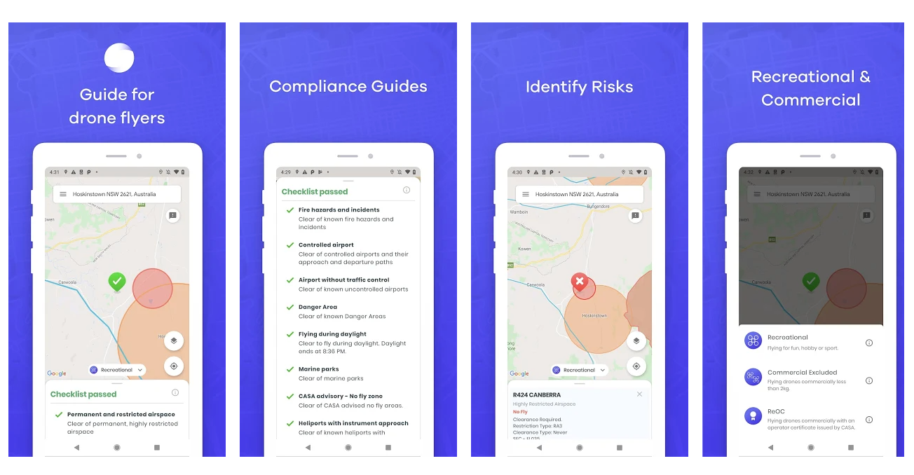
The upgrade will primarily benefit AgEagle’s American customers, since Wing’s OpenSky is currently available in the US and Australia. The Alphabet-owned company describes the free app as “the simplest and fastest way to view drone rules and regulations, so you can take flight with confidence – whether that means flying a single drone or an entire fleet.”
By integrating OpenSky, Measure’s ground control system will allow individual and commercial fliers to (according to Wing) “type in a specific address or just pinpoint your geolocation, and we’ll tailor a flight brief to your operation and drone… (You’ll) only see the airspace rules that apply to your specific drone operation, so you can have confidence in your flight plan.”
The move takes AgEagle’s strategy for acquiring Measure another operational and business step forward
“It is AgEagle’s goal to deliver only best-in-class, full stack drone solutions to the market,” explains Brandon Torres Declet, AgEagle CEO. “In this regard, integrating OpenSky from Wing into Measure Ground Control is expected to materially enhance the capabilities and underpinning value proposition AgEagle offers to our enterprise and government customers, which require accurate situational awareness to safely and compliantly operate their drone programs in the U.S. airspace.”
In addition to allowing pilots to verify whether planned missions will take drones into restricted airspaces or not, operators realizing they’ll indeed need to penetrate controlled zones can make real-time authorization requests to the Federal Aviation Administration’s Low Altitude Authorization and Notification Capability. Users in Australia can do the same via the Civil Aviation Safety Authority’s Automated Access Authorizations Trial.
Wing calls the inclusion of its app by Measure an extension of its logic in creating the service in the first place.
“We built OpenSky because we believe it is paramount that everyone be able to access the sky safely,” said Wing’s head of UTM Reinaldo Negron. “Since we launched OpenSky, it has been used by tens of thousands of operators to find out where they can safely fly and request necessary authorizations.”
FTC: We use income earning auto affiliate links. More.

Comments