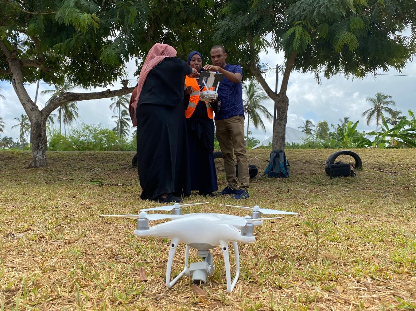
Public health authorities in Tanzania’s semi-autonomous islands of Zanzibar are using drones to locate and map mosquito breeding sites in malaria hotspots.
The project is being spearheaded by an international team comprising of the UK’s Aberystwyth University, Liverpool School of Tropical Medicine, London School of Hygiene and Tropical Medicine, Zanzibar Malaria Elimination Program, Tanzanian Flying Labs, Mosquito Consulting, and Zzapp Malaria. Funding is being provided by the Innovative Vector Control Consortium, which was established in 2005 with an initial grant of $50 million from the Bill & Melinda Gates Foundation.
Drones boost malaria elimination efforts in Zanzibar
Public health authorities need up-to-date information on malaria hotspots to target elimination efforts better. Drones can map these areas quickly, and once the breeding sites are identified in the drone images, the authorities can use the data within a bespoke smartphone app to precisely locate and treat mosquito habitats.
Explaining that the technology-driven solution will complement existing interventions such as bed nets and indoor residual sprays, Dr Andy Hardy from the Department of Geography and Earth Sciences at Aberystwyth University says:
One of the main challenges to disease managers is finding small water bodies that mosquitoes use to breed. This is where drones come in. For the first time, drone imagery can be routinely captured by the malaria elimination program in Zanzibar, to create precise and accurate maps of potential breeding sites.
Hardy adds that a single drone is able to survey a 30-hectare rice paddy in just 20 minutes. This imagery is then processed and analyzed on the same afternoon to locate and map potential breeding sites.
The approach has proven to be so accurate and efficient, Dr Silas Majambere from Pan-African Mosquito Control Association wants drone mapping to be adopted in other national malaria campaigns in Africa as well, including those in Rwanda, Tanzania, Uganda, and Ghana.
Here’s Majambere:
As we strive towards the ultimate goal of malaria elimination we look to new techniques and technologies to inform intervention strategies. Drone mapping work is helping to provide critical information to enable a broad-scale assessment of where permanent and semi-permanent water bodies exist – key targets for malarial mosquito control.
The international team is now incorporating drone imagery and smartphone technology into a spatial intelligence system to help guide efforts to eradicate the disease which kills more than 400,000 people each year.
Read more: Iris Automation receives FAA waiver to test BVLOS drones in Nevada river rescue missions
FTC: We use income earning auto affiliate links. More.


Comments