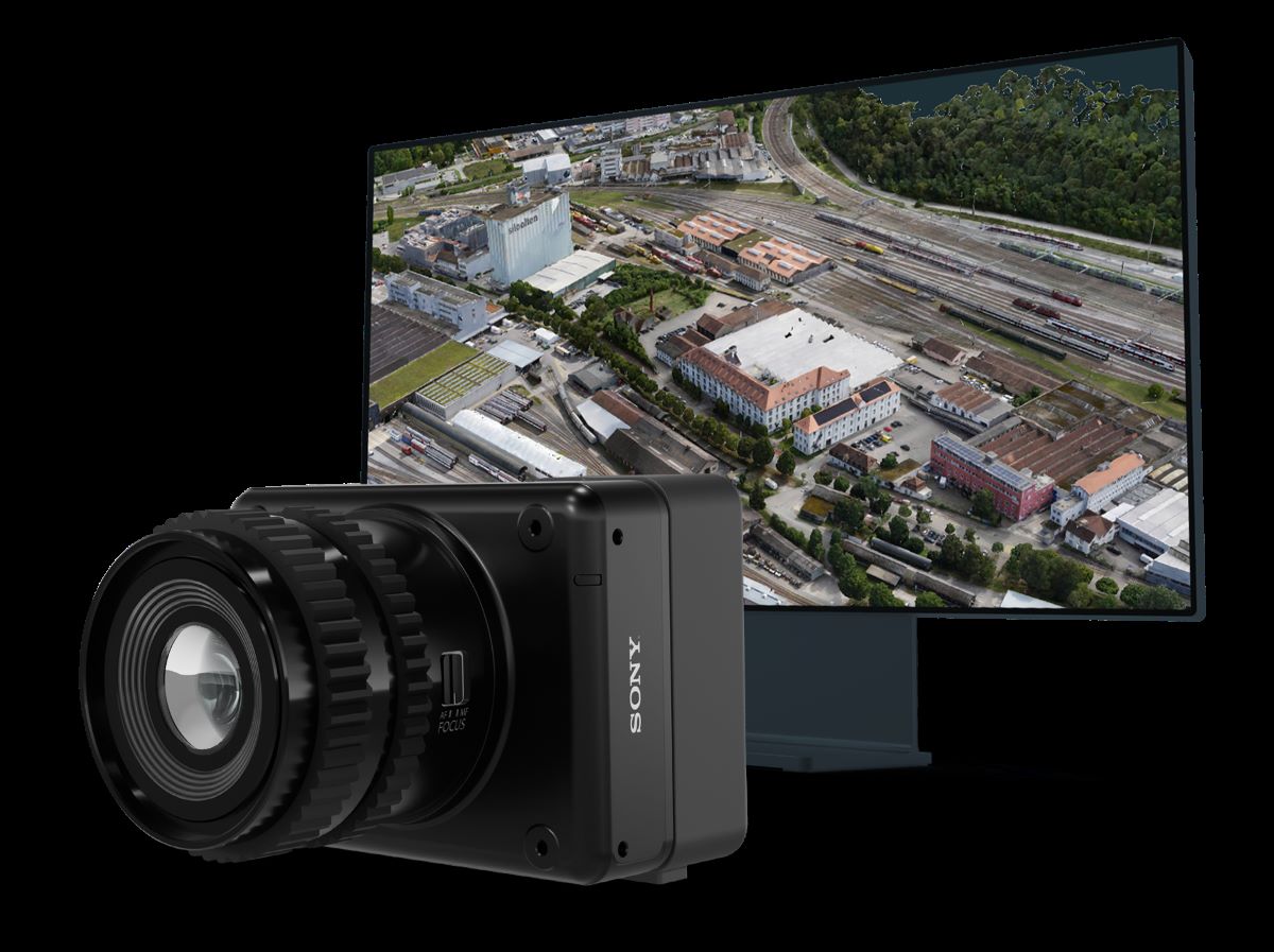
Swiss drone maker Wingtra has unveiled a new sensor, MAP61, that dramatically reduces the capture and processing time of 2D drone data while offering hyper-efficient, single-pass 3D optimized data capture when needed.
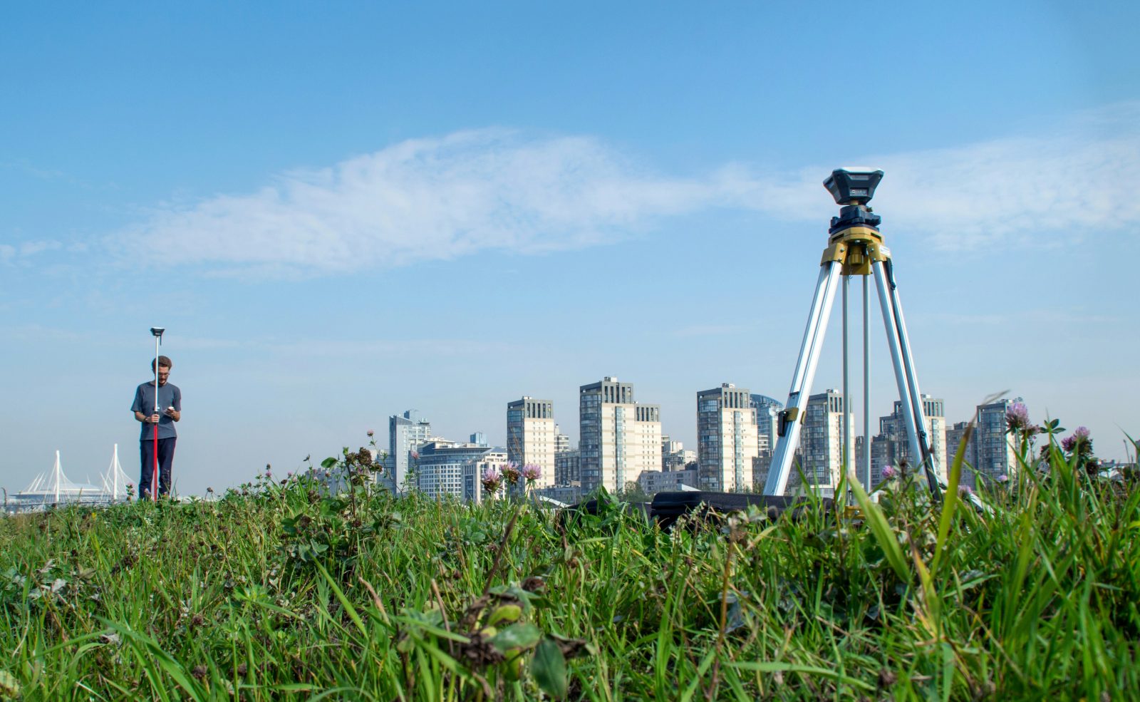
The effects of drone technology have been sufficiently disruptive – or perhaps “threatening” is a better term – to legacy land surveying officials that a North Carolina aerial imaging and mapping service provider is now having to defend attacks on his activity with arguments it’s a form of free speech protected by the First Amendment.
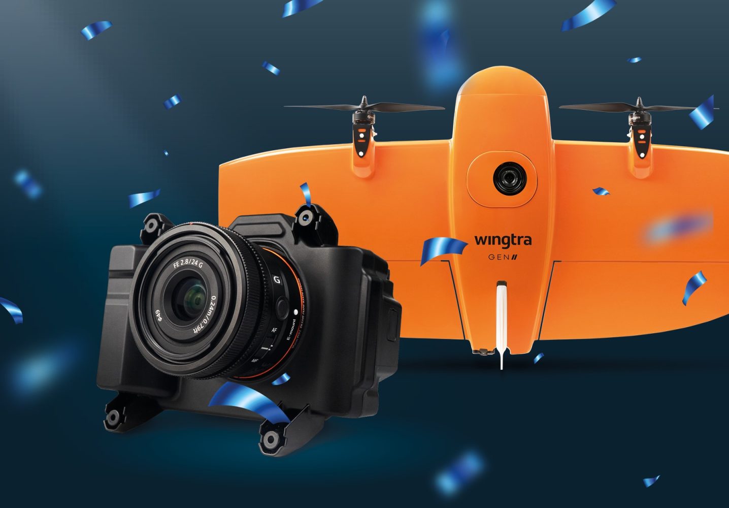
Switzerland-based VTOL drone manufacturer Wingtra has released a new mapping payload, the RGB61. Wingtra’s latest drone mapping solution is a customized Sony Alpha 7 Mark IV 61MP RGB camera that maps 1.4 times the area with up to 40% lighter data and post-processing loads to complete missions much faster than previously possible.
Military-grade drone company Teal Drones says it has partnered with defense tech specialist Reveal Technology on mapping software that automatically combines imagery from multiple drones to produce high-fidelity 3D maps.
Score another drones-for-good point for Australia’s UAV and geospatial education provider SheMaps, whose aerial tech introduction and training have led a young Queensland woman to take to the skies in an effort to safeguard the history of the Aboriginal Koko-Muluridji people’s Wallara clan.
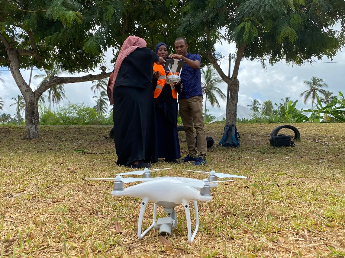
Public health authorities in Tanzania’s semi-autonomous islands of Zanzibar are using drones to locate and map mosquito breeding sites in malaria hotspots.
Australian startup Emesent has scooped up an impressive $23 million (AUD 32 million) in Series A funding to take its autonomous drone mapping and analytics tech to new markets across the globe.
Esri Site Scan Flight for ArcGIS, a popular cloud-based drone mapping software, has added support for the DJI Matrice 300 (M300) RTK drone with the Zenmuse P1 photogrammetry camera.
A pair of environmental non-governmental organizations in England are using drones – and a dose of humor – to measure the volume of cigarette butts littering the city of Bristol, and convince smokers to stop illegally flicking the polluting nubs in public spaces.
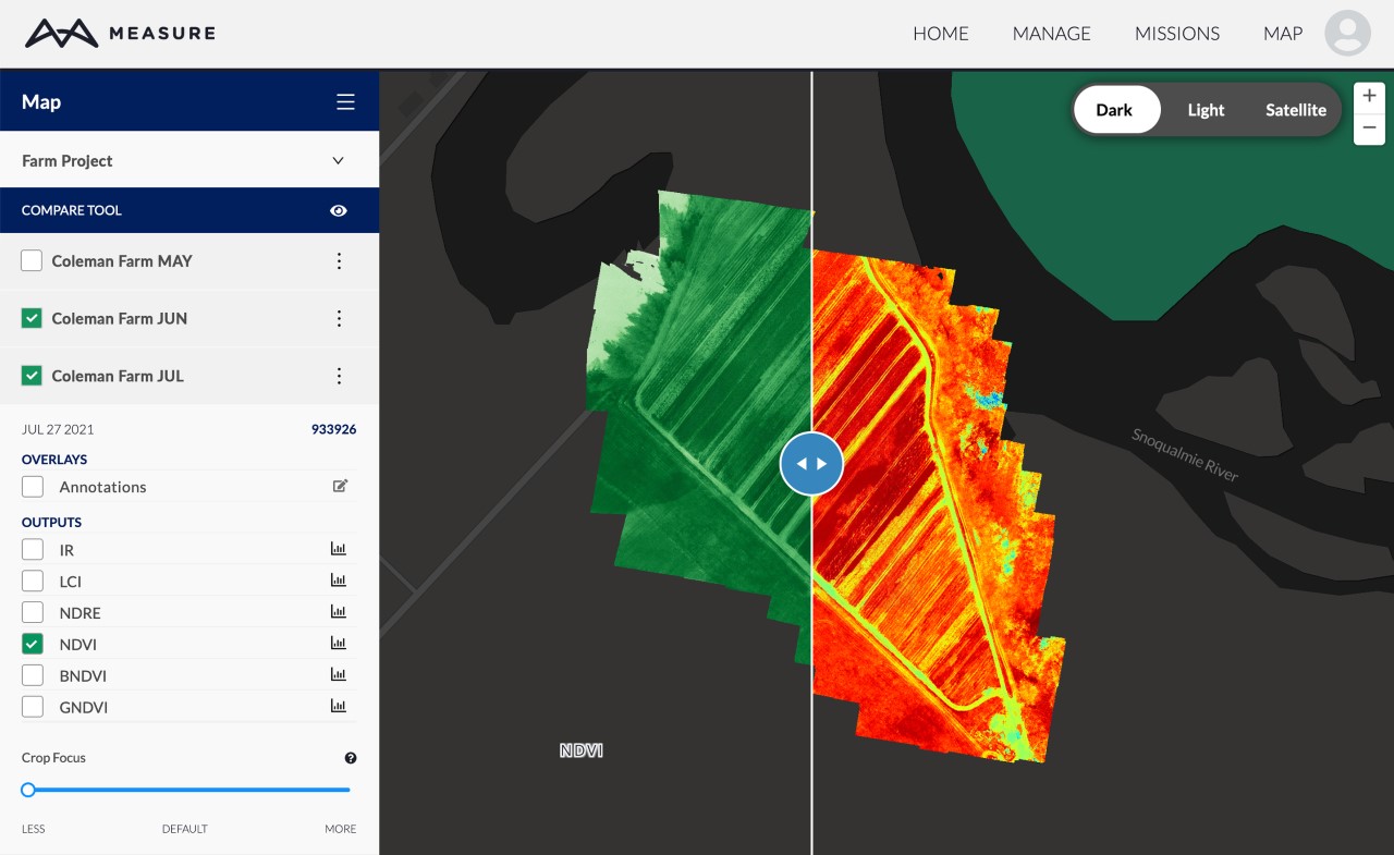
Drone mapping software Measure Ground Control has received a whole new set of features and functions for 2022. The update improves photogrammetry and map visualization for infrastructure companies, while also enhancing the software’s capabilities for users of MicaSense and other multispectral sensors.
Custodians of the Seaford Head coastal cliffs in southeast England know loss of their archeologically important site to erosion and rising sea levels is a question of when, not if, and as a result are using drones and other digital technology to thoroughly map and model the area before it’s gone.
The City of Woodland Park, Colorado, has a problem that cannot be buried: Its cemetery is running out of space. So now, the city is looking at modern technology solutions like drones and ground-penetrating radar (GPR) equipment to figure out how it can create more room.
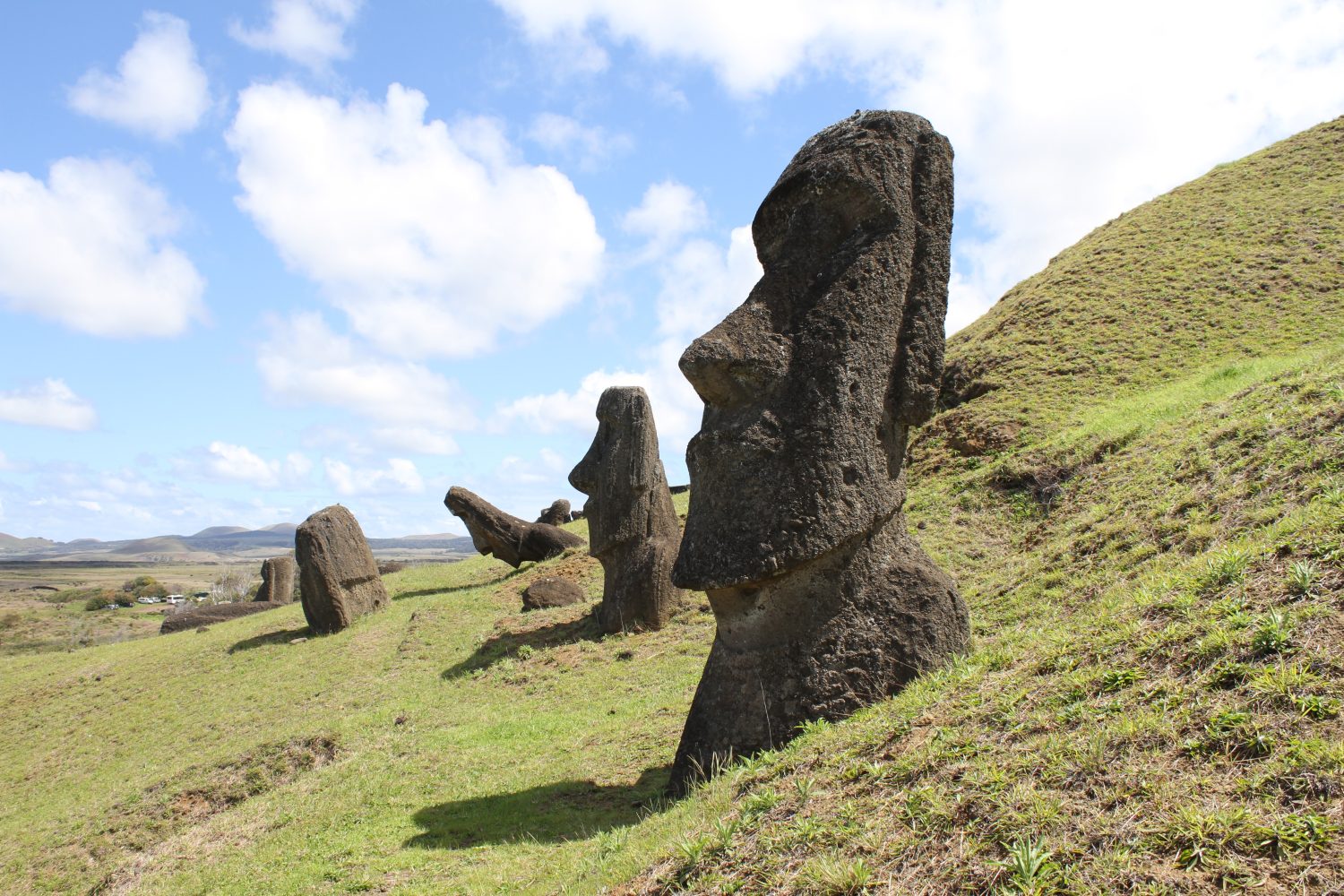
Visitors to Easter Island have described an almost magical vibe emanating amid the mysterious, ocean-facing maoi statues erected by its original inhabitants. But located as it is about 2,000 miles from either Tahiti or Chile, it’s also a land of hardship – especially during recurring droughts. Now drones are seeking to alleviate that aridity by searching for fresh water sources.
The Nebraska State Patrol (NSP) is launching a new drone program that will help to get the roads cleared faster after an accident, while still allowing NSP investigators to conduct a thorough crash investigation. NSP has bought 18 Autel EVO drones and is deploying 19 certified drone pilots in troop areas throughout the state for drone-based accident reconstruction and mapping.
Scores of search and rescue workers at Miami’s Champlain Towers site have been nothing short of heroic in their hunt for victims buried by the building’s June 24th collapse. Among those are a team of Florida State University (FSU) drone experts gathering evidence at the condo disaster that may explain why the structure crumbled – and provide information on how similar failures may been avoided in the future.
Aerial mapper and surveyor Michael Jones is fighting the North Carolina surveying board after it said he was operating without a license – something Jones said isn’t needed as he wasn’t marking property lines in his aerial photos with legal accuracy.
Brazilian drone maker Nuvem UAV has released its Spectral 2 mapping drone with support for a wide range of plug-and-play payloads. The Spectral 2 has support for MicaSene, FLIR, and its own custom mapping sensors.
DroneU offers a multi-day drone mapping training course in New York for anyone interested in turning their hobby into a profession. If you have been thinking about making money with your DJI Phantom 4 Pro well this course will teach you how, and how to do it well. I had the pleasure of flying with drone mapping expert Paul Aitken and his team of DroneU instructors last year at the NTSB facility in Ashburn, VA and we had a blast. The DroneU instructors are thorough, knowledgeable, and share a wealth of hands-on experience with the students. It is a course I can highly recommend.
As DJI and drone mapping further disrupt the civil engineering, surveying and GIS fields, there seems to be a common debate amongst most drone mappers about the practical application of the Phantom 4 RTK replacing ground control points (GCP’s) and checkpoints. With the evolution of the Phantom 4 RTK is there still a need for ground control points or checkpoints? Many argue there is no need for GCP’s and others argue that drone mappers always need a control. These questions have come up numerous times and even caused outright yelling matches at some recent conferences.
The question is, will the Phantom 4 Pro RTK replace GCP’s and checkpoints and the necessity for traditional survey equipment?
What does the new firmware update for the DJI Phantom 4 RTK mean for drone mapping experts and other commercial drone pilots who use this drone for their day to day business? We checked in with Paul Aitken, a drone mapping expert, and from DroneU to get his take on the latest firmware update for the DJI Phantom 4 RTK.