DJI has unveiled FlightHub 2 drone fleet management cloud software that integrates perfectly with the company’s just-announced Matrice 30 enterprise drone. Offering several major improvements over the original DJI FlightHub, version 2 is meant to enable seamless synchronization and coordination between the pilots, backend teams, drones, payloads, and all the data they gather.
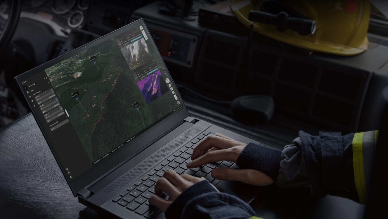
The first thing to know is that the solution is now completely cloud-based. This means flight mission management and operational viewing can be undertaken not only from the pilot’s remote controller but also from any web browser (computers, tablets) or mobile device.
Basically, everyone involved in a drone operation – right from the ground teams to nearby supervisors to managers in their offices – can log into the same mission and see the data gathered by the drones and the pilots.
Also read: DJI Mini 3 shell leak hints at design revamp for beginner drone
Further, DJI FlightHub 2 supports remote planning and mapping so you can respond to developing situations quickly. A couple of notable features that caught our eye include:
One-Tap Panorama Sync: With this feature, you can create a 360-degree overview and upload it to the cloud with a single tap. Shared panoramas, and the coordinates they were captured from, are placed on the drone mission’s 2.5D Base Map, granting all team members quick aerial awareness.
Cloud Mapping: Cloud mapping will come in handy when you need a better perspective during emergency response planning situations. Simply highlight an area of interest, and the M30 drone will automatically map it in 2D. Then, the DJI FlightHub 2 will turn these images into a map and overlay it on your base map so you can build a mission plan around it.
That’s not all. The DJI FlightHub 2 supports Live Annotations too. Annotations are points, lines, or polygons that you can draw on the map. And thanks to the laser rangefinder of the DJI M30, a pilot can also pinpoint the coordinates of a missing person during a search and rescue mission. These coordinates will automatically sync through the DJI FlightHub 2 mission interface allowing the command center and the team on the ground to have live updates of coordinates and to simultaneously generate rescue routes.
All these maps, models, and inspection data can be uploaded to the cloud, supported by AWS, and accessed and managed remotely.
You can learn more about DJI Flighthub 2 here and take advantage of a free testing period that runs through October 31, 2022.
Read more: Bought DJI Action 2 camera? Now grab its new accessory for free
FTC: We use income earning auto affiliate links. More.


Comments