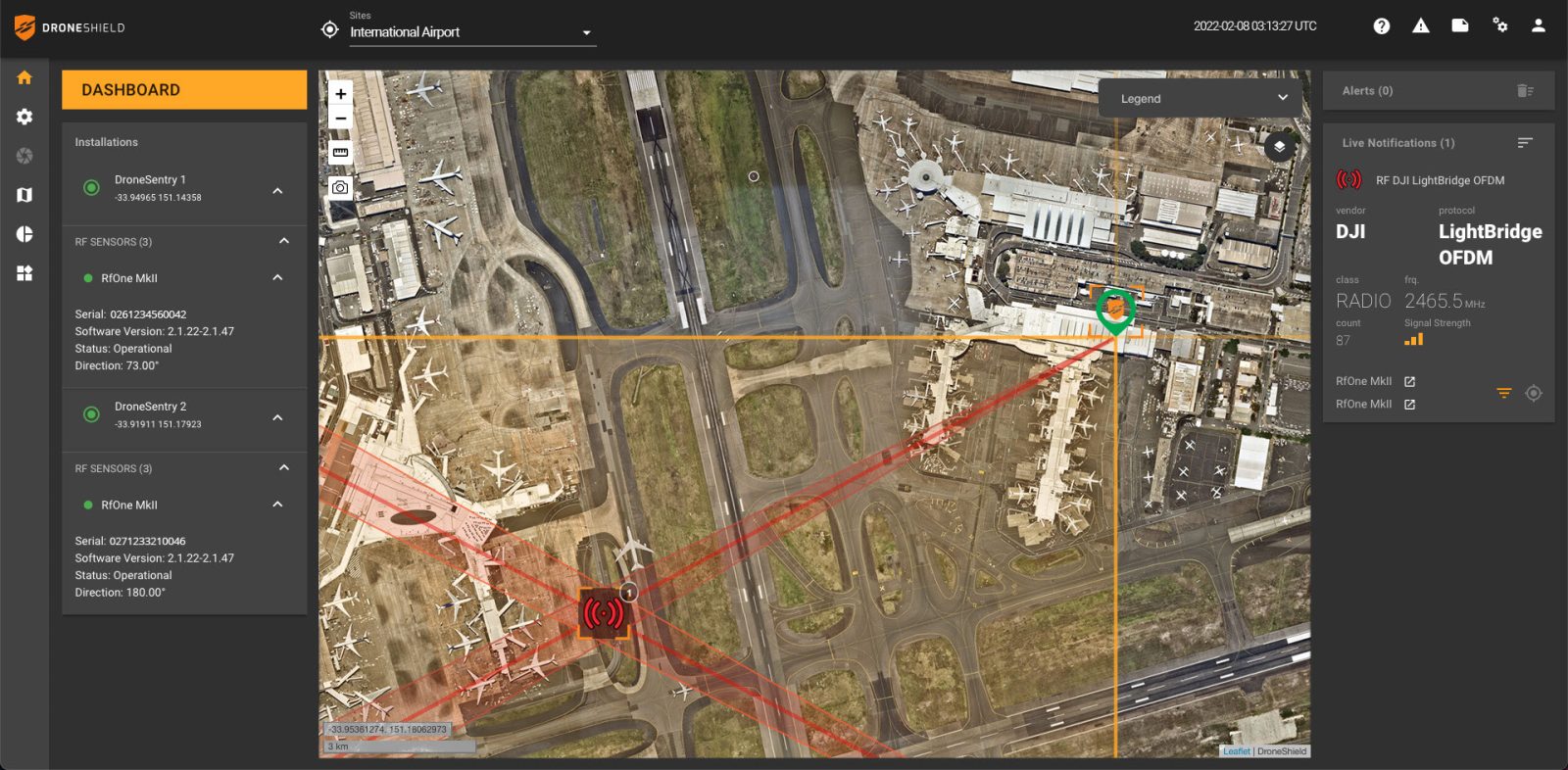
Counter-drone specialist DroneShield is joining forces with location intelligence firm Nearmap to make its DroneSentry-C2 Command-and-Control software more precise than ever. An upgrade adds a layer of high-resolution aerial imagery to DroneShield’s existing mapping service, so users have more precise information while responding to drone threats.
But this mapping enhancement will not come free of cost, and DroneShield expects demand to be driven by high-performance markets such as government, intelligence, homeland security, and defense. Meanwhile, for cost-sensitive users, standard mapping options will continue to remain available.
It’s also worth highlighting that the city-scale high-resolution aerial imagery Nearmap offers is currently available in select geographies only – Australia, New Zealand, and North America.
A quick recap on the DroneSentry-C2: The software platform integrates both DroneShield and third-party counter-drone sensors and effectors. These include multiple AI-enabled sensing and tracking products, such as RfOne long-range direction-finding sensors for UAS detection and tracking, and camera-agnostic DroneOptID optical/thermal camera AI software.
The software comes as an on-premises, air-gapped solution that focuses on intelligence, homeland security, and defense users, or secure cloud for enterprise customers. The on-prem solution also includes a high-grade physical server. Both options come with regular mapping updates, including the ability for the user to load their own maps for sensitive locations.
As DroneShield CEO Oleg Vornik explains:
One of DroneShield’s differentiators is that we are both a sensor manufacturer and an integrator. Providing a streamlined and standardized hard/software bundle that gives our user community an easy to deploy and run command-and-control software, will be critical, as more fixed and pop-up site users seek to deploy counter-UAS products. Importantly, the offering is already validated by deployments such as US Air Force and Australian Army, amongst a number of other tier-1 end-users globally.
Read more: Interactive US map shows nearly 10,000 drone, UFO encounter incident reports
FTC: We use income earning auto affiliate links. More.


Comments