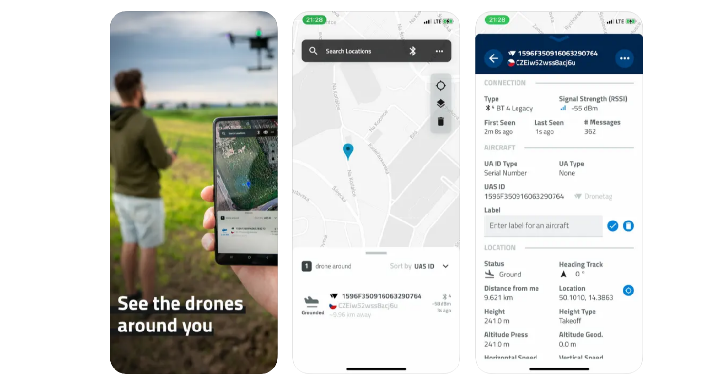
There’s a new app on the market, and it’s one that transforms any phone or tablet into a drone tracking device.
Czech start-up Dronetag, which is developing Remote ID compliance solutions for drone operators and manufacturers alike, has released a new mobile app called Drone Scanner. The free app, available for both iOS and Android devices, tracks all nearby flights using the Remote ID data being broadcast by a drone.
Remote ID is a feature that allows a drone to transmit information such as its identity, location, aircraft altitude, and control station or takeoff location. Most drones operating in the US airspace are required to have this Remote ID capability by law. A drone can either have Remote ID capabilities built in or it could be outfitted with an external device to ensure compliance.
Related: These DJI drones are approved for FAA’s Remote ID mandate
Dronetag makes an add-on Remote ID device that can be mounted to any drone. It is also developing a module for drone manufacturers that will be connectible with the flight controller for reliable Remote ID data transmission and identification in the airspace. And now, the Prague-based company has released a mobile app that would allow anyone to quickly identify what drones are flying in the sky nearby.
Recommended: DJI discontinues Care Refresh+, launches new drone insurance plan
How does Drone Scanner track nearby flights?
Drone Scanner uses a mobile device’s Wi-Fi and Bluetooth receivers to pick up the data being transmitted by a Remote ID-enabled drone. More specifically, the app leverages Bluetooth 4, Bluetooth 5, Wi-Fi Beacon, and Wi-Fi NAN protocols to extract detailed information about the drones flying nearby in real-time.
According to the app developers, you can use Drone Scanner to:
- Browse a detailed map with your location and all nearby aircraft.
- Check available data about drones, including real-time height, direction, pilot identification, pilot position, operation description, and location history.
- See various flying zones marked and highlighted on the map.
- Export collected drone data easily.
Dronetag says it will update the app continuously to reflect the latest European and US drone regulations. But it’s not clear if the company will also take steps to ensure the information relayed, especially the location of the drone pilot, is not misused for any kind of violence or unprovoked confrontations by the app users.
Related: Annoyed by its buzzing noise, Dutch vacationer fires multiple shots at high-end DJI drone
Dronetag CEO Lukáš Brchl tells DroneDJ:
We naturally reflect the regulatory requirements and provide the data in the app for anyone. Moreover, anyone can be assured that we don’t misuse the data because the full implementation and code are published on GitHub. Anyone can dive into the code, add their comments and even steer the future development of the app.
You can download Drone Scanner for iOS here and for Android here.
Since the compliance deadline for operators in the US isn’t until September 2023, don’t expect to see the app track many drones for you right away. Moreover, in Europe, remote identification for drones in the Specific category becomes mandatory only in January 2024.
Nonetheless, as Brchl points out, several drones are now equipped with Remote ID even though the mandate is not in place. Dronetag maintains an open-source list of such drones that it has already verified.
Read: 25 takes, GoPro: How that viral Chicago Cubs drone video was shot
FTC: We use income earning auto affiliate links. More.


Comments