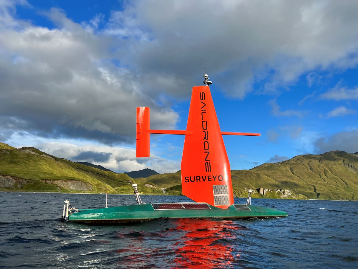
For the first time ever, more than 45,000 square kilometers of previously unknown seafloor around Alaska’s Aleutian Islands and off the California coast has been surveyed by an ocean drone.
Funded by the National Oceanic and Atmospheric Administration (NOAA) and the Bureau of Ocean Energy Management (BOEM), the project leveraged the world’s largest uncrewed ocean mapping vehicle Saildrone Surveyor to gather critical data. The expedition aimed to address ocean exploration gaps in remote areas so that critical natural resources can be managed more sustainably.
Read: Mississippi passes new law to quash undue restrictions on drones
Alaska is the least mapped region in the United States Exclusive Economic Zone (EEZ), which stretches from the coast to 200 nautical miles from shore. But as Dr. Aurora Elmore, cooperative institute manager at NOAA Ocean Exploration, points out:
Every American, in one way or another, depends on the ocean — from protein from fish to feed animals or humans, to deep-sea cables that make the internet possible. The only way the US can maximize our ocean resources is to understand what’s there.
As such, this mission is the first step to mapping the seafloor of key regions in Aleutian waters in high resolution. And it helps that the Saildrone ocean drone has gotten the initial exploration step done faster, cheaper, and without as much staff.
Read: Stuck in snow, man gets help by tying phone to DJI camera drone
The expedition was undertaken in two parts. First, between August and October 2022, the ocean drone mapped 16,254 square kilometers or 4,739 square nautical miles of unknown seafloor around the Aleutian Islands in a period of 52 days. And then, in the second half of the mission off the coast of California, the Saildrone Surveyor mapped an additional 29,720 square kilometers or 8,665 square nautical miles of the US EEZ.
Collected data will be used to optimize dive targets during upcoming expeditions on the NOAA ship Okeanos Explorer. The data will also be publicly available through NOAA’s National Centers for Environmental Information once post-processing has been completed by the Center for Coastal and Ocean Mapping at the University of New Hampshire.
“Surveyor brings a new and exciting capability for ocean exploration and mapping,” says Brian Connon, Saildrone VP of ocean mapping. “Mapping in the Aleutians is not trivial, and the conditions there can be austere any time of year. The Surveyor weathered the storms, collected high-resolution bathymetry, and put no humans at risk.”
Read: DJI has quietly released two new products this week
FTC: We use income earning auto affiliate links. More.


Comments