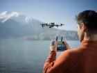
Terra, the all-in-one drone mapping solution from DJI, has received a new firmware update. Version 3.8.0 of the software packs in several new features including a revamped workflow for cluster reconstruction. And as always, many existing features have been optimized, and occasional issues fixed.
Here’s everything you need to know about DJI Terra’s latest firmware update…
What’s new in DJI Terra
- Support for generating DEM during LiDAR point cloud reconstruction.
- Updated workflow for cluster reconstruction. DJI Terra drone mapping software now supports multiple worker devices on the same computer. Worker devices can be added or deleted automatically, and more information about the devices can be displayed.
- Cluster output file directory can now be set to DOS directory of network drive, such as “Z: \DJI\Terra”, allowing access to worker devices.
- Updated layout of Quality Report for LiDAR Point Cloud.
- Help Center now redirects users to access the DJI Terra webpage for downloading product manuals.
Also read: Walmart expanding drone delivery service with Alphabet’s Wing
What’s updated in drone mapping software
- With this latest firmware update, DJI has improved the accuracy of the Optimize Point Cloud Accuracy function.
- The Restricted Zone can now be disabled by default.
- Support to set gimbal tilt angle over 30 degrees for Detailed Inspection missions using DJI Matrice 300 RTK drone has been added.
New: D-Fend unveils backpack deployable counter-drone solution
What the firmware fixes
- The layout display error for the exported PDF file of Quality Report has been fixed by firmware v3.8.0.
- Fixed the screen lagging issue when clicking Optimize on the GCP Management page.
- Fixed the issue where network connection error occasionally occurs when entering the GCP Management or ROI page.
Do note that for DJI Terra v3.8.0 and later versions, when using the free trial license from the official website and performing charged functions in LiDAR point cloud reconstruction, the maximum imported files cannot exceed 8 GB. You can check out the complete release notes here.
Read more: New drone floodlight can illuminate two tennis courts at once
FTC: We use income earning auto affiliate links. More.


Comments