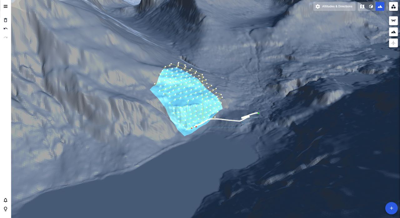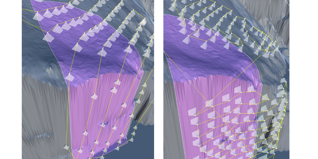
Mapping steep and complex terrain poses significant challenges, even with advanced drone technology. Many drones today are equipped with terrain-following tech, but they can also struggle in environments such as cliffs, rock walls, and steep hills. This leads to inefficiencies and inaccuracies, compromising the quality of the survey. But automated drone mission planning platform Drone Harmony says its Hill Scan technology can help surveyors overcome all such challenges.
Challenges with conventional drone surveys
Many drones find it challenging to map very steep or vertical terrains, such as cliffs, rock walls, and steep hills. Maintaining a consistent altitude and capturing detailed data on such surfaces is difficult, often resulting in incomplete or inaccurate maps. Moreover, when the terrain is highly non-uniform, many drones struggle to adapt, leading to gaps in data collection.
In addition, for certain applications, it is crucial to direct the camera perpendicularly at the terrain surface. Many drones may not be able to maintain this angle consistently, especially over uneven and steep landscapes, affecting the quality and usefulness of the collected data.
The thing is, traditional drone mapping surveys, including those utilizing Terrain-Following tech, rely on grid missions, which cover the area of interest with nadir images placed on a grid. The spacing between adjacent images is chosen to match an overlap parameter, and the flight altitude is selected according to the desired ground sampling distance (GSD), which determines what area of the surface is represented by each pixel in the image.
Compared to a standard grid mission, Terrain Following improves the acquisitions by adjusting the height of the flight to the local profile. This ensures a fixed GSD but still does not ensure overlap consistency. Nor does it adjust camera angles to the terrain slope.
Also see: DJI releases new firmware for Mavic 3 drone series
Drone Harmony’s Hill Scan solution
Drone Harmony’s Hill Scan solves all these issues. This advanced system leverages sophisticated algorithms and automation to ensure consistent altitude maintenance, efficient obstacle navigation, and accurate data collection, even in the most challenging terrains.
Planning a Hill Scan mission works like planning any other terrain-aware mission. You will require a terrain and at least one polygonal area in your scene to plan the mission. The parameters to set are distance to surface (determining the Ground Sampling Distance), overlap parameters, and camera settings. All other attributes of the missions are set automatically by Hill Scan to achieve ideal results.

Another valuable attribute of Hill Scan is its flexibility. This technology allows users to map larger areas with varying elevation profiles seamlessly, eliminating the need to divide the region into smaller, slope-coherent sections. Consequently, hilly areas can be mapped alongside flatter areas within a single, continuous mission. This makes Hill Scan a powerful tool for a variety of inspection activities, including cliff stability assessments, mine site inspections, dam inspections, and more.
Images: Drone Harmony
Read more: Explosive volcanic activity in Iceland? Drones are on the watch
FTC: We use income earning auto affiliate links. More.


Comments