
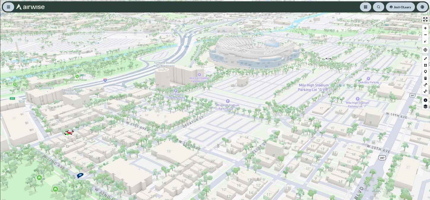
Drone operators aren’t the only ones who need to know what’s flying nearby. Airports, utilities, energy companies and critical infrastructure operators also need visibility into drones operating around their facilities. That’s the focus of a new partnership between Airwise Solutions and UAS Sentry, which aims to combine drone detection with a broader view of low-altitude airspace.
The companies are integrating UAS Sentry’s Nexus Remote ID detection system with Airwise’s Nexus platform. The goal is to give enterprise customers a single operational picture showing not only their own drone fleets, but also other Remote ID-equipped drones operating in or around their airspace.
And this isn’t the first Remote ID integration Airwise has announced recently.
Earlier this month, Airwise partnered with Dronetag to bring Remote ID data from Dronetag’s Scout and RIDER receivers into its Nexus common operating picture. That integration allows information such as drone location, pilot position, aircraft model, and serial number to be viewed alongside telemetry, radar, ADS-B, weather, and other airspace data.
Now, UAS Sentry is bringing another detection system into that same broader picture.
UAS Sentry Nexus is a modular Remote ID detection platform designed to scale from three to 18 independently processed antennas through a single LAN or LTE connection. It provides drone detection, identification, geofencing, alerting, classification, historical identification, and analytics.
The system also supports the UAS Sentry API, allowing its detection data to be integrated with third-party command-and-control, situational-awareness, and mapping platforms.
With the integration into Airwise Nexus, that information can sit alongside enterprise drone fleets, mission activity, airspace information, telemetry, FAA services, weather, and other connected data sources.
That distinction matters because simply knowing that a drone is nearby doesn’t necessarily tell an operator why it’s there or how it relates to ongoing operations.
Airwise and UAS Sentry are essentially looking to connect those dots. “Organizations need visibility into the entire low-altitude operating environment, not just the aircraft they are managing,” John Powers, chief revenue officer at Airwise Solutions, said in the announcement.
UAS Sentry’s David Burritt said the company’s system was designed to make sophisticated Remote ID detection scalable and accessible, adding that integrating its data with Airwise puts detection information into a broader operational environment.
The combined capability is aimed at organizations that need greater awareness of low-altitude airspace, including critical infrastructure operators, utilities, energy companies, public-safety agencies, airports and industrial facilities.
For those customers, the idea is to bring several pieces of information into one place instead of treating drone detection as a standalone function.
The partnership also gives customers room to expand. UAS Sentry Nexus can be deployed where detection is needed today, with additional coverage added as requirements grow. Its API and modular architecture are designed to connect with other systems as well.
That open approach could become increasingly useful as commercial drone operations become more complicated and more aircraft share low-altitude airspace.
Airwise has been building its Nexus platform around that broader concept. Alongside drone operations, its platform handles airspace authorizations, pilot and fleet management, mission planning, analytics and UAS Traffic Management (UTM) operational intent.
The recent Dronetag partnership and now the UAS Sentry integration add another layer to that strategy: bringing data from different Remote ID detection systems into the same operational picture.
UAS Sentry says its software and firmware are developed in the US, with final assembly also performed domestically.
Ultimately, the companies aren’t just trying to help operators answer one question — “Is there a drone nearby?” They’re aiming to provide enough surrounding information to help organizations understand what is happening across their low-altitude airspace and how it relates to their own drone operations.
More: Alabama photographer’s $5,000 DJI drone shot out of the sky


FTC: We use income earning auto affiliate links. More.


Comments