Drone flown robotic arm revolutionizes Kauai’s rare flora preservation
Botanical researchers on the island of Kauai have teamed up with engineers in Quebec’s University of Sherbrooke to create a robotic arm flown…
Botanical researchers on the island of Kauai have teamed up with engineers in Quebec’s University of Sherbrooke to create a robotic arm flown…

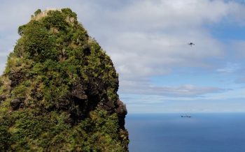
Today we have selected a drone video fo Hawaii. A little longer than our normal videos but definitely worth your time. So go get that coffee. Kick back for a bit and relax while you enjoy the most beautiful Hawaiian landscapes.
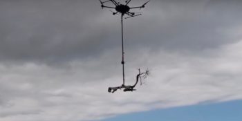
Innovating botanists in Hawaii are again adapting tech loaded on drones to preserve native plants from extinction in areas too remote or dangerous for…
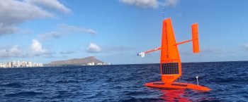
Three semi-autonomous uncrewed marine drones have set sail from Honolulu for a six-month mission collecting data off the coasts of Hawaii’s larger islands to…
Hawaii may seem like a tropical paradise to many, but its climate and location make it vulnerable to some rapidly growing…
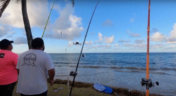
The state legislature of Hawai‘i is moving closer to passing a law that would prohibit the use of drones for…
The Federal Aviation Administration and the state Department of Land and Natural Resources have started an investigation into a report that a drone struck a Kauai tour helicopter.
In this short but beautiful YouTube video, legendary surfer Derek Ho is almost hit by a Phantom drone as he…
Yesterday the U.S. Geological Services (USGS) took a drone to the top of Kilauea Summit to show a dramatic drop and cracks running through the ground at the south side of the crater. Steve Brantley, a scientist from the USGS Hawaiian Volcano Observatory talks about the 300ft subsidence of the Halema‘uma‘u crater floor in the drone video below.
In pursuit of amazing photos of 2,000-degree hot lava, Erez Marom flew his DJI Phantom drone too close and caused it to melt. It was worth it though according to Marom.
Last Sunday, a drone rescue mission from U.S. Geological Survey (USGS) in Kīlauea volcano’s lower East Rift Zone, helped guide a resident who was trapped at his residence to a team of rescue workers, who were on their way to evacuate the civilian. The individual was instructed to follow the drone back to safety. The unmanned aerial system (UAS) team could keep track of the person visually as he was instructed to use his cell phone’s flashlight. Meanwhile, the team was also assisting the rescue workers in their effort to reach and evacuate the resident.
In this latest video from DJI, we see how drones have become an invaluable tool in freeing whales from ocean debris such as lines and fishing nets. The people from Ocean Unmanned have teamed up with the National Oceanic and Atmospheric Administration’s (NOAA) Hawaiian Islands Humpback Whale National Marine Sanctuary and have started to use drones to assess the whale and the way the lines are wrapped around its body. The unmanned aerial systems provide a clear picture of the situation, before they approach the whale, minimizing the risk to the people on board the boat.
A drone video shows Mount Kilauea erupting and spewing fountains of lava into the sky in a residential area. The volcano eruption in Hawaii has caused a large-scale evacuation in the Leilani estates residential area, home to about 1,500 people. The footage from the unmanned aerial vehicle shows the lava oozing through the local forest. Yesterday afternoon the FAA issued a Temporary Flight Restriction (TFR) for the area to prevent drones from interfering with first aid responders.

