Drone mapping software Measure Ground Control has received a whole new set of features and functions for 2022. The update improves photogrammetry and map visualization for infrastructure companies, while also enhancing the software’s capabilities for users of MicaSense and other multispectral sensors.
Measure joined AgEagle Aerial Systems in 2021 and gained two sister companies in the process – MicaSense, a leader in multispectral sensors, and fixed-wing drone manufacturer senseFly. Measure Ground Control’s first update of 2022 integrates the drone mapping software more tightly with these companies, but not without improving functionality and workflows for general users as well. Here’s what’s new in Measure Ground Control…
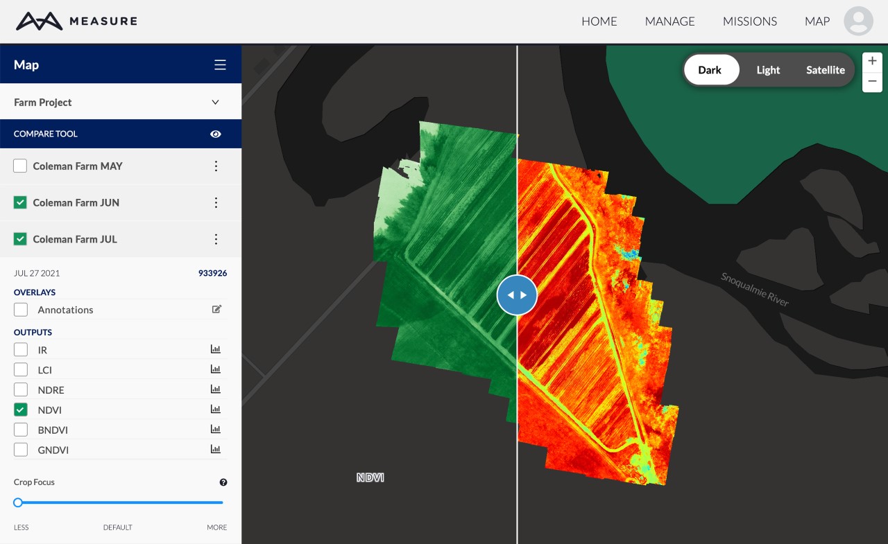
The software now makes it easier to process, manage, and share multispectral drone data. New enhancements have been brought in to bring down common data processing errors and reduce the time to get to actionable insights:
- Cloud photogrammetry has been tailored for multispectral processing. Updates include a Histogram tool to help reveal plant health for agronomists as well as a CropFocus opacity tool for multispectral analysis.
- Auto radiometric calibration for multispectral sensors.
- Additional multispectral output file types for agricultural indices.
- MicaSense flights on DJI drones can now be planned on top of past data sets.
- Improved surface model mapping in infrastructure and energy applications.
- Streamlined navigation and faster, more robust data visualization including data compare slider tool that allows the analysis of two different data sets at a time.
- Integration with the latest version of Mapbox, the industry-standard in mapping.
- More data output visualization options as well as improved collaboration through more annotation options and faster download wizard to share exports.
- Improvements in overall software stability.
Measure is quick to point out that this update is the first of many planned for this year, and that drone mapping users can look forward to even greater capability and value in future updates.
Read more: MicaSense launches Altum-PT drone sensor for advanced remote sensing, farm research
FTC: We use income earning auto affiliate links. More.


Comments