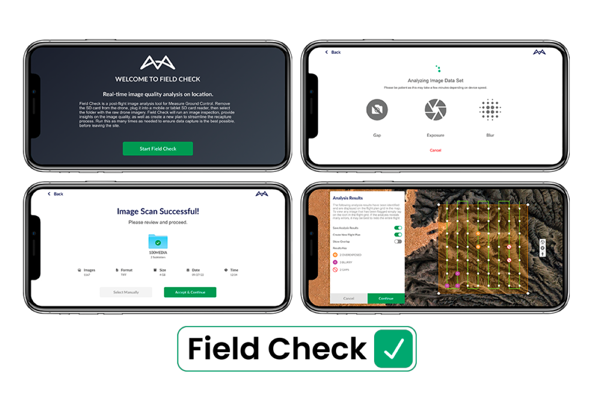
Drone program management software Measure Ground Control has added a new feature called Field Check to its mobile app. Field Check lets drone operators review and check the quality of mapping imagery while still on-site.
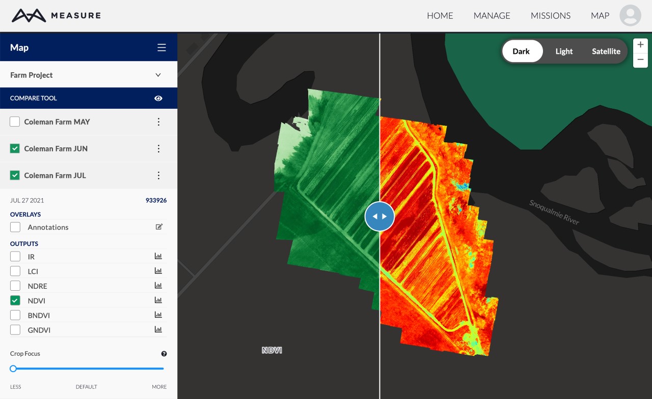
Drone mapping software Measure Ground Control has received a whole new set of features and functions for 2022. The update improves photogrammetry and map visualization for infrastructure companies, while also enhancing the software’s capabilities for users of MicaSense and other multispectral sensors.
A commercial drone pilot from Rhode Island was making $2,000 a day back in 2015. Now he only gets about $175 dollars per day for the same work. Ever since the Federal Aviation Administration (FAA) started to allow commercial drone flights the unmanned aerial devices have come down in price while at the same time their capabilities have improved and the competition has increased tremendously resulting in dramatically lower prices. Noticeably, the new competition is not only from other smaller players but increasingly from large companies such as General Electric, Intel Corp., Verizon Communications and other well-funded startups like PrecisionHawk and Airware.