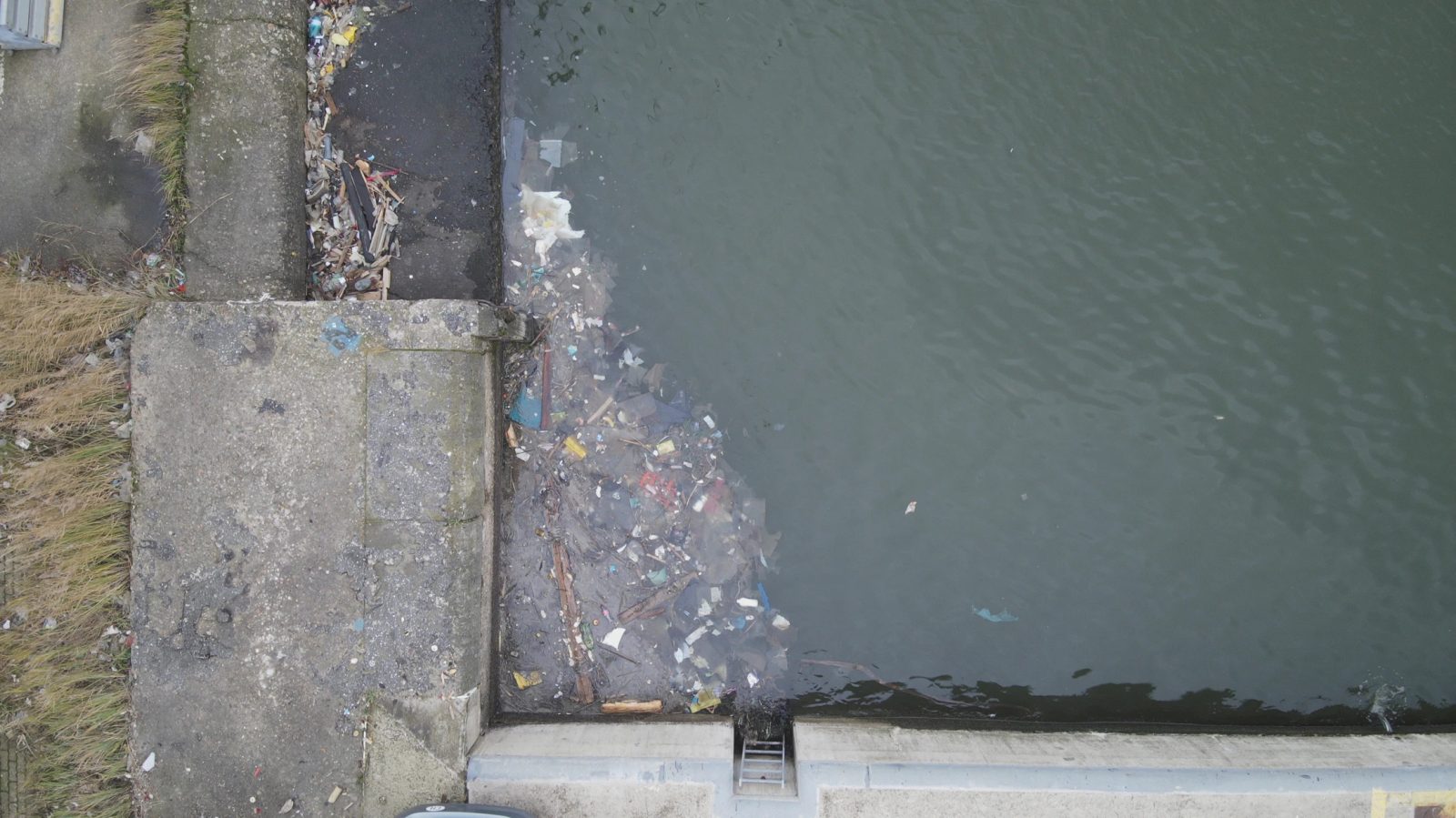
About 50 tons of floating debris – plastics, wood, cardboard, organic material, mooring lines – are collected every year from the docks in Belgium’s port of Antwerp. Not only does this waste pollute the waters, but it also has an impact on biodiversity and can cause damage to ships. This is why port authorities are now turning to drones to detect and clean up the debris as soon as possible.
The port of Antwerp spans more than 120 km², which makes screening the area thoroughly a challenge for cleanup crews. However, a new machine vision application based on drone images can automatically populate a map to indicate where floating waste is present. Since drones can fly over the entire port area several times a day, debris can be located and cleaned up more quickly and efficiently.
This efficiency will be enhanced further once 5G is deployed to support the live streaming of drone images. The ambition is to develop a network of autonomous drones that can provide a live feed of the various port activities to support safety and security initiatives as well. As such, drones will soon be used for infrastructure inspection, surveillance and monitoring, incident management, berth management, and the detection of oil spills.
Also read: Can 5G help drones to respond to changing weather in real time?
The port’s digitalization plan is already winning accolades from Petra De Sutter, the country’s deputy prime minister and minister of civil service, public enterprises, telecommunications, and postal services. In a recent visit to the port, De Sutter said:
I see a glimpse of the future here in the port of Antwerp. Drones that keep the port clean and safe. It is a good example of how digitalization, a clean environment, and the fight against climate change can go hand in hand. I am really looking forward to the further added value that 5G can offer in terms of ecological applications. With the help of 5G, a drone can transmit very large amounts of data without any problem. This is not only good for the environment, but also for safety. The port is close to the city. If there is a fire, the thermal cameras can immediately help the fire brigade.
Read more: Drone maps ‘at risk’ 15th-century monument in brick-by-brick detail
FTC: We use income earning auto affiliate links. More.


Comments