There’s a new tech start-up on the block, and it’s armed with a patented drone solution that can help locate a missing person in just 30 minutes within a 50-meter radius.
New York-based Flyhound Corporation, which has just graduated from the NEC X incubator program, says it has developed a drone-mountable module that uses radio signals to expedite the search for missing people. The patented technology, developed at NEC Laboratories Europe, works by triangulating cellular signals from the mobile devices of lost hikers or victims of natural disasters.
But the cutting-edge localization algorithms of this tech do not require an active cellular network signal, meaning the solution can also be used in remote or disaster areas where cellular network infrastructure is not available or has been disabled. Additionally, Flyhound’s offering can help to keep track of interagency resources in challenging environments.
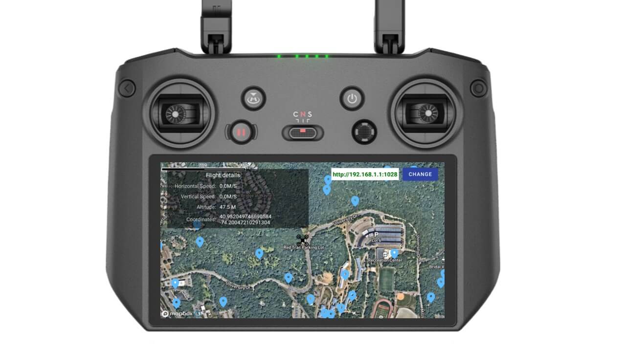
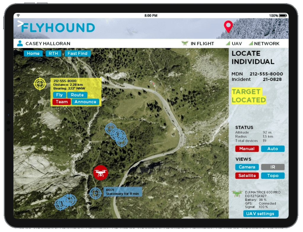
The solution, which is compatible with DJI Phantom and Matrice drone series, displays the position of a person on a digital map of the search area in real time. It also overcomes the temperature limitations of thermal imaging cameras. As such, first responders are able to determine the location of missing people “100 times faster” than with current search and rescue methods.
New: Drone films nuclear waste storage vault built in the ’60s [Video]
The start-up explains that first responders can also use its solution to identify channel artifacts produced by different propagation environments, such as rubble caused by earthquakes, floodwaters, or extreme snowfall. This capability further enhances the location detection of disaster victims or missing people.
Moreover, Flyhound integrates seamlessly into drone and incident management platforms, making it easy for agencies to deploy the technology rapidly to meet their needs. Here’s what the interface looks like:
Read: Boost your DJI drone’s ability to locate missing persons with this guide
Stressing that Flyhound has completed several proofs of concept with public safety agencies to validate the product-market fit, Shige Ihara, president and CEO of NEC X, says:
Public safety and disaster response are resource intensive. First responders are often in need of additional manpower – technology that saves time, money, and lives will always be in demand.
Corey Hoefling, a firefighter at New Jersey’s Carlstadt Fire Department, adds:
It’s incredibly valuable from a rescue standpoint to be able to map out where cellphones are in an emergency. Cellphones are something people always carry with them, so if we need to find someone in an emergency, this is a tool that can get us to them faster, and ultimately help save lives.
Though platform support for Flyhound is limited to DJI Phantom, DJI Matrice, Phy Sci Instant Eye, and Yuneec Typhoon drones at the moment, integration with Skydio, BRINC, and Parrot models is expected soon. You can apply for early access to the technology here.
Read: How the new DJI M30 drone helped save a life even before launch
FTC: We use income earning auto affiliate links. More.


Comments