In what is believed to be the first mission of its kind in the world, the US Department of Energy (DOE) has successfully used a drone to map a vault that was built in the 1960s to store radioactive nuclear waste.
Under contract with DOE, the Idaho Nuclear Technology and Engineering Center at the Idaho National Laboratory Site in eastern Idaho has been home to 4,400 cubic meters of nuclear waste called calcine for decades. Calcine is a highly radioactive, granular solid made from spent nuclear fuel.
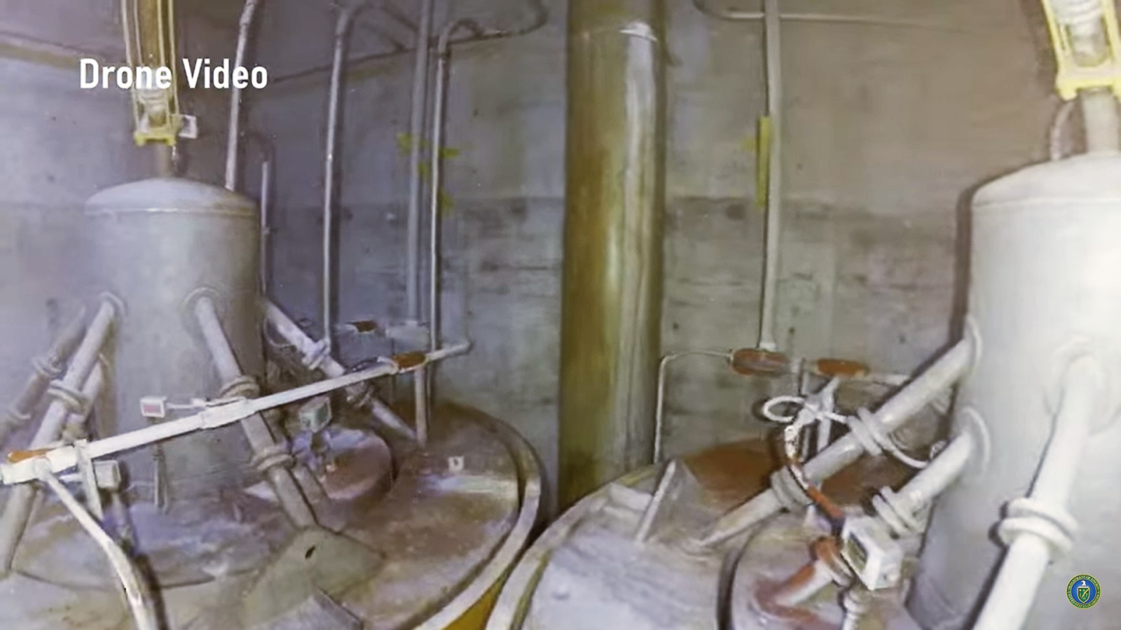
In 2015, when the DOE’s contract came up for renewal, the state of Idaho decided it no longer wanted to harbor irradiated material. So, the Idaho Environmental Coalition (IEC) was tasked with planning the removal and movement of the calcine. But the nuclear waste was placed in huge, 20-foot-tall stainless-steel bins inside an underground storage vault with no plans for its removal, which meant that moving the calcine was not going to be easy.
After painstaking research, IEC came up with the plan to remove the waste by drilling into the vault, robotically welding pipes onto the tops of each bin, and then cutting into the bins using a plasma cutter. These pipes would pneumatically suck out the calcine, providing a comparatively safe way for it to be removed, significantly reducing the risk of radiation exposure for those doing the work.
Now, the problem was, the blueprints for the vaults were not detailed enough to let IEC know where to drill the holes. The agency tried lowering a LiDAR sensor into one of the vaults to 3D map the area, but since the sensor could not move around, there were significant gaps in the data. IEC then looked at several other methods including the use of an articulating arm, a helium-filled blimp, and drilling holes into the vault, but decided that sending in a high-endurance indoor drone to map the area was the safest and most reliable option.
Enter, Flyability Elios 3, the world’s first collision-tolerant drone equipped with a LiDAR sensor for indoor 3D mapping.
Read: New solution for DJI drones finds missing persons faster
IEC had identified the tool that could do the job, but before sending it on the mission, the agency needed to make sure it had all the bases covered. After all, if the drone was lost inside the vault, no one would be able to retrieve it.
Elios 3 was then tested in a high-radiation environment, getting exposed to up to 10,000 Roentgen per hour of radiation to ensure it would be able to operate inside the vault. The IEC also built a life-sized replica of the vault so that its pilots could be trained in an environment that simulated the real world in which they planned to fly.
And on the day of the flight, approximately 50 people were on hand to support the mission — helping to cover the top of the vault with a plastic tent to ensure the mission took place indoors as described by FAA regulations and DOE requirements, and using a crane to lift back the vault’s lid and underlying hatch.
Once the drone was lowered into the vault, it took only a single flight of seven minutes to get the data required to create a robust 3D map of the vault. And, as the principal electrical engineer at IEC, Kevin Young, put it, “The mission was a huge success.”
Watch historic drone flight inside nuclear waste storage vault
Read: Flyability bags $15M in new funding to improve Elios 3 drone
The IEC conducted two successful LiDAR data collection flights in total. But then, it decided to perform a third experimental flight with one of its own dosimeters attached to the drone, making the aircraft much heavier. For reasons not fully understood, after the drone entered the vault for this flight it was not able to produce enough lift to maintain altitude. It made a slow descent to the top of one of the storage bins and became snagged on a piece of angle iron.
All attempts to free the drone failed. Before the battery died, the drone was able to transmit a maximum radiation reading of 7 Gy/h at the top of the bin. ICP subject matter experts completed a comprehensive analysis and concluded that leaving the drone on top of the storage bin would present no hazards to worker safety or the integrity of the bin.
Now that the vault has been 3D mapped, the next step is to plan for the removal of the calcine this year.
Read: Autonomous drones to remotely monitor electric power station in Canada
FTC: We use income earning auto affiliate links. More.


Comments