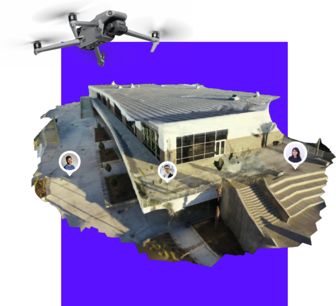
One-click reality capture platform SkyeBrowse has launched a new situational awareness tool that allows for real-time tracking of team members within a drone 3D model. In other words, you create a 2D or 3D model of an area in less than five minutes using a single drone video, and participating members can plot their GPS coordinates onto that model in real time.
SkyeBrowse’s new offering, TacBrowse, is a public safety tool that aims to give tactical teams live, actionable intelligence during missions. It builds upon the company’s proprietary technology which uses videogrammetry to create instant 3D models from drone videos.
Here’s how TacBrowse works…
First, an officer flies a SkyeBrowse or WideBrowse mission with a DJI or Autel drone to create a 3D model with the SkyeBrowse app. Then, an incident commander uploads the model of the incident scene to the TacBrowse web application. And finally, the ground team signs into the TacBrowse mobile app to transmit their GPS location. The team members appear as dots on the 2D map or 3D model, giving the incident commander full situational awareness in real time.
In addition to real-time location tracking, incident commanders can also annotate the drone model with notes and measurements. On the web browser, anyone signed into the session can view the slope map between two points. They can also virtually place themselves in the model with the perspective tool from the profile panel for complete situational awareness.
SkyeBrowse cofounder and CEO Bobby Ouyang says the new tool can be availed as a premium service for $39 per person per month. Here’s Ouyang:
SkyeBrowse has long been useful for quickly and effectively planning tactical operations, but we wanted to take it a step further and create a tool that can provide real-time data during mission execution. TacBrowse gives tactical teams the situational awareness necessary for critical decision-making and officer safety during operations.
Read: Lanius, the body of a racing drone and the mind of a calculated assassin
FTC: We use income earning auto affiliate links. More.


Comments