California-based aerial data collection and analytics company Aerial Imaging Technology has released a new, free drone image overlap estimator tool. As the name suggests, the tool can help operators using DJI drones or Micasense payloads to confirm a project’s orthographic image coverage while still on site.
Gathering consistently overlapping images is one of the most critical factors for producing a high-resolution map or 3D model using a drone. The higher the image overlap, the easier it is for modern image processing software to stitch together the images using repeated areas as a reference to ensure that everything aligns perfectly.
Generally, overlap settings of 70% or greater are considered sufficient for high-quality 3D model reconstruction with a visual sensor. If thermal is required, an 80% sidelap and frontlap is recommended.
But it’s not uncommon for drone pilots to realize the dataset has gaps or missing imagery after they have left the job site. And as Aerial Imaging Technology points out, it’s a horrible feeling for any operator because time is money, and more time at a particular site means fewer sites captured per day. This is what inspired the company to create a free tool to help pilots estimate the overlap in drone images.
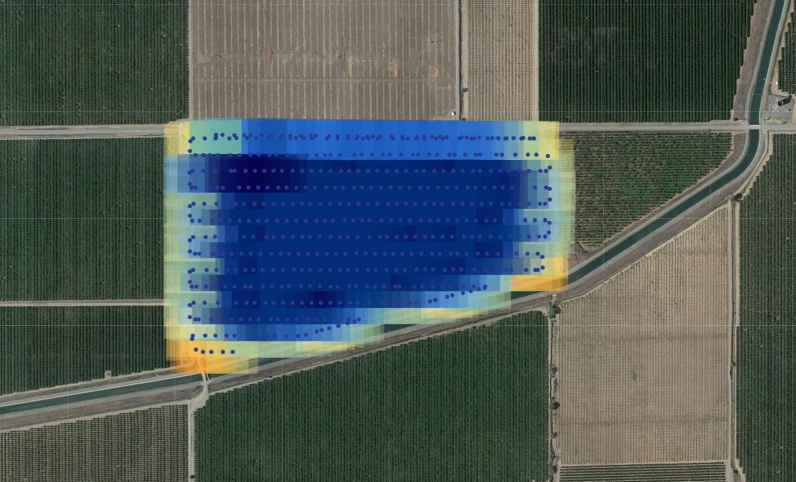
We’ve created a tool for pilots to confirm the orthographic image coverage of a project, while still on site! This browser-based service works by taking DJI or Micasense images and projecting their estimated locations plus coverage footprints on a map. This allows easy and fast data capture confirmation.
You can also use the tool for plotting the locations of DJI or Micasense images on a map as well, without using the footprint component.

But what about project locations where Internet connectivity is limited? Will operators be able to estimate image overlap with this tool there?
According to Aerial Imaging Technology, the tool doesn’t actually “upload” any images. All it uploads is the coordinates and metadata, which should work well with severely limited Internet services. And if you are only looking for the image locations, i.e. dots on the screen, it should work perfectly then as well. The base map, however, will not be visible in this case.
Check out the free tool for yourself here. And if you have any suggestions for improvement, add them to the form at the bottom of the page, so they can be reviewed by the development team.
Read: DJI updates Mobile SDK roadmap for Mini 3, Mavic 3, Avata drones
FTC: We use income earning auto affiliate links. More.


Comments