The new DJI Mavic 3M drone, which is equipped with a multispectral imaging system, has received its first firmware update since being released in November 2022.
It’s a major firmware update that DJI is rolling out today for the Mavic 3M, packing in a ton of new features and functionalities for farmers and organizations engaged in precision agriculture.
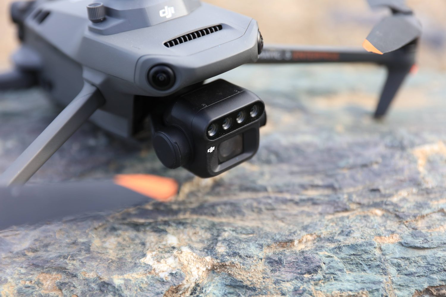
Mavic 3M uses a two-in-one camera system to gather information that farmers can use to get better results on the field. First, there’s an RGB camera that is equipped with a 4/3-inch CMOS and 20MP image sensor as well as a mechanical shutter with a maximum speed of 1/2000. And then there’s a four-lens multispectral camera that provides a deeper understanding of crop conditions by sensing details that the human eye cannot detect.
Read: The drone photo that won $15K in prizes at DJI SkyPixel contest
With the new software package that DJI is pushing out today, the Mavic 3M aircraft firmware can now be updated to version 06.01.06.06, while its remote controller can be brought up to v02.00.04.07. In addition, updates are available to move the DJI Pilot 2 app to v6.1.1.1, DJI Terra all-in-one drone software to v3.6.6, DJI Assistant 2 (Enterprise Series) to v2.1.7, and DJI Assistant 2 for MG to v2.1.3.
There’s plenty that’s new in this firmware update, so we recommend you go through the complete release notes below:
- Added support for 8x digital zoom for RGB camera.
- Added Terrain Follow for flight tasks:
- Smart Oblique and Linear tasks support both Real-Time Follow and DSM Follow.
- Oblique tasks only support DSM Follow.
- Added POI function. The aircraft can circle and fly around a PinPoint to obtain omnidirectional information about the target.
- Added ability to customize the camera angle for Mapping tasks. When planning a flight route, the aircraft orientation and gimbal pitch angle can be set for the route.
- Added ability to execute flight tasks during flight for fast and efficient execution of flight tasks at the current location. Tap the flight route icon to create or select a flight task on the camera or map view of the DJI Pilot 2 app.
- Added ability to set Safe Takeoff Altitude for flight tasks to improve flight safety. This parameter setting is only valid when the aircraft executes a flight task before takeoff. If the aircraft starts a flight task during flight, the safe takeoff altitude will not take effect.
- Added ability to import MBTiles format maps downloaded from Maptiler. The map layer can be customized in the DJI Pilot 2 app.
- Added the ability to export logs by different modules in the DJI Pilot 2 app.
- Added encryption for Network Security Mode in the DJI Pilot 2 app. After setting a password, users can only change the Network Security Mode or adjust the function settings after entering the password.
- Adjusted the XMP Tag field to meet third-party development requirements.
- Optimized Real-Time Follow. The minimum altitude is adjusted from 80 m to 30 m. The altitude for Real-Time Follow is updated to 30-200 m.
- Optimized firmware update prompt in the DJI Pilot 2 app.
You will need to restart the aircraft and remote controller after the update is complete. If the update fails, restart the aircraft, remote controller, and DJI Pilot 2 or DJI Assistant 2, and retry. Also, make sure the firmware of the aircraft and the remote controller, and DJI Pilot 2 are the latest versions. Otherwise, usage may be affected.
Read: DJI releases major firmware update for Mavic 3E drone series
FTC: We use income earning auto affiliate links. More.


Comments